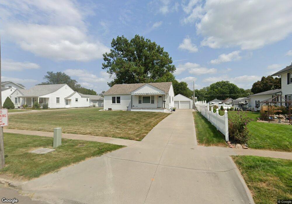
203 N Main St Rock Port, MO 64482
Estimated Value: $125,000 - $131,000
Studio
1
Bath
1,296
Sq Ft
$99/Sq Ft
Est. Value
About This Home
This home is located at 203 N Main St, Rock Port, MO 64482 and is currently estimated at $128,840, approximately $99 per square foot. 203 N Main St is a home with nearby schools including Rock Port Elementary School and Rock Port High School.
Ownership History
Date
Name
Owned For
Owner Type
Purchase Details
Closed on
Feb 22, 2013
Sold by
Etal Vette and Etal Lutz
Bought by
Hogue Travis R and Hogue Marsha Kay
Current Estimated Value
Purchase Details
Closed on
Oct 6, 2011
Sold by
Vette
Bought by
Vette Eidenmiller Scott Balle Eddinger L
Purchase Details
Closed on
Apr 19, 2011
Sold by
Vette
Bought by
Vette
Purchase Details
Closed on
Oct 11, 2000
Sold by
Vette Alfred H
Bought by
Vette
Purchase Details
Closed on
Jun 15, 2000
Bought by
Vette Alfred H
Create a Home Valuation Report for This Property
The Home Valuation Report is an in-depth analysis detailing your home's value as well as a comparison with similar homes in the area
Purchase History
| Date | Buyer | Sale Price | Title Company |
|---|---|---|---|
| Hogue Travis R | $65,000 | -- | |
| Vette Eidenmiller Scott Balle Eddinger L | -- | -- | |
| Vette | -- | -- | |
| Vette | -- | -- | |
| Vette Alfred H | $50,000 | -- |
Source: Public Records
Tax History
| Year | Tax Paid | Tax Assessment Tax Assessment Total Assessment is a certain percentage of the fair market value that is determined by local assessors to be the total taxable value of land and additions on the property. | Land | Improvement |
|---|---|---|---|---|
| 2025 | $1,289 | $80,340 | $0 | $0 |
| 2024 | $1,124 | $13,509 | $2,356 | $11,153 |
| 2023 | $1,123 | $13,509 | $2,356 | $11,153 |
| 2022 | $102,294 | $64,700 | $2,147 | $10,146 |
| 2021 | $936 | $12,293 | $2,147 | $10,146 |
| 2020 | $936 | $11,172 | $0 | $11,172 |
| 2019 | $935 | $11,172 | $0 | $11,172 |
| 2018 | -- | $11,172 | $1,957 | $9,215 |
| 2017 | -- | $11,172 | $1,957 | $9,215 |
| 2016 | -- | $11,172 | $1,957 | $9,215 |
| 2015 | -- | $10,963 | $1,957 | $9,006 |
| 2012 | -- | $10,241 | $0 | $0 |
Source: Public Records
Map
Nearby Homes
- 106 Us Hwy 136 E Hwy
- 105 E US Highway 136
- 212 W Mill St
- 402 S Market St
- 601 S Water St
- 17348 US Highway 136
- 17287 US Highway 136
- 20269 U S 275
- 20269 US 275 Hwy
- 25984 Outer Rd
- St Hwy East St
- 1102 Maple St
- 505 S 8th St
- 607 Pine St
- 0 270 St
- 503 Linden St
- 402 Vine St
- 164 E Allen St
- 626 Atlantic St
- 509 N US Highway 59
Your Personal Tour Guide
Ask me questions while you tour the home.