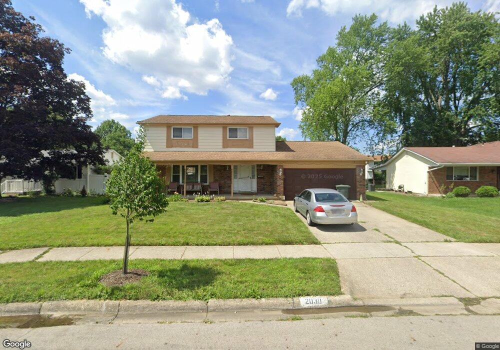
2030 Sharbot Dr Columbus, OH 43229
Forest Park East NeighborhoodEstimated Value: $305,000 - $332,000
About This Home
This home is located at 2030 Sharbot Dr, Columbus, OH 43229 and is currently estimated at $318,265, approximately $160 per square foot. 2030 Sharbot Dr is a home located in Franklin County with nearby schools including Northtowne Elementary School, Woodward Park Middle School, and Northland High School.
Ownership History
We collect this data history from publicly available records. To have your information removed, we recommend requesting removal directly through your county’s website.
Purchase Details
Home Financials for this Owner
Home Financials are based on the most recent Mortgage that was taken out on this home.Purchase Details
Purchase Details
Home Financials for this Owner
Home Financials are based on the most recent Mortgage that was taken out on this home.Purchase Details
Home Financials for this Owner
Home Financials are based on the most recent Mortgage that was taken out on this home.Home Values in the Area
Average Home Value in this Area
Purchase History
We collect this data history from publicly available records. To have your information removed, we recommend requesting removal directly through your county’s website.
| Date | Buyer | Sale Price | Title Company |
|---|---|---|---|
| $111,500 | Accutitle Agency Inc | ||
| $92,000 | None Available | ||
| -- | Advantage One Title Agency I | ||
| $101,000 | -- |
Mortgage History
We collect this data history from publicly available records. To have your information removed, we recommend requesting removal directly through your county’s website.
| Date | Status | Borrower | Loan Amount |
|---|---|---|---|
| Open | $105,925 | ||
| Previous Owner | $119,800 | ||
| Previous Owner | $90,900 |
Tax History
We collect this data history from publicly available records. To have your information removed, we recommend requesting removal directly through your county’s website.
| Year | Tax Paid | Tax Assessment Tax Assessment Total Assessment is a certain percentage of the fair market value that is determined by local assessors to be the total taxable value of land and additions on the property. | Land | Improvement |
|---|---|---|---|---|
| 2025 | $4,032 | $89,850 | $22,120 | $67,730 |
| 2024 | $4,032 | $89,850 | $22,120 | $67,730 |
| 2023 | $3,981 | $89,845 | $22,120 | $67,725 |
| 2022 | $3,079 | $59,360 | $13,160 | $46,200 |
| 2021 | $3,084 | $59,360 | $13,160 | $46,200 |
| 2020 | $3,088 | $59,360 | $13,160 | $46,200 |
| 2019 | $2,863 | $47,190 | $10,540 | $36,650 |
| 2018 | $2,692 | $47,190 | $10,540 | $36,650 |
| 2017 | $2,823 | $47,190 | $10,540 | $36,650 |
| 2016 | $2,785 | $42,040 | $9,420 | $32,620 |
| 2015 | $2,528 | $42,040 | $9,420 | $32,620 |
| 2014 | $2,534 | $42,040 | $9,420 | $32,620 |
| 2013 | $1,373 | $46,165 | $9,905 | $36,260 |
Map
- 1944 Coghill Dr
- 2229 Waldorf Rd
- 1859 Tamarack Ct S
- 2224 Kilbourne Ave
- 4730 Edinburgh Ln
- 2166 Blackoak Ave
- 4710 Larkhall Ln
- 5016 Julie Place
- 0 Chester Rd
- 2392 Minerva Park Place
- 0 Abington Rd Unit 224031704
- 5330 Torchwood Loop W
- 1485 Norma Rd
- 2235 Belcher Dr
- 5232 Karl Rd
- 2227 Lilacwood Ave
- 2594 Adda Ave
- 2601 Brooklyn Rd
- 1638 Arrowood Loop N
- 2164 Fenton St
- 2038 Sharbot Dr
- 2046 Sharbot Dr
- 2039 Cannington Ct
- 2031 Cannington Ct
- 2022 Sharbot Dr
- 2058 Sharbot Dr
- 2047 Cannington Ct
- 2023 Cannington Ct
- 2035 Sharbot Dr
- 2047 Sharbot Dr
- 2055 Cannington Ct
- 2015 Cannington Ct
- 2010 Sharbot Dr
- 2053 Sharbot Dr
- 4803 Cannington Dr
- 2023 Sharbot Dr
- 2007 Cannington Ct
- 4815 Cannington Dr
- 2061 Sharbot Dr
- 2002 Sharbot Dr
Ask me questions while you tour the home.