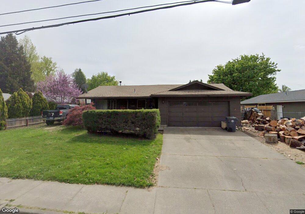
2031 Taylor Rd Central Point, OR 97502
Estimated Value: $363,565 - $380,000
3
Beds
2
Baths
1,373
Sq Ft
$270/Sq Ft
Est. Value
About This Home
This home is located at 2031 Taylor Rd, Central Point, OR 97502 and is currently estimated at $370,641, approximately $269 per square foot. 2031 Taylor Rd is a home located in Jackson County with nearby schools including Richardson Elementary School, Scenic Middle School, and Crater High School.
Ownership History
Date
Name
Owned For
Owner Type
Purchase Details
Closed on
Dec 23, 2008
Sold by
Conklin Patricia A and Kirk Dan
Bought by
Kirk Dan and Conklin Patricia A
Current Estimated Value
Home Financials for this Owner
Home Financials are based on the most recent Mortgage that was taken out on this home.
Original Mortgage
$171,298
Interest Rate
5.97%
Mortgage Type
New Conventional
Purchase Details
Closed on
Mar 1, 1999
Sold by
Conklin Patricia A and Keeney Leroy M
Bought by
Conklin Patricia A
Home Financials for this Owner
Home Financials are based on the most recent Mortgage that was taken out on this home.
Original Mortgage
$32,150
Interest Rate
6.76%
Create a Home Valuation Report for This Property
The Home Valuation Report is an in-depth analysis detailing your home's value as well as a comparison with similar homes in the area
Purchase History
| Date | Buyer | Sale Price | Title Company |
|---|---|---|---|
| Kirk Dan | -- | Netco Title | |
| Conklin Patricia A | -- | Crater Title Insurance |
Source: Public Records
Mortgage History
| Date | Status | Borrower | Loan Amount |
|---|---|---|---|
| Closed | Kirk Dan | $171,298 | |
| Closed | Conklin Patricia A | $32,150 |
Source: Public Records
Tax History
| Year | Tax Paid | Tax Assessment Tax Assessment Total Assessment is a certain percentage of the fair market value that is determined by local assessors to be the total taxable value of land and additions on the property. | Land | Improvement |
|---|---|---|---|---|
| 2026 | $3,260 | $196,970 | -- | -- |
| 2025 | $3,180 | $191,240 | $98,080 | $93,160 |
| 2024 | $3,180 | $185,670 | $95,220 | $90,450 |
| 2023 | $3,077 | $180,270 | $92,440 | $87,830 |
| 2022 | $3,005 | $180,270 | $92,440 | $87,830 |
| 2021 | $2,920 | $175,020 | $89,750 | $85,270 |
| 2020 | $2,835 | $169,930 | $87,140 | $82,790 |
| 2019 | $2,765 | $160,190 | $82,150 | $78,040 |
| 2018 | $2,681 | $155,530 | $79,760 | $75,770 |
| 2017 | $2,599 | $155,530 | $79,760 | $75,770 |
| 2016 | $2,537 | $146,610 | $75,180 | $71,430 |
| 2015 | $2,340 | $141,660 | $26,110 | $115,550 |
| 2014 | $2,387 | $142,340 | $70,870 | $71,470 |
Source: Public Records
Map
Nearby Homes
- 404 Silver Creek Dr
- 659 Blue Moon Dr
- 349 W Pine St
- 50 Kathryn Ct
- 209 Corcoran Ln
- 185 Logan Ave
- 342 Hazel St
- 1134 Steamboat Dr
- 489 Vincent Ave
- 0 N 3rd St
- 650 Golden Peak Dr
- 55 Crater Ln
- 296 Brandon St
- 0 Boulder Ridge St
- 570 Bachand Cir
- 144 N 5th St
- 338 Joseph St
- 350 Alder St
- 1160 Boulder Ridge St
- 625 Cherry St
- 2041 Taylor Rd
- 631 Palo Verde Way
- 625 Palo Verde Way
- 2051 Taylor Rd
- 1985 Taylor Rd
- 1981 Taylor Rd
- 2030 Taylor Rd
- 0 Taylor Tl1801 Rd Unit 102961847
- 1977 Taylor Rd
- 613 Palo Verde Way
- 2061 Taylor Rd
- 0 Taylor Tl1801-02 Rd Unit 102961021
- 643 Palo Verde Way
- 1988 Taylor Rd
- 607 Palo Verde Way
- 624 Palo Verde Way
- 1967 Taylor Rd
- 425 Valley Oak Blvd
- 1961 Taylor Rd
- 618 Palo Verde Way
Your Personal Tour Guide
Ask me questions while you tour the home.