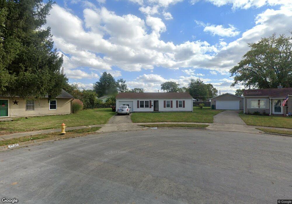
2033 Gridley Ct Springfield, OH 45505
Estimated Value: $131,157 - $152,000
3
Beds
1
Bath
925
Sq Ft
$151/Sq Ft
Est. Value
About This Home
This home is located at 2033 Gridley Ct, Springfield, OH 45505 and is currently estimated at $140,039, approximately $151 per square foot. 2033 Gridley Ct is a home located in Clark County with nearby schools including Kenwood Elementary School, Hayward Middle School, and Springfield High School.
Ownership History
Date
Name
Owned For
Owner Type
Purchase Details
Closed on
Jun 30, 2006
Sold by
Hartman Glen E
Bought by
Smith Maxine
Current Estimated Value
Home Financials for this Owner
Home Financials are based on the most recent Mortgage that was taken out on this home.
Original Mortgage
$65,550
Outstanding Balance
$38,468
Interest Rate
6.73%
Mortgage Type
Purchase Money Mortgage
Estimated Equity
$101,571
Purchase Details
Closed on
Jun 4, 2001
Sold by
Hud
Bought by
Hartman Glen E
Purchase Details
Closed on
Sep 20, 2000
Sold by
Ault Mary E
Bought by
Hud
Purchase Details
Closed on
May 4, 1999
Sold by
Ault Rockey D
Bought by
Ault Mary E
Create a Home Valuation Report for This Property
The Home Valuation Report is an in-depth analysis detailing your home's value as well as a comparison with similar homes in the area
Home Values in the Area
Average Home Value in this Area
Purchase History
We collect this data history from publicly available records. To have your information removed, we recommend requesting removal directly through your county’s website.
| Date | Buyer | Sale Price | Title Company |
|---|---|---|---|
| Smith Maxine | $69,000 | None Available | |
| Hartman Glen E | $58,000 | -- | |
| Hud | $41,000 | -- | |
| Ault Mary E | -- | -- |
Source: Public Records
Mortgage History
We collect this data history from publicly available records. To have your information removed, we recommend requesting removal directly through your county’s website.
| Date | Status | Borrower | Loan Amount |
|---|---|---|---|
| Open | Smith Maxine | $65,550 |
Source: Public Records
Tax History
| Year | Tax Paid | Tax Assessment Tax Assessment Total Assessment is a certain percentage of the fair market value that is determined by local assessors to be the total taxable value of land and additions on the property. | Land | Improvement |
|---|---|---|---|---|
| 2025 | $1,403 | $38,180 | $5,730 | $32,450 |
| 2024 | $1,367 | $27,680 | $5,240 | $22,440 |
| 2023 | $1,367 | $27,680 | $5,240 | $22,440 |
| 2022 | $1,401 | $27,680 | $5,240 | $22,440 |
| 2021 | $1,316 | $23,950 | $4,090 | $19,860 |
| 2020 | $1,319 | $23,950 | $4,090 | $19,860 |
| 2019 | $1,322 | $23,950 | $4,090 | $19,860 |
| 2018 | $1,170 | $20,340 | $3,070 | $17,270 |
| 2017 | $1,169 | $20,010 | $3,066 | $16,944 |
| 2016 | $1,171 | $20,010 | $3,066 | $16,944 |
| 2015 | $1,100 | $18,781 | $3,066 | $15,715 |
| 2014 | $1,096 | $18,781 | $3,066 | $15,715 |
| 2013 | $1,084 | $18,781 | $3,066 | $15,715 |
Source: Public Records
Map
Nearby Homes
- 2050 S Hadley Rd
- 1835 S Sweetbriar Ln
- 2037 Gerald Dr
- 2214 Wrenwood Rd
- 1740 Victory Dr
- 1633 N Sweetbriar Ln
- 1612 Victory Dr
- 1705 Rutland Ave
- 2203 Hackberry St
- 2207 Hackberry St
- 2209 Hackberry St
- 2211 Hackberry St
- 2208 Hackberry St
- 2210 Hackberry St
- 1979 Kenton St
- 2390 Old Selma Rd
- 1714 Kenton St
- 1652 Kenton St
- 1628 Kenton St
- 1625 E Pleasant St
- 2022 Gridley Ct
- 2014 Gridley Ct
- 2028 Gridley Ct
- 2008 Gridley Ct
- 1869 Chatham Place
- 2033 S Hadley Rd
- 2032 Gridley Ct
- 2023 Gridley Ct
- 2036 Gridley Ct
- 2015 Gridley Ct
- 1904 S Belmont Ave
- 2037 S Hadley Rd
- 2009 Gridley Ct
- 2029 Gridley Ct
- 1867 Chatham Place
- 1874 S Belmont Ave
- 2032 Chatham Place
- 2045 S Hadley Rd
- 1920 S Belmont Ave
- 2107 Tanager Rd
Your Personal Tour Guide
Ask me questions while you tour the home.