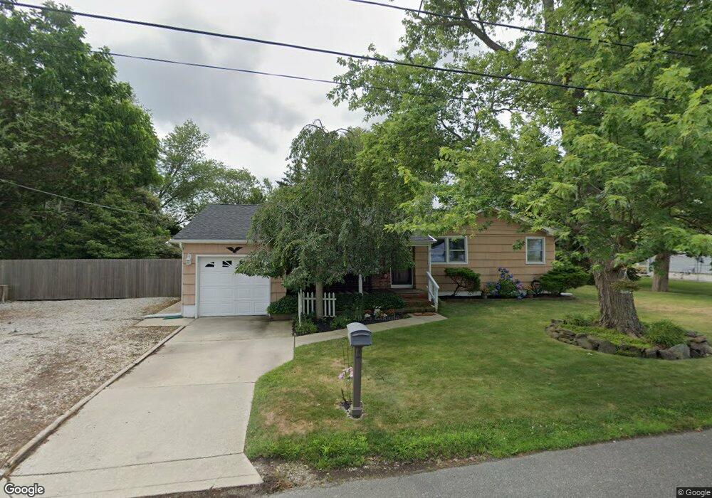
2034 Sutton Ave Northfield, NJ 08225
Estimated Value: $394,735 - $491,000
About This Home
This home is located at 2034 Sutton Ave, Northfield, NJ 08225 and is currently estimated at $448,934, approximately $274 per square foot. 2034 Sutton Ave is a home located in Atlantic County with nearby schools including Northfield Community Elementary School, Northfield Community Middle School, and Mainland Regional High School.
Ownership History
We collect this data history from publicly available records. To have your information removed, we recommend requesting removal directly through your county’s website.
Purchase Details
Home Financials for this Owner
Home Financials are based on the most recent Mortgage that was taken out on this home.Home Values in the Area
Average Home Value in this Area
Purchase History
We collect this data history from publicly available records. To have your information removed, we recommend requesting removal directly through your county’s website.
| Date | Buyer | Sale Price | Title Company |
|---|---|---|---|
| $125,000 | -- |
Mortgage History
We collect this data history from publicly available records. To have your information removed, we recommend requesting removal directly through your county’s website.
| Date | Status | Borrower | Loan Amount |
|---|---|---|---|
| Open | $100,000 |
Tax History
We collect this data history from publicly available records. To have your information removed, we recommend requesting removal directly through your county’s website.
| Year | Tax Paid | Tax Assessment Tax Assessment Total Assessment is a certain percentage of the fair market value that is determined by local assessors to be the total taxable value of land and additions on the property. | Land | Improvement |
|---|---|---|---|---|
| 2025 | $8,082 | $225,000 | $83,900 | $141,100 |
| 2024 | $8,082 | $225,000 | $83,900 | $141,100 |
| 2023 | $7,857 | $225,000 | $83,900 | $141,100 |
| 2022 | $7,857 | $225,000 | $83,900 | $141,100 |
| 2021 | $7,774 | $225,000 | $83,900 | $141,100 |
| 2020 | $7,803 | $225,000 | $83,900 | $141,100 |
| 2019 | $7,670 | $225,000 | $83,900 | $141,100 |
| 2018 | $7,533 | $225,000 | $83,900 | $141,100 |
| 2017 | $7,283 | $225,000 | $83,900 | $141,100 |
| 2016 | $6,993 | $225,000 | $83,900 | $141,100 |
| 2015 | $6,896 | $225,000 | $83,900 | $141,100 |
| 2014 | $7,010 | $241,900 | $83,900 | $158,000 |
Map
- 1900 Oak Ave
- 1203 W Mill Rd
- 11 Dani Dr
- 701 W Mill Rd
- 1 Rose Ln
- 2053 N Shepherd Dr
- 227 W Glencove Ave
- 1030 Old Zion Rd
- 1036 Old Zion Rd
- 603 Banning Ave
- 327 W Oakcrest Ave
- 6708 Mill Rd
- 403 Park Ln
- 3 Jackson Dr
- 550 Central Ave Unit E8
- 550 Central Ave Unit N8
- 550 Central Ave Unit B-7
- 550 Central Ave Unit m12
- 550 Central Ave Unit H-15
- 550 Central Ave Unit H-12
Ask me questions while you tour the home.