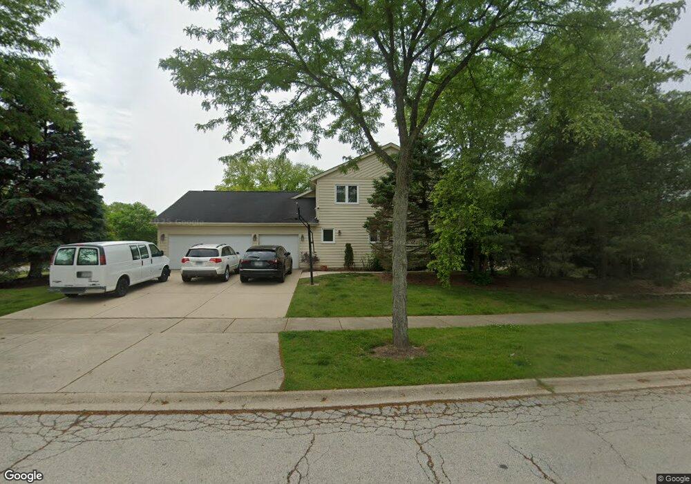
2035 Sheridan Rd Buffalo Grove, IL 60089
Rolling Hills NeighborhoodEstimated Value: $842,000 - $972,000
Studio
1
Bath
3,240
Sq Ft
$274/Sq Ft
Est. Value
About This Home
This home is located at 2035 Sheridan Rd, Buffalo Grove, IL 60089 and is currently estimated at $887,490, approximately $273 per square foot. 2035 Sheridan Rd is a home located in Lake County with nearby schools including Ivy Hall Elementary School, Twin Groves Middle School, and Adlai E Stevenson High School.
Ownership History
Date
Name
Owned For
Owner Type
Purchase Details
Closed on
Jul 12, 1995
Sold by
American National Bk & Tr Co Of Chicago
Bought by
Guralnik Vladislav and Guralnik Victoria
Current Estimated Value
Home Financials for this Owner
Home Financials are based on the most recent Mortgage that was taken out on this home.
Original Mortgage
$310,500
Interest Rate
7.12%
Create a Home Valuation Report for This Property
The Home Valuation Report is an in-depth analysis detailing your home's value as well as a comparison with similar homes in the area
Home Values in the Area
Average Home Value in this Area
Purchase History
We collect this data history from publicly available records. To have your information removed, we recommend requesting removal directly through your county’s website.
| Date | Buyer | Sale Price | Title Company |
|---|---|---|---|
| Guralnik Vladislav | $388,500 | Chicago Title Insurance Co |
Source: Public Records
Mortgage History
We collect this data history from publicly available records. To have your information removed, we recommend requesting removal directly through your county’s website.
| Date | Status | Borrower | Loan Amount |
|---|---|---|---|
| Closed | Guralnik Vladislav | $310,500 |
Source: Public Records
Tax History
| Year | Tax Paid | Tax Assessment Tax Assessment Total Assessment is a certain percentage of the fair market value that is determined by local assessors to be the total taxable value of land and additions on the property. | Land | Improvement |
|---|---|---|---|---|
| 2025 | $22,314 | $249,841 | $55,623 | $194,218 |
| 2024 | $20,722 | $235,521 | $52,435 | $183,086 |
| 2023 | $19,507 | $211,649 | $47,120 | $164,529 |
| 2022 | $19,507 | $197,034 | $43,866 | $153,168 |
| 2021 | $18,884 | $194,909 | $43,393 | $151,516 |
| 2020 | $18,514 | $195,574 | $43,541 | $152,033 |
| 2019 | $18,065 | $194,853 | $43,380 | $151,473 |
| 2018 | $19,451 | $214,936 | $47,158 | $167,778 |
| 2017 | $19,141 | $209,919 | $46,057 | $163,862 |
| 2016 | $18,463 | $201,014 | $44,103 | $156,911 |
| 2015 | $18,080 | $187,987 | $41,245 | $146,742 |
| 2014 | $18,380 | $188,000 | $44,296 | $143,704 |
| 2012 | $18,283 | $188,377 | $44,385 | $143,992 |
Source: Public Records
Map
Nearby Homes
- 2038 Sheridan Rd
- 1944 Beverly Ln
- 805 Summer Ct
- 2116 Birchwood Ln
- 563 Dover Ct
- 2212 Magnolia Ct W
- 5176 Aptakisic Rd
- 5544 Oak Grove Dr
- 5212 Briarcrest Ln
- 331 Didier Ct
- 2520 Live Oak Ln Unit 194
- 324 Satinwood Ct N Unit 1913
- 2530 Live Oak Ln Unit 183
- 2544 Live Oak Ln Unit 163
- 2529 Live Oak Ln Unit 132
- 301 Didier Ct Unit D
- 5152 Bridlewood Ln
- 701 Thompson Blvd
- 1120 Thompson Blvd
- 421 Thompson Blvd
- 2035 Sheridan Rd
- 2035 Sheridan Rd
- 2039 Sheridan Rd
- 2026 Sheridan Ct
- 1990 Sheridan Ct
- 2043 Sheridan Rd
- 1986 Sheridan Rd
- 1990 Sheridan Rd
- 1994 Sheridan Ct
- 2031 Sheridan Rd
- 2030 Sheridan Rd
- 2027 Sheridan Rd
- 2022 Sheridan Ct
- 2047 Sheridan Rd
- 2034 Sheridan Rd
- 1982 Sheridan Rd
- 2023 Sheridan Rd
- 1978 Sheridan Rd
- 2002 Sheridan Ct
- 1974 Sheridan Rd
Your Personal Tour Guide
Ask me questions while you tour the home.