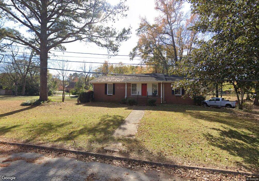
204 E 6th St West Point, GA 31833
Estimated Value: $142,655 - $176,000
3
Beds
2
Baths
1,375
Sq Ft
$112/Sq Ft
Est. Value
About This Home
This home is located at 204 E 6th St, West Point, GA 31833 and is currently estimated at $154,414, approximately $112 per square foot. 204 E 6th St is a home located in Troup County with nearby schools including West Point Elementary School, Long Cane Elementary School, and Whitesville Road Elementary School.
Ownership History
Date
Name
Owned For
Owner Type
Purchase Details
Closed on
Mar 13, 2019
Sold by
Reeves Ken
Bought by
Cdr Ventures Llc
Current Estimated Value
Purchase Details
Closed on
Jul 24, 2006
Sold by
Winiton Yancie C
Bought by
Reeves Kenneth E and Reeves Coleman
Home Financials for this Owner
Home Financials are based on the most recent Mortgage that was taken out on this home.
Original Mortgage
$66,500
Interest Rate
6.32%
Mortgage Type
New Conventional
Purchase Details
Closed on
Nov 6, 1997
Sold by
Geo Allen
Bought by
Joyce Yancie C and Joyce Winton
Purchase Details
Closed on
Aug 1, 1988
Bought by
Geo Allen
Create a Home Valuation Report for This Property
The Home Valuation Report is an in-depth analysis detailing your home's value as well as a comparison with similar homes in the area
Home Values in the Area
Average Home Value in this Area
Purchase History
| Date | Buyer | Sale Price | Title Company |
|---|---|---|---|
| Cdr Ventures Llc | -- | -- | |
| Reeves Kenneth E | $70,000 | -- | |
| Joyce Yancie C | $48,500 | -- | |
| Geo Allen | -- | -- |
Source: Public Records
Mortgage History
| Date | Status | Borrower | Loan Amount |
|---|---|---|---|
| Previous Owner | Reeves Kenneth E | $66,500 |
Source: Public Records
Tax History
| Year | Tax Paid | Tax Assessment Tax Assessment Total Assessment is a certain percentage of the fair market value that is determined by local assessors to be the total taxable value of land and additions on the property. | Land | Improvement |
|---|---|---|---|---|
| 2025 | $1,753 | $50,240 | $2,400 | $47,840 |
| 2024 | $1,535 | $43,400 | $2,840 | $40,560 |
| 2023 | $1,496 | $42,000 | $2,840 | $39,160 |
| 2022 | $1,114 | $39,920 | $2,840 | $37,080 |
| 2021 | $968 | $32,080 | $2,840 | $29,240 |
| 2020 | $820 | $27,200 | $1,280 | $25,920 |
| 2019 | $805 | $26,680 | $1,280 | $25,400 |
| 2018 | $700 | $23,216 | $1,296 | $21,920 |
| 2017 | $700 | $23,216 | $1,296 | $21,920 |
| 2016 | $677 | $22,459 | $1,296 | $21,163 |
| 2015 | $678 | $22,459 | $1,296 | $21,163 |
| 2014 | $646 | $21,345 | $1,296 | $20,049 |
| 2013 | -- | $22,844 | $1,296 | $21,548 |
Source: Public Records
Map
Nearby Homes
- 506 E 6th St
- 707 E 7th St
- 1202 E 9th St
- 112 Hillcrest Rd
- 712 4th Ave
- 900 E 9th St
- 128 Highland Dr
- 1104 E 8th St
- 509 Cleveland St
- 0 Arrowhead Dr Unit 10451860
- 1007 4th Ave
- 1026 N 6th Ave
- 403 N 15th St
- 1508 N 4th Ave
- 302 N 6th Ave
- 514 N 8th Ave
- 811 Cherry Dr
- 1418 E 10th St
- 902 1st St
- 0 Sunset Dr Unit 10451831
Your Personal Tour Guide
Ask me questions while you tour the home.