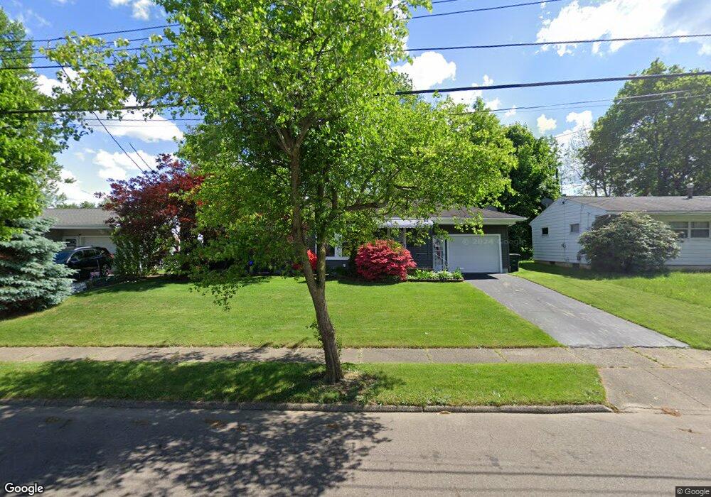
204 E Ralston Ave Akron, OH 44301
Firestone Park NeighborhoodEstimated Value: $157,000 - $173,000
2
Beds
2
Baths
1,107
Sq Ft
$149/Sq Ft
Est. Value
About This Home
This home is located at 204 E Ralston Ave, Akron, OH 44301 and is currently estimated at $165,361, approximately $149 per square foot. 204 E Ralston Ave is a home located in Summit County with nearby schools including Kenmore Garfield Community Learning Center, Main Preparatory Academy, and Eagle Elementary.
Ownership History
Date
Name
Owned For
Owner Type
Purchase Details
Closed on
May 16, 2016
Sold by
Mastrojohn Tami J
Bought by
Barnett Mary
Current Estimated Value
Purchase Details
Closed on
Mar 25, 2008
Sold by
Hunt Robert C
Bought by
Mastrojohn Tami J
Home Financials for this Owner
Home Financials are based on the most recent Mortgage that was taken out on this home.
Original Mortgage
$90,578
Interest Rate
6.1%
Mortgage Type
FHA
Purchase Details
Closed on
Oct 21, 2003
Sold by
Petroff Patrick D and Petroff Mildred
Bought by
Riley Brenda L
Create a Home Valuation Report for This Property
The Home Valuation Report is an in-depth analysis detailing your home's value as well as a comparison with similar homes in the area
Home Values in the Area
Average Home Value in this Area
Purchase History
We collect this data history from publicly available records. To have your information removed, we recommend requesting removal directly through your county’s website.
| Date | Buyer | Sale Price | Title Company |
|---|---|---|---|
| Barnett Mary | $89,000 | None Available | |
| Mastrojohn Tami J | $92,000 | Attorney | |
| Riley Brenda L | $94,000 | Land America/Lawyers Title |
Source: Public Records
Mortgage History
We collect this data history from publicly available records. To have your information removed, we recommend requesting removal directly through your county’s website.
| Date | Status | Borrower | Loan Amount |
|---|---|---|---|
| Previous Owner | Mastrojohn Tami J | $90,578 |
Source: Public Records
Tax History
| Year | Tax Paid | Tax Assessment Tax Assessment Total Assessment is a certain percentage of the fair market value that is determined by local assessors to be the total taxable value of land and additions on the property. | Land | Improvement |
|---|---|---|---|---|
| 2024 | $2,246 | $41,696 | $11,186 | $30,510 |
| 2023 | $2,246 | $41,696 | $11,186 | $30,510 |
| 2022 | $2,079 | $30,216 | $8,106 | $22,110 |
| 2021 | $2,081 | $30,216 | $8,106 | $22,110 |
| 2020 | $2,051 | $30,220 | $8,110 | $22,110 |
| 2019 | $2,178 | $29,260 | $8,110 | $21,150 |
| 2018 | $2,149 | $29,260 | $8,110 | $21,150 |
| 2017 | $2,183 | $29,260 | $8,110 | $21,150 |
| 2016 | $2,185 | $29,260 | $8,110 | $21,150 |
| 2015 | $2,183 | $29,260 | $8,110 | $21,150 |
| 2014 | $2,166 | $29,260 | $8,110 | $21,150 |
| 2013 | $2,130 | $29,380 | $8,110 | $21,270 |
Source: Public Records
Map
Nearby Homes
- 270 E Ralston Ave
- 231 E Dresden Ave
- 106 E Dresden Ave
- 126 Clinton Ave
- 1780 Evergreen Ave
- 355 E Dresden Ave
- 248 E Catawba Ave
- 604 S Firestone Blvd
- 23 Wayne Ave
- 1712 Girard St
- 435 Selden Ave
- 30 Youtz Ave
- 1633 Glenmount Ave
- 18 Youtz Ave
- 1646 Evergreen Ave
- 1681 Girard St
- 41 E Rosewood Ave
- 1701 Brown St
- 14 E Dartmore Ave
- 2152 Thornbury Ln
- 210 E Ralston Ave
- 196 E Ralston Ave
- 201 E Ralston Ave
- 1936 Thane Ave
- 188 E Ralston Ave
- 1946 Thane Ave
- 191 E Ralston Ave
- 1914 Thane Ave
- 185 E Ralston Ave
- 182 E Ralston Ave
- 1921 Thane Ave
- 230 E Ralston Ave
- 223 E Ralston Ave
- 227 E Boxwood Ave
- 174 E Ralston Ave
- 234 E Ralston Ave
- 179 E Ralston Ave
- 1905 Thane Ave
- 194 E Woodsdale Ave
- 229 E Ralston Ave
Your Personal Tour Guide
Ask me questions while you tour the home.