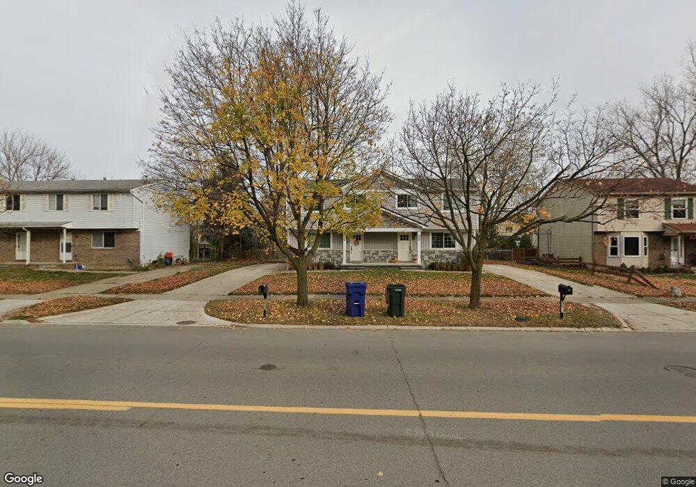
2040 N Sheldon Rd Canton, MI 48187
Estimated Value: $337,000 - $416,000
Studio
2
Baths
2,272
Sq Ft
$164/Sq Ft
Est. Value
About This Home
This home is located at 2040 N Sheldon Rd, Canton, MI 48187 and is currently estimated at $372,533, approximately $163 per square foot. 2040 N Sheldon Rd is a home located in Wayne County with nearby schools including Canton High School, Discovery Middle School, and Salem High School.
Ownership History
Date
Name
Owned For
Owner Type
Purchase Details
Closed on
May 4, 2017
Sold by
Draplin Draplin Robert J Robert J
Bought by
2040 N Sheldon Rd Llc
Current Estimated Value
Home Financials for this Owner
Home Financials are based on the most recent Mortgage that was taken out on this home.
Original Mortgage
$148,160
Outstanding Balance
$123,146
Interest Rate
4.08%
Mortgage Type
Construction
Estimated Equity
$249,387
Purchase Details
Closed on
Apr 23, 2012
Sold by
Draplin David
Bought by
Trustee Of The Robert J Draplin Revocabl
Purchase Details
Closed on
Jan 13, 2010
Sold by
Draplin Robert and Draplin Christine
Bought by
Trustee Of The Robert J Draplin Irrevoca
Create a Home Valuation Report for This Property
The Home Valuation Report is an in-depth analysis detailing your home's value as well as a comparison with similar homes in the area
Home Values in the Area
Average Home Value in this Area
Purchase History
| Date | Buyer | Sale Price | Title Company |
|---|---|---|---|
| 2040 N Sheldon Rd Llc | $40,000 | None Available | |
| Trustee Of The Robert J Draplin Revocabl | -- | None Available | |
| Trustee Of The Robert J Draplin Irrevoca | -- | None Available |
Source: Public Records
Mortgage History
| Date | Status | Borrower | Loan Amount |
|---|---|---|---|
| Open | 2040 N Sheldon Rd Llc | $148,160 |
Source: Public Records
Tax History
| Year | Tax Paid | Tax Assessment Tax Assessment Total Assessment is a certain percentage of the fair market value that is determined by local assessors to be the total taxable value of land and additions on the property. | Land | Improvement |
|---|---|---|---|---|
| 2025 | $4,111 | $157,900 | $0 | $0 |
| 2024 | $3,991 | $147,400 | $0 | $0 |
| 2023 | $3,803 | $127,800 | $0 | $0 |
| 2022 | $5,982 | $116,500 | $0 | $0 |
| 2021 | $5,801 | $109,200 | $0 | $0 |
| 2020 | $5,725 | $110,500 | $0 | $0 |
| 2019 | $5,622 | $108,680 | $0 | $0 |
| 2018 | $2,771 | $77,420 | $0 | $0 |
| 2017 | $3,241 | $86,900 | $0 | $0 |
| 2016 | $4,136 | $87,900 | $0 | $0 |
| 2015 | $7,012 | $81,430 | $0 | $0 |
| 2013 | $6,793 | $71,000 | $0 | $0 |
| 2010 | -- | $77,220 | $26,032 | $51,188 |
Source: Public Records
Map
Nearby Homes
- 1977 Elmhurst St
- 1822 N Sheldon Rd
- 58560 Stuart Dr
- 1567 Marlowe St
- 44652 Nantucket Dr
- 45005 Saltz Rd
- 49772 Shoreline Dr
- 0000 Ford
- 835 Coldrose Way
- 1584 Commodore Cir Unit 33
- 5806 Wedgewood Rd
- 48590 Ford Rd
- 1215 Orchid Cir
- 45678 Aragon Ln
- 1276 W Crystal Cir Unit 202
- 1285 W Crystal Cir Unit 214
- 6852 New Providence Way Unit 104
- 1399 Copeland Cir
- 1632 Peninsula Ct Unit 159
- 6907 Harvard Ln
- 2016 N Sheldon Rd
- 2050 N Sheldon Rd
- 2048 N Sheldon Rd
- 1986 N Sheldon Rd
- 2017 Brookline St
- 1993 Brookline St
- 2066 N Sheldon Rd
- 2029 Brookline St
- 1981 Brookline St
- 2053 Brookline St
- 1957 Brookline St
- 1964 N Sheldon Rd
- 2078 N Sheldon Rd
- V/L Brookline
- 2065 Brookline St
- 1944 N Sheldon Rd
- 1945 Brookline St
- 44403 Savery Dr Unit 140
- 2189 Brookline St
- 2132 N Sheldon Rd
Your Personal Tour Guide
Ask me questions while you tour the home.