20436 Freeport Rd Sterling, IL 61081
Estimated Value: $162,000 - $214,000
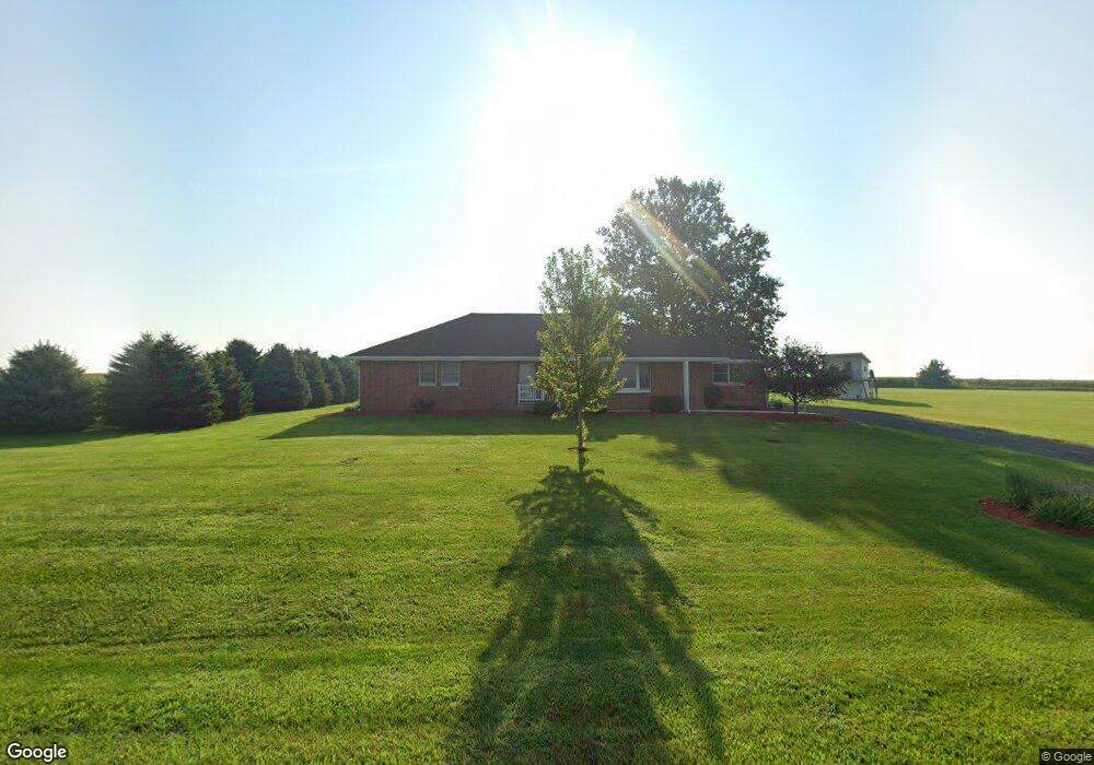
About This Home
This home is located at 20436 Freeport Rd, Sterling, IL 61081 and is currently estimated at $188,000. 20436 Freeport Rd is a home located in Whiteside County.
Ownership History
We collect this data history from publicly available records. To have your information removed, we recommend requesting removal directly through your county’s website.
Purchase Details
Home Financials for this Owner
Home Financials are based on the most recent Mortgage that was taken out on this home.Purchase History
We collect this data history from publicly available records. To have your information removed, we recommend requesting removal directly through your county’s website.
| Date | Buyer | Sale Price | Title Company |
|---|---|---|---|
| $140,000 | None Available |
Mortgage History
We collect this data history from publicly available records. To have your information removed, we recommend requesting removal directly through your county’s website.
| Date | Status | Borrower | Loan Amount |
|---|---|---|---|
| Open | $110,000 |
Tax History
We collect this data history from publicly available records. To have your information removed, we recommend requesting removal directly through your county’s website.
| Year | Tax Paid | Tax Assessment Tax Assessment Total Assessment is a certain percentage of the fair market value that is determined by local assessors to be the total taxable value of land and additions on the property. | Land | Improvement |
|---|---|---|---|---|
| 2025 | $752 | $11,292 | $8,223 | $3,069 |
| 2024 | $715 | $10,517 | $7,659 | $2,858 |
| 2023 | $667 | $9,795 | $7,133 | $2,662 |
| 2022 | $622 | $8,942 | $6,512 | $2,430 |
| 2021 | $320 | $4,508 | $2,254 | $2,254 |
| 2020 | $304 | $4,248 | $2,124 | $2,124 |
| 2019 | $287 | $3,930 | $1,965 | $1,965 |
| 2018 | $282 | $3,876 | $1,938 | $1,938 |
| 2017 | $283 | $3,758 | $1,879 | $1,879 |
| 2016 | $302 | $3,990 | $1,995 | $1,995 |
| 2015 | $290 | $3,790 | $1,895 | $1,895 |
| 2014 | $299 | $3,916 | $1,958 | $1,958 |
| 2013 | $290 | $3,790 | $1,895 | $1,895 |
Map
- 31040 Penrose Rd
- Lot 7 Rodeo Dr
- 104 Gaston St
- 3603 14th Ave
- 1725 Heritage Dr
- 7006 S Unity Rd
- Lot 3 Lenox Rd
- Lot 5 Lenox Rd
- Lot 4 Lenox Rd
- 2202 Meadows Dr
- 26292 Covell Rd
- 2205 Meadows Dr
- 0 E Lincolnway Unit MRD12284937
- 1203 24th Place
- 1206 E 24th St
- 2203 20th Ave
- 905 E 21st St
- Lot 4 E 19th St
- Lot 1 E 19th St
- Lot 403 E 21st St
- 20436 Freeport Rd
- 20342 Freeport Rd
- 20227 Freeport Rd
- 20734 Freeport Rd
- 20024 Freeport Rd
- 20888 Freeport Rd
- 20911 Freeport Rd
- 20914 Freeport Rd
- 19877 Freeport Rd
- 20987 Freeport Rd
- 20988 Freeport Rd
- 30085 Penrose Rd
- 29545 Penrose Rd
- 29909 Penrose Rd
- 29610 Capp Rd
- 29986 Penrose Rd
- 30078 Penrose Rd
- 29890 Penrose Rd
- 29942 Penrose Rd
- 29864 Penrose Rd
Ask me questions while you tour the home.