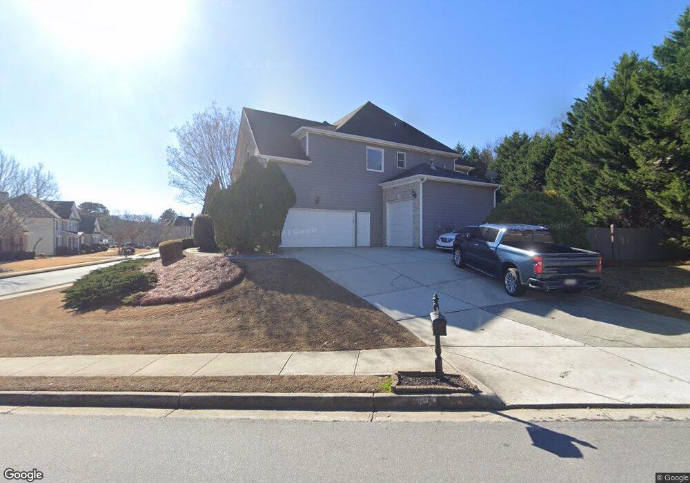
2049 Mapmaker Dr Dacula, GA 30019
Estimated Value: $553,000 - $686,000
5
Beds
3
Baths
3,608
Sq Ft
$171/Sq Ft
Est. Value
About This Home
This home is located at 2049 Mapmaker Dr, Dacula, GA 30019 and is currently estimated at $616,468, approximately $170 per square foot. 2049 Mapmaker Dr is a home located in Gwinnett County with nearby schools including Fort Daniel Elementary School, Frank N. Osborne Middle School, and Mill Creek High School.
Ownership History
Date
Name
Owned For
Owner Type
Purchase Details
Closed on
Apr 10, 2014
Sold by
Colfin Ai Ga 1 Llc
Bought by
Cah 2014 A Borrower Llc
Current Estimated Value
Purchase Details
Closed on
Dec 4, 2012
Sold by
Franco Anthony C
Bought by
Colfin Ai Ga 1 Llc
Purchase Details
Closed on
Feb 25, 2005
Sold by
Bainbridge Homes Llc
Bought by
Franco Anthony C
Home Financials for this Owner
Home Financials are based on the most recent Mortgage that was taken out on this home.
Original Mortgage
$157,500
Interest Rate
5.25%
Mortgage Type
New Conventional
Create a Home Valuation Report for This Property
The Home Valuation Report is an in-depth analysis detailing your home's value as well as a comparison with similar homes in the area
Home Values in the Area
Average Home Value in this Area
Purchase History
| Date | Buyer | Sale Price | Title Company |
|---|---|---|---|
| Cah 2014 A Borrower Llc | -- | -- | |
| Colfin Ai Ga 1 Llc | -- | -- | |
| Franco Anthony C | $342,500 | -- |
Source: Public Records
Mortgage History
| Date | Status | Borrower | Loan Amount |
|---|---|---|---|
| Previous Owner | Franco Anthony C | $157,500 |
Source: Public Records
Tax History
| Year | Tax Paid | Tax Assessment Tax Assessment Total Assessment is a certain percentage of the fair market value that is determined by local assessors to be the total taxable value of land and additions on the property. | Land | Improvement |
|---|---|---|---|---|
| 2025 | $9,599 | $269,800 | $44,000 | $225,800 |
| 2024 | $7,955 | $212,160 | $41,200 | $170,960 |
| 2023 | $7,955 | $212,160 | $41,200 | $170,960 |
| 2022 | $8,063 | $216,160 | $41,200 | $174,960 |
| 2021 | $5,754 | $148,640 | $29,400 | $119,240 |
| 2020 | $5,788 | $148,640 | $29,400 | $119,240 |
| 2019 | $4,535 | $161,120 | $29,400 | $131,720 |
| 2018 | $4,541 | $118,920 | $21,600 | $97,320 |
| 2016 | $5,130 | $135,280 | $21,600 | $113,680 |
| 2015 | $4,367 | $112,160 | $20,000 | $92,160 |
| 2014 | $3,343 | $82,800 | $20,800 | $62,000 |
Source: Public Records
Map
Nearby Homes
- 1958 Mapmaker Dr
- 1838 Mapmaker Dr
- 2727 Captain Ct
- 1728 Scouts Walk NE
- 2755 Fort Daniels Dr
- 1720 Fort Daniels Trail
- 1515 Brisbane Dr
- 2628 Adair Trail
- 1608 School House Run
- 2461 Lance Ridge Way
- 1714 Fort Shawnee Trace Unit 6
- 2678 Adair Trail
- 1521 Rocky Knoll Ln
- 1418 Wilkes Ive Dr
- 2950 Belshire Trail
- 1640 Burnt Oak Way
- 2159 Shin Ct
- 1458 Whitaker Park Place
- 1455 Wilkes Crest Dr
- 1722 Laurel Song Trail Unit 1
- 2049 Mapmaker Dr NE
- 1769 Mapmaker Dr Unit 3
- 2039 Mapmaker Dr Unit 3
- 2048 Mapmaker Dr
- 2029 Mapmaker Dr
- 1779 Mapmaker Dr
- 1779 Mapmaker Dr NE Unit UN 3 PH E
- 1779 Mapmaker Dr NE
- 2038 Mapmaker Dr
- 1748 Mapmaker Dr
- 1768 Mapmaker Dr
- 2512 Hidden Path Trace
- 2009 Mapmaker Dr
- 1778 Mapmaker Dr
- 2555 Wild Heron Ct
- 1789 Mapmaker Dr
- 2525 Hidden Path Trace Unit 3
- 1989 Mapmaker Dr Unit 3
- 1798 Mapmaker Dr Unit 3
- 2575 Wild Heron Ct
Your Personal Tour Guide
Ask me questions while you tour the home.