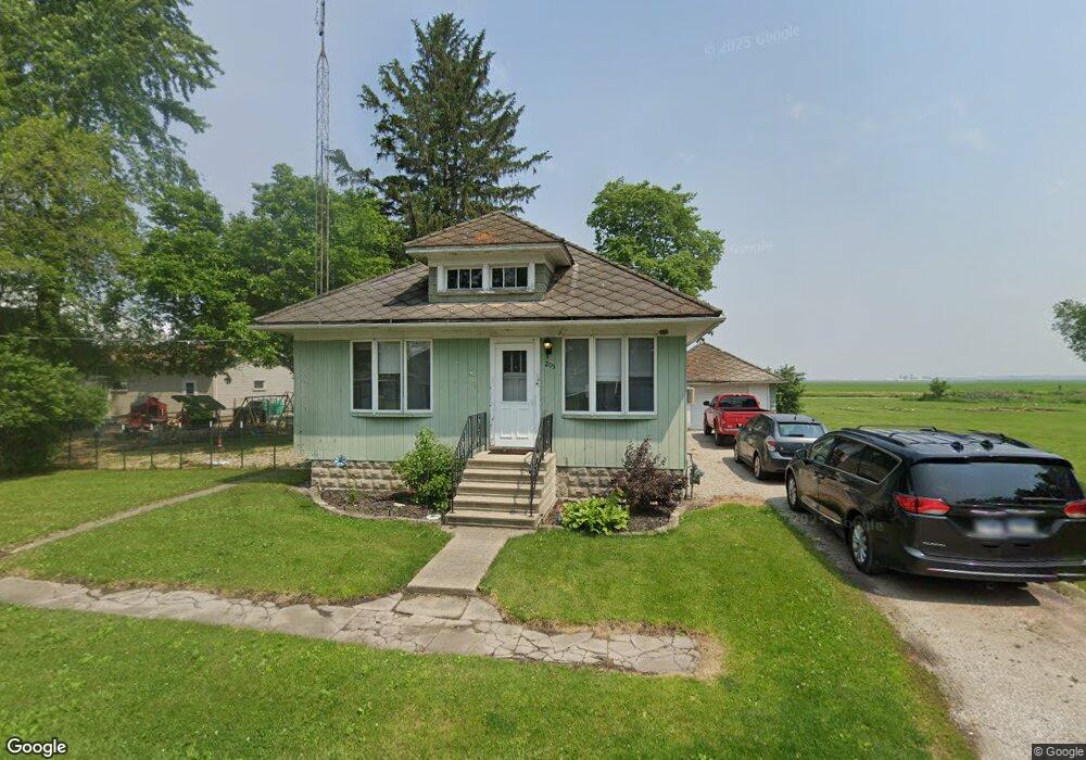
205 Lydia St Graymont, IL 61743
Estimated Value: $58,000 - $109,000
2
Beds
1
Bath
1,032
Sq Ft
$81/Sq Ft
Est. Value
About This Home
This home is located at 205 Lydia St, Graymont, IL 61743 and is currently estimated at $83,802, approximately $81 per square foot. 205 Lydia St is a home located in Livingston County with nearby schools including Graymont Elementary School and Pontiac High School.
Ownership History
Date
Name
Owned For
Owner Type
Purchase Details
Closed on
Aug 30, 2021
Sold by
Jones Carol A and Zehr Lynn R
Bought by
Masching Tyler A and Rudolph Ashley M
Current Estimated Value
Home Financials for this Owner
Home Financials are based on the most recent Mortgage that was taken out on this home.
Original Mortgage
$20,000
Outstanding Balance
$18,199
Interest Rate
2.8%
Mortgage Type
New Conventional
Estimated Equity
$65,603
Create a Home Valuation Report for This Property
The Home Valuation Report is an in-depth analysis detailing your home's value as well as a comparison with similar homes in the area
Purchase History
| Date | Buyer | Sale Price | Title Company |
|---|---|---|---|
| Masching Tyler A | $36,000 | None Available | |
| Masching Tyler A | -- | None Available |
Source: Public Records
Mortgage History
| Date | Status | Borrower | Loan Amount |
|---|---|---|---|
| Open | Masching Tyler A | $20,000 |
Source: Public Records
Tax History
| Year | Tax Paid | Tax Assessment Tax Assessment Total Assessment is a certain percentage of the fair market value that is determined by local assessors to be the total taxable value of land and additions on the property. | Land | Improvement |
|---|---|---|---|---|
| 2024 | $1,577 | $25,602 | $1,085 | $24,517 |
| 2023 | $1,511 | $24,153 | $1,024 | $23,129 |
| 2022 | $1,429 | $22,843 | $985 | $21,858 |
| 2021 | $1,916 | $22,395 | $966 | $21,429 |
| 2020 | $1,917 | $21,743 | $938 | $20,805 |
| 2019 | $1,911 | $21,110 | $911 | $20,199 |
| 2018 | $1,869 | $20,046 | $884 | $19,162 |
| 2017 | $1,779 | $19,275 | $850 | $18,425 |
| 2016 | $1,833 | $20,078 | $885 | $19,193 |
| 2015 | $1,763 | $18,420 | $812 | $17,608 |
| 2013 | $1,722 | $18,079 | $834 | $17,245 |
Source: Public Records
Map
Nearby Homes
- 10735 E 1700 Rd N
- 408 E Ririe Place
- 211 N Monroe St
- 202 N Harrison St
- 100 N Jackson St
- 501 S Main St
- 108 N Jefferson St
- 103 N Jefferson St
- 9898 E 1200 North Rd
- 1635 Mockingbird Ln
- 23750 N 800 Rd E
- 23750 N 800 Rd E
- 1309 W Indian Dr
- 606 Carol Ct Unit B-2
- 43 Crystal Ct Unit B-1
- 25 Crystal Ct Unit D1
- 44 Crystal Ct Unit B-2
- 115 Park Estate Ave Unit 115
- 10788 N 1000 East Rd
- 119 Village Ave
Your Personal Tour Guide
Ask me questions while you tour the home.