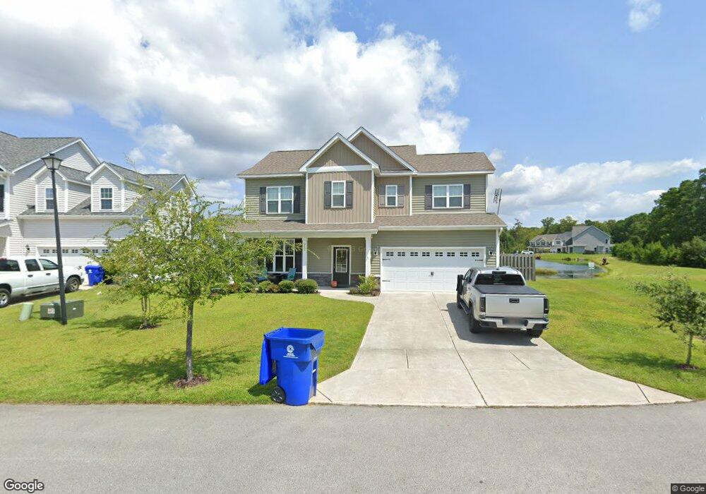
205 Pine Island Dr Hampstead, NC 28443
Estimated Value: $393,537 - $438,000
3
Beds
3
Baths
1,968
Sq Ft
$209/Sq Ft
Est. Value
About This Home
This home is located at 205 Pine Island Dr, Hampstead, NC 28443 and is currently estimated at $410,634, approximately $208 per square foot. 205 Pine Island Dr is a home located in Pender County with nearby schools including North Topsail Elementary School, Topsail Middle School, and Topsail High School.
Ownership History
Date
Name
Owned For
Owner Type
Purchase Details
Closed on
Oct 26, 2020
Sold by
Sampson Tauren Mykel and Sampson Emily Jane
Bought by
Francis Jeffrey Ross
Current Estimated Value
Home Financials for this Owner
Home Financials are based on the most recent Mortgage that was taken out on this home.
Original Mortgage
$219,920
Outstanding Balance
$193,452
Interest Rate
2.8%
Mortgage Type
New Conventional
Estimated Equity
$217,182
Purchase Details
Closed on
Jul 16, 2014
Sold by
Summer Ducks Llc
Bought by
American Homesmith Llc
Create a Home Valuation Report for This Property
The Home Valuation Report is an in-depth analysis detailing your home's value as well as a comparison with similar homes in the area
Home Values in the Area
Average Home Value in this Area
Purchase History
| Date | Buyer | Sale Price | Title Company |
|---|---|---|---|
| Francis Jeffrey Ross | $275,000 | None Available | |
| American Homesmith Llc | $462,500 | None Available |
Source: Public Records
Mortgage History
| Date | Status | Borrower | Loan Amount |
|---|---|---|---|
| Open | Francis Jeffrey Ross | $219,920 |
Source: Public Records
Tax History
| Year | Tax Paid | Tax Assessment Tax Assessment Total Assessment is a certain percentage of the fair market value that is determined by local assessors to be the total taxable value of land and additions on the property. | Land | Improvement |
|---|---|---|---|---|
| 2025 | $1,863 | $373,697 | $32,235 | $341,462 |
| 2024 | $1,863 | $224,407 | $47,591 | $176,816 |
| 2023 | $1,863 | $224,407 | $47,591 | $176,816 |
| 2022 | $1,655 | $224,407 | $47,591 | $176,816 |
| 2021 | $1,655 | $224,407 | $47,591 | $176,816 |
| 2020 | $1,655 | $224,407 | $47,591 | $176,816 |
| 2019 | $1,655 | $224,407 | $47,591 | $176,816 |
| 2018 | $1,509 | $194,122 | $45,000 | $149,122 |
| 2017 | $1,509 | $194,122 | $45,000 | $149,122 |
| 2016 | $1,490 | $194,122 | $45,000 | $149,122 |
| 2015 | -- | $194,122 | $45,000 | $149,122 |
| 2014 | -- | $38,000 | $38,000 | $0 |
Source: Public Records
Map
Nearby Homes
- 206 Pine Island Dr
- 121 Poplar Branch Way
- 118 Poplar Branch Way
- 153 Poplar Branch Way
- 156 Poplar Branch Way
- 125 Belvedere Dr
- 8 Hwy 50
- 236 Red Carnation Dr
- 229 Red Carnation Dr
- 411 Tree Ct
- 215 Chalet Rd
- 232 Belvedere Dr
- 206 Holden Rd
- 111 Woodpecker Rd
- Tract 3 Old Landing Rd
- 207 Willow Ridge Dr
- 105 Hampton Dr
- 106 Porch Swing Way
- 317 Belvedere Dr
- 109 Mockingbird Ln
- 205 Pine Island Dr
- 203 Pine Island Dr
- 203 Pine Island Dr
- 207 Pine Island Dr
- 207 Pine Island Dr
- 138 Poplar Branch Way
- 140 Poplar Branch Way
- 204 Pine Island Dr
- 132 Poplar Branch Way
- 142 Poplar Branch Way
- 132 Pinestraw Dr
- 144 Poplar Branch Way
- 130 Poplar Branch Way
- 139 Poplar Branch Way
- 135 Poplar Branch Way
- 137 Poplar Branch Way
- 146 Poplar Branch Way
- 133 Poplar Branch Way
- 128 Poplar Branch Way
- 131 Poplar Branch Way
Your Personal Tour Guide
Ask me questions while you tour the home.