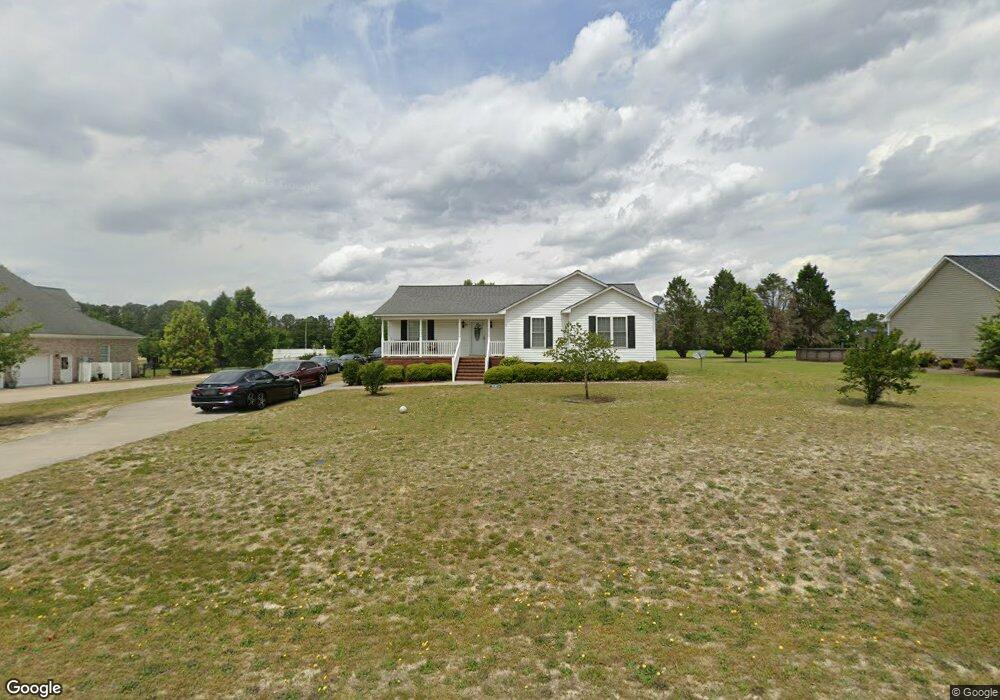
205 Spence St La Grange, NC 28551
Estimated Value: $215,000 - $276,000
About This Home
This home is located at 205 Spence St, La Grange, NC 28551 and is currently estimated at $247,067, approximately $144 per square foot. 205 Spence St is a home located in Lenoir County with nearby schools including La Grange Elementary School, E.B. Frink Middle School, and North Lenoir High School.
Ownership History
We collect this data history from publicly available records. To have your information removed, we recommend requesting removal directly through your county’s website.
Purchase Details
Purchase Details
Home Values in the Area
Average Home Value in this Area
Purchase History
We collect this data history from publicly available records. To have your information removed, we recommend requesting removal directly through your county’s website.
| Date | Buyer | Sale Price | Title Company |
|---|---|---|---|
| $154,869 | Attorney | ||
| $104,000 | None Available |
Tax History
We collect this data history from publicly available records. To have your information removed, we recommend requesting removal directly through your county’s website.
| Year | Tax Paid | Tax Assessment Tax Assessment Total Assessment is a certain percentage of the fair market value that is determined by local assessors to be the total taxable value of land and additions on the property. | Land | Improvement |
|---|---|---|---|---|
| 2025 | $2,099 | $209,222 | $30,874 | $178,348 |
| 2024 | $1,761 | $127,909 | $16,000 | $111,909 |
| 2023 | $1,761 | $127,909 | $16,000 | $111,909 |
| 2022 | $1,761 | $127,909 | $16,000 | $111,909 |
| 2021 | $1,761 | $127,909 | $16,000 | $111,909 |
| 2020 | $1,761 | $127,909 | $16,000 | $111,909 |
| 2019 | $1,761 | $127,909 | $16,000 | $111,909 |
| 2018 | $1,742 | $127,909 | $16,000 | $111,909 |
| 2017 | $1,749 | $127,909 | $16,000 | $111,909 |
| 2014 | $1,735 | $134,989 | $16,000 | $118,989 |
| 2013 | -- | $134,989 | $16,000 | $118,989 |
| 2011 | -- | $134,989 | $16,000 | $118,989 |
Map
- 115 Claude St
- 121 Claude St
- 109 Claude St
- 122 Claude St
- 116 Claude St
- 103 Claude St
- 112 Claude St
- 110 Claude St
- 620 S Caswell St
- 104 Claude St
- 505 S Wooten St
- 501 S Carey St Unit Lot 65
- 409 S Carey St Unit Lot 66
- 407 S Carey St Unit Lot 67
- 405 S Carey St Unit Lot 68
- 802 Madison Ann Dr
- 103 Springhill St
- 302 S Carey St
- 603 Madison Ann Dr
- 112 Abbey Frank St
- 207 Spence St
- 203 Spence St
- 206 Spence St
- 208 Spence St
- 209 Spence St
- 201 Spence St
- 210 Spence St
- 305 Spence St
- 205 Fire Tower Rd
- 301 Spence St
- 205 Firetower Rd
- 203 Fire Tower Rd
- 201 Fire Tower Rd
- 209 Fire Tower Rd
- 303 Spence St
- 301 Fire Tower Rd
- 304 Spence St
- 605 S Caswell St
- 607 S Caswell St
- 221 Wood St
Ask me questions while you tour the home.