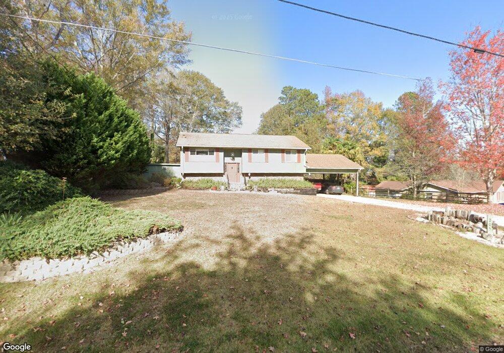
205 Sunset Dr West Point, GA 31833
Estimated Value: $137,000 - $198,355
2
Beds
3
Baths
1,164
Sq Ft
$153/Sq Ft
Est. Value
About This Home
This home is located at 205 Sunset Dr, West Point, GA 31833 and is currently estimated at $178,589, approximately $153 per square foot. 205 Sunset Dr is a home located in Troup County with nearby schools including West Point Elementary School, Long Cane Elementary School, and Whitesville Road Elementary School.
Ownership History
Date
Name
Owned For
Owner Type
Purchase Details
Closed on
Dec 12, 2005
Sold by
Crook Paul A
Bought by
Crook Paul A and Crook Jeanette B
Current Estimated Value
Purchase Details
Closed on
May 1, 1984
Bought by
Paul A Crook
Purchase Details
Closed on
Jan 5, 1977
Purchase Details
Closed on
Sep 15, 1976
Purchase Details
Closed on
Jan 1, 1953
Create a Home Valuation Report for This Property
The Home Valuation Report is an in-depth analysis detailing your home's value as well as a comparison with similar homes in the area
Home Values in the Area
Average Home Value in this Area
Purchase History
| Date | Buyer | Sale Price | Title Company |
|---|---|---|---|
| Crook Paul A | -- | -- | |
| Paul A Crook | -- | -- | |
| -- | -- | -- | |
| -- | -- | -- | |
| -- | -- | -- |
Source: Public Records
Tax History
| Year | Tax Paid | Tax Assessment Tax Assessment Total Assessment is a certain percentage of the fair market value that is determined by local assessors to be the total taxable value of land and additions on the property. | Land | Improvement |
|---|---|---|---|---|
| 2025 | $2,113 | $73,956 | $8,000 | $65,956 |
| 2024 | $1,884 | $59,288 | $8,000 | $51,288 |
| 2023 | $785 | $54,496 | $4,000 | $50,496 |
| 2022 | $1,259 | $52,856 | $4,000 | $48,856 |
| 2021 | $1,170 | $46,540 | $4,000 | $42,540 |
| 2020 | $1,170 | $46,540 | $4,000 | $42,540 |
| 2019 | $1,151 | $45,920 | $4,000 | $41,920 |
| 2018 | $1,087 | $43,800 | $4,000 | $39,800 |
| 2017 | $1,087 | $43,800 | $4,000 | $39,800 |
| 2016 | $938 | $38,848 | $4,000 | $34,848 |
| 2015 | $938 | $38,848 | $4,000 | $34,848 |
| 2014 | $883 | $37,013 | $4,000 | $33,013 |
| 2013 | -- | $37,805 | $4,000 | $33,805 |
Source: Public Records
Map
Nearby Homes
- 0 Sunset Dr Unit 10451831
- 1418 E 10th St
- 0 Arrowhead Dr Unit 10451860
- 1104 E 8th St
- 900 E 9th St
- 4517 Georgia 18
- 4509 Georgia 18
- 4523 Georgia 18
- 4527 Georgia 18
- 1202 E 9th St
- 508 Pine St
- 509 Cleveland St
- 707 E 7th St
- 1800 Malco Dr
- 506 E 6th St
- 1903 Ridgewood Dr
- 0 Ga Highway 0116 Unit 10619139
- 0 Samples Rd Unit 10705121
- 147 Stocks Cir
- 197 Stocks Cir
- 207 Sunset Dr
- 1102 Hawthorn Terrace
- 204 Arrowhead Dr
- 206 Arrowhead Dr
- 204 Sunset Dr
- 210 Arrowhead Dr
- 0 Hawthorn Terrace
- 200 Arrowhead Dr
- 208 Sunset Dr
- 1101 Hawthorn Terrace
- 119 Sunset Dr
- 211 Arrowhead Dr
- 207 Arrowhead Dr
- 205 Arrowhead Dr
- 124 Arrowhead Dr
- 213 Arrowhead Dr
- 203 Arrowhead Dr
- 115 Sunset Dr
- 201 Arrowhead Dr
- 0 Sunset Dr Unit 10338623
Your Personal Tour Guide
Ask me questions while you tour the home.