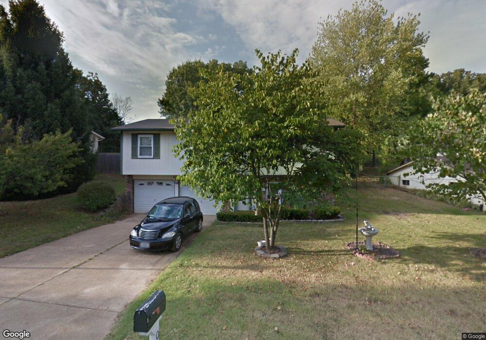
2051 Donnell Dr Barnhart, MO 63012
Estimated Value: $190,349 - $266,000
Studio
--
Bath
1,008
Sq Ft
$235/Sq Ft
Est. Value
About This Home
This home is located at 2051 Donnell Dr, Barnhart, MO 63012 and is currently estimated at $237,337, approximately $235 per square foot. 2051 Donnell Dr is a home located in Jefferson County with nearby schools including Windsor High School and St. Joseph Catholic School.
Ownership History
Date
Name
Owned For
Owner Type
Purchase Details
Closed on
Oct 17, 2019
Sold by
Goebel Etta and Estate Of Tina Marie Crossno
Bought by
Crossno Joshua Matthew and Crossno Devan Wade
Current Estimated Value
Purchase Details
Closed on
May 21, 1998
Sold by
Crossno Anthony and Goebel Tina
Bought by
Crossno Anthony W and Crossno Tina M
Home Financials for this Owner
Home Financials are based on the most recent Mortgage that was taken out on this home.
Original Mortgage
$74,000
Interest Rate
7.22%
Create a Home Valuation Report for This Property
The Home Valuation Report is an in-depth analysis detailing your home's value as well as a comparison with similar homes in the area
Home Values in the Area
Average Home Value in this Area
Purchase History
| Date | Buyer | Sale Price | Title Company |
|---|---|---|---|
| Crossno Joshua Matthew | -- | None Available | |
| Crossno Anthony W | -- | -- |
Source: Public Records
Mortgage History
| Date | Status | Borrower | Loan Amount |
|---|---|---|---|
| Previous Owner | Crossno Anthony W | $74,000 |
Source: Public Records
Tax History
| Year | Tax Paid | Tax Assessment Tax Assessment Total Assessment is a certain percentage of the fair market value that is determined by local assessors to be the total taxable value of land and additions on the property. | Land | Improvement |
|---|---|---|---|---|
| 2025 | $1,590 | $22,900 | $4,800 | $18,100 |
| 2024 | $1,590 | $21,700 | $4,800 | $16,900 |
| 2023 | $1,590 | $21,700 | $4,800 | $16,900 |
| 2022 | $1,404 | $19,200 | $2,300 | $16,900 |
| 2021 | $1,405 | $19,200 | $2,300 | $16,900 |
| 2020 | $1,290 | $17,100 | $1,900 | $15,200 |
| 2019 | $1,288 | $17,100 | $1,900 | $15,200 |
| 2018 | $1,271 | $17,100 | $1,900 | $15,200 |
| 2017 | $1,222 | $17,100 | $1,900 | $15,200 |
| 2016 | $1,126 | $15,700 | $1,900 | $13,800 |
Source: Public Records
Map
Nearby Homes
- 1955 Parkton Way
- 2149 Meadow Dr
- 0 Hwy Mm Unit MAR24032005
- 1660 Old State Road M
- 7235 Adams Ct
- 2118 Birchwood Dr
- 1962 Birchwood Dr
- 2211 Castlegate Dr
- 2525 Castle Pines Dr
- 1721 Burgess Way
- 6788 Haven Hill Rd
- 1022 Graystone Park
- 36 Huntleigh Woods
- 1702 Springbrook Dr
- 1530 1st St
- 6573 Buckingham Palace Dr
- 6570 Ike Dr
- 2712 Kings Crossing Dr
- 1473 Grey Wolf Dr
- 1525 Prehistoric Hill Dr
- 2047 Donnell Dr
- 2055 Donnell Dr
- 2054 Donnell Dr
- 2050 Donnell Dr
- 2043 Donnell Dr
- 2048 Donnell Dr
- 2058 Donnell Dr
- 2042 Parkton West Dr
- 2103 S Oaks Dr
- 2038 Parkton West Dr
- 2046 Parkton Dr W
- 2044 Donnell Dr
- 2046 Parkton West Dr
- 2034 Parkton Dr W
- 2100 S Oaks Dr
- 2100 S Oaks Dr
- 2034 Parkton West Dr
- 2129 Catlin Ct
- 2125 Catlin Ct
- 2040 Donnell Dr
Your Personal Tour Guide
Ask me questions while you tour the home.