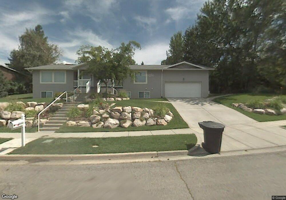
2053 S 1150 E Bountiful, UT 84010
Estimated Value: $628,000 - $679,965
5
Beds
4
Baths
3,156
Sq Ft
$208/Sq Ft
Est. Value
About This Home
This home is located at 2053 S 1150 E, Bountiful, UT 84010 and is currently estimated at $656,741, approximately $208 per square foot. 2053 S 1150 E is a home located in Davis County with nearby schools including Muir School, Mueller Park Junior High School, and Bountiful High School.
Ownership History
Date
Name
Owned For
Owner Type
Purchase Details
Closed on
Jul 12, 2017
Sold by
Owens Stephanie
Bought by
Owens David S
Current Estimated Value
Home Financials for this Owner
Home Financials are based on the most recent Mortgage that was taken out on this home.
Original Mortgage
$288,750
Outstanding Balance
$239,652
Interest Rate
3.94%
Mortgage Type
New Conventional
Estimated Equity
$417,089
Purchase Details
Closed on
Aug 24, 2006
Sold by
Webb Richard R and Webb Linda R
Bought by
Metcalf Richard H and Metcalf Cindy L
Create a Home Valuation Report for This Property
The Home Valuation Report is an in-depth analysis detailing your home's value as well as a comparison with similar homes in the area
Purchase History
| Date | Buyer | Sale Price | Title Company |
|---|---|---|---|
| Owens David S | -- | First American Title | |
| Metcalf Richard H | -- | Cottonwood Title Ins Agency |
Source: Public Records
Mortgage History
| Date | Status | Borrower | Loan Amount |
|---|---|---|---|
| Open | Owens David S | $288,750 |
Source: Public Records
Tax History
| Year | Tax Paid | Tax Assessment Tax Assessment Total Assessment is a certain percentage of the fair market value that is determined by local assessors to be the total taxable value of land and additions on the property. | Land | Improvement |
|---|---|---|---|---|
| 2025 | $923 | $341,000 | $143,211 | $197,789 |
| 2024 | $311 | $328,899 | $131,891 | $197,008 |
| 2023 | $3,377 | $317,900 | $132,603 | $185,296 |
| 2022 | $3,417 | $583,000 | $233,919 | $349,081 |
| 2021 | $810 | $447,000 | $191,386 | $255,614 |
| 2020 | $2,755 | $397,000 | $174,224 | $222,776 |
| 2019 | $2,790 | $393,000 | $167,302 | $225,698 |
| 2018 | $2,599 | $360,000 | $155,994 | $204,006 |
| 2016 | $216 | $172,150 | $51,572 | $120,578 |
| 2015 | $2,240 | $158,840 | $51,572 | $107,268 |
| 2014 | $288 | $149,632 | $51,572 | $98,060 |
| 2013 | -- | $141,757 | $52,805 | $88,952 |
Source: Public Records
Map
Nearby Homes
- 2156 Elaine Dr
- 994 Deborah Dr
- 1087 Arlington Way
- 2198 Elaine Dr
- 2136 S 900 E
- 2115 S Ridgewood Way
- 1812 S 900 E
- 831 E San Simeon Way S
- 0 Bountiful Blvd
- 1785 1450 E
- 761 San Simeon Way
- 1761 S Davis Blvd
- 1735 S Temple Ct Unit 203
- 1596 E Millbrook Way
- 1885 Spring Creek Dr
- 775 E 1500 S
- 631 E 1700 S
- 2768 E 1500
- 2768 S 1500 E
- 795 Abby Ln Unit 5
- 1164 E 2050 S
- 2077 S 1150 E
- 1164 Deborah Dr
- 2080 Browns Park Dr
- 1140 Deborah Dr
- 1140 E 2050 S
- 1153 E 2050 S
- 2062 Browns Park Dr
- 2089 S 1150 E
- 2080 S 1150 E
- 2062 S 1200 E
- 1202 Golf Course Dr
- 1141 E 2050 S
- 2092 S 1150 E
- 1130 Deborah Dr
- 1181 E 2050 S
- 1130 E 2050 S
- 2024 S 1175 E
- 2071 S 1125 E
- 2101 S 1150 E
Your Personal Tour Guide
Ask me questions while you tour the home.