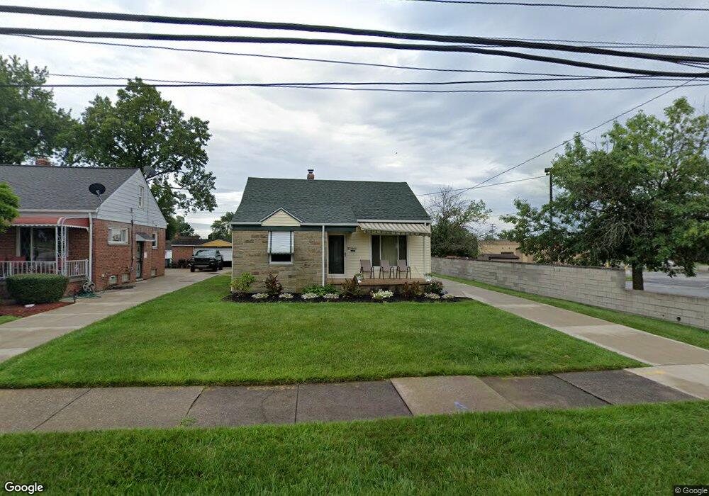
20600 Applegate Rd Maple Heights, OH 44137
Estimated Value: $132,269 - $166,000
About This Home
This home is located at 20600 Applegate Rd, Maple Heights, OH 44137 and is currently estimated at $143,567, approximately $115 per square foot. 20600 Applegate Rd is a home located in Cuyahoga County with nearby schools including Abraham Lincoln Elementary School, Rockside/ J.F. Kennedy School, and Barack Obama School.
Ownership History
We collect this data history from publicly available records. To have your information removed, we recommend requesting removal directly through your county’s website.
Purchase Details
Home Financials for this Owner
Home Financials are based on the most recent Mortgage that was taken out on this home.Purchase Details
Purchase Details
Purchase Details
Purchase Details
Home Values in the Area
Average Home Value in this Area
Purchase History
We collect this data history from publicly available records. To have your information removed, we recommend requesting removal directly through your county’s website.
| Date | Buyer | Sale Price | Title Company |
|---|---|---|---|
| $93,000 | Transcounty Title Agency Inc | ||
| -- | Transcounty Title Agency Inc | ||
| -- | -- | ||
| -- | -- | ||
| -- | -- | ||
| -- | -- |
Mortgage History
We collect this data history from publicly available records. To have your information removed, we recommend requesting removal directly through your county’s website.
| Date | Status | Borrower | Loan Amount |
|---|---|---|---|
| Open | $92,229 |
Tax History
We collect this data history from publicly available records. To have your information removed, we recommend requesting removal directly through your county’s website.
| Year | Tax Paid | Tax Assessment Tax Assessment Total Assessment is a certain percentage of the fair market value that is determined by local assessors to be the total taxable value of land and additions on the property. | Land | Improvement |
|---|---|---|---|---|
| 2025 | $3,574 | $43,645 | $6,650 | $36,995 |
| 2024 | $3,978 | $43,645 | $6,650 | $36,995 |
| 2023 | $3,028 | $28,360 | $4,380 | $23,980 |
| 2022 | $3,017 | $28,350 | $4,380 | $23,980 |
| 2021 | $3,223 | $28,350 | $4,380 | $23,980 |
| 2020 | $2,744 | $21,490 | $3,330 | $18,170 |
| 2019 | $2,731 | $61,400 | $9,500 | $51,900 |
| 2018 | $2,647 | $21,490 | $3,330 | $18,170 |
| 2017 | $2,790 | $21,670 | $3,330 | $18,340 |
| 2016 | $2,679 | $21,500 | $3,330 | $18,170 |
| 2015 | $2,700 | $21,500 | $3,330 | $18,170 |
| 2014 | $2,700 | $23,630 | $3,640 | $19,990 |
Map
- 20724 Applegate Rd
- 419 Center Rd
- 54 Willard Ave
- 0 Hubbell Cir
- 54 Hubbell Way
- 66 Hubbell Way
- 58 Hubbell Way
- 62 Hubbell Way
- 20514 Mountville Dr
- 61 Hubbell Way
- 57 Hubbell Way
- 19513 Beverly Ave
- 19280 Stafford Ave
- 21202 Gardenview Dr
- 19910 Mountville Dr
- 21506 Kenyon Dr
- 19409 Libby Rd
- 5147 Warrensville Center Rd
- 130 Grand Blvd
- 5427 Mardale Ave
- 20616 Applegate Rd
- 20620 Applegate Rd
- 20612 Applegate Rd
- 20608 Applegate Rd
- 20624 Applegate Rd
- 20618 Centurway
- 20618 Centuryway Rd
- 20604 Applegate Rd
- 20628 Applegate Rd
- 20615 Donny Brook Rd
- 20611 Donny Brook Rd
- 20619 Donny Brook Rd
- 20623 Donny Brook Rd
- 20629 Bowling Green Rd
- 20622 Centuryway Rd
- 20632 Applegate Rd
- 20603 Donny Brook Rd
- 20613 Centuryway Rd
- 20627 Donny Brook Rd
- 20623 Donnybrook Rd
Ask me questions while you tour the home.