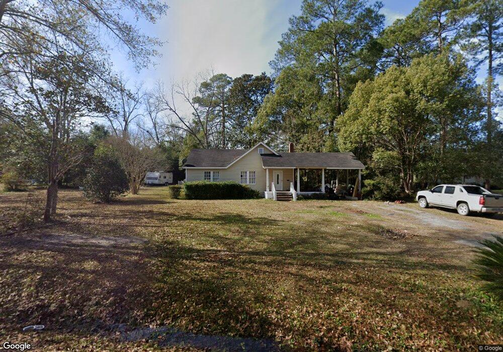
2061 Leon Hurst St Ochlocknee, GA 31773
Estimated Value: $120,000 - $173,000
Studio
1
Bath
1,476
Sq Ft
$92/Sq Ft
Est. Value
About This Home
This home is located at 2061 Leon Hurst St, Ochlocknee, GA 31773 and is currently estimated at $135,378, approximately $91 per square foot. 2061 Leon Hurst St is a home located in Thomas County with nearby schools including Hand in Hand Primary School, Cross Creek Elementary School, and Garrison-Pilcher Elementary School.
Ownership History
Date
Name
Owned For
Owner Type
Purchase Details
Closed on
Feb 26, 2012
Sold by
Lombardi Robyn H
Bought by
Lombardi Robyn H
Current Estimated Value
Purchase Details
Closed on
Jul 26, 2007
Sold by
Lombardi Robyn H
Bought by
Huffmaster Robert Monroe
Purchase Details
Closed on
Oct 22, 2002
Sold by
Lombardi Daryl L Jr Estate
Bought by
Lombardi Robyn H
Purchase Details
Closed on
Dec 29, 1998
Bought by
Lombardi Daryl L
Create a Home Valuation Report for This Property
The Home Valuation Report is an in-depth analysis detailing your home's value as well as a comparison with similar homes in the area
Purchase History
| Date | Buyer | Sale Price | Title Company |
|---|---|---|---|
| Lombardi Robyn H | -- | -- | |
| Huffmaster Robert Monroe | -- | -- | |
| Lombardi Robyn H | -- | -- | |
| Lombardi Daryl L | $40,900 | -- |
Source: Public Records
Tax History
| Year | Tax Paid | Tax Assessment Tax Assessment Total Assessment is a certain percentage of the fair market value that is determined by local assessors to be the total taxable value of land and additions on the property. | Land | Improvement |
|---|---|---|---|---|
| 2025 | $910 | $32,736 | $3,484 | $29,252 |
| 2024 | $937 | $32,416 | $3,484 | $28,932 |
| 2023 | $863 | $30,336 | $3,484 | $26,852 |
| 2022 | $646 | $26,917 | $2,904 | $24,013 |
| 2021 | $606 | $22,968 | $2,904 | $20,064 |
| 2020 | $612 | $22,655 | $2,904 | $19,751 |
| 2019 | $615 | $22,655 | $2,904 | $19,751 |
| 2018 | $621 | $22,683 | $2,904 | $19,779 |
| 2017 | $632 | $22,754 | $2,584 | $20,170 |
| 2016 | $630 | $22,599 | $2,584 | $20,014 |
| 2015 | $708 | $25,180 | $2,410 | $22,770 |
| 2014 | $697 | $24,628 | $2,410 | $22,218 |
| 2013 | -- | $24,628 | $2,410 | $22,218 |
Source: Public Records
Map
Nearby Homes
- 27286 U S Highway 19
- 27286 U S 19
- 5801 State Route 188
- 1594 Dollar Store Rd
- 116 Yellow Pine Ln
- 415 Jane's Ln
- 00 Rupp Rd
- 23481 N Us 19 (7 46 Ac) Hwy
- 23481 N Us Hwy 19 (7 46 Ac)
- 23481 N Us Hwy 19 (7 46 Acres)
- 2542 Maddox Rd
- 1065 Egg and Butter Rd N
- 108 Quail Ridge St
- 127 Quail Ridge
- 124 Quail Ridge
- 5488 Bulloch Rd
- 210 Egg and Butter Rd N
- 210 Egg & Butter Rd
- 107 Mossy Creek Way
- 105 Mossy Creek Way
- 2019 Leon Hurst St
- 3050 Spence St
- 2062 Spence St
- 2056 Leon Hurst St
- 3092 Spence St
- 2110 Spence St
- 3041 Spence St
- 3021 Spence St
- 3059 Spence St
- 3025 Beverly St
- 3077 Spence St
- 4030 Spence St
- 1065 Leon Hurst St
- 2091 Spence St
- Tract 6 Bullock Rd
- Tract 5 Bullock Rd
- 1136 Beverly St
- 1056 Beverly St
- 1065 Beverly St
- 3013 Leon Hurst St
Your Personal Tour Guide
Ask me questions while you tour the home.