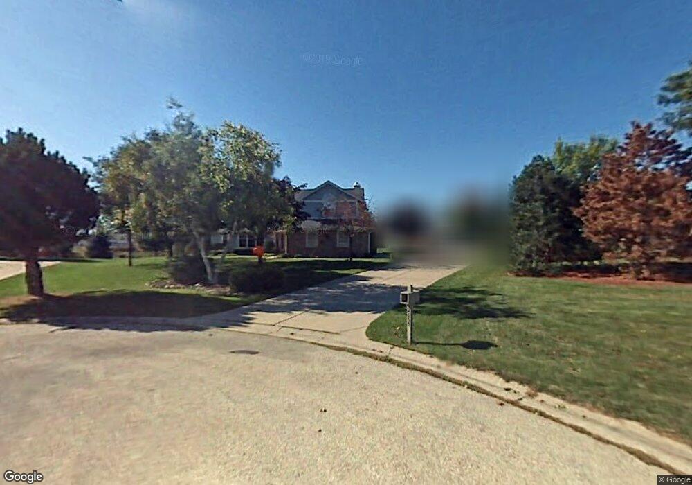
2065 Colby Ct Brookfield, WI 53045
Brookfield AreaEstimated Value: $615,000 - $740,000
About This Home
This home is located at 2065 Colby Ct, Brookfield, WI 53045 and is currently estimated at $684,982, approximately $276 per square foot. 2065 Colby Ct is a home located in Waukesha County with nearby schools including Brookfield Elementary School, Wisconsin Hills Middle School, and Brookfield Central High School.
Ownership History
We collect this data history from publicly available records. To have your information removed, we recommend requesting removal directly through your county’s website.
Purchase Details
Home Financials for this Owner
Home Financials are based on the most recent Mortgage that was taken out on this home.Purchase Details
Home Financials for this Owner
Home Financials are based on the most recent Mortgage that was taken out on this home.Home Values in the Area
Average Home Value in this Area
Purchase History
We collect this data history from publicly available records. To have your information removed, we recommend requesting removal directly through your county’s website.
| Date | Buyer | Sale Price | Title Company |
|---|---|---|---|
| $363,000 | Priority Title Corporation | ||
| $335,000 | -- |
Mortgage History
We collect this data history from publicly available records. To have your information removed, we recommend requesting removal directly through your county’s website.
| Date | Status | Borrower | Loan Amount |
|---|---|---|---|
| Open | $263,000 | ||
| Previous Owner | $268,000 |
Tax History
We collect this data history from publicly available records. To have your information removed, we recommend requesting removal directly through your county’s website.
| Year | Tax Paid | Tax Assessment Tax Assessment Total Assessment is a certain percentage of the fair market value that is determined by local assessors to be the total taxable value of land and additions on the property. | Land | Improvement |
|---|---|---|---|---|
| 2025 | $6,233 | $540,200 | $144,500 | $395,700 |
| 2024 | $6,057 | $540,200 | $144,500 | $395,700 |
| 2023 | $6,062 | $540,200 | $144,500 | $395,700 |
| 2022 | $6,189 | $431,400 | $139,100 | $292,300 |
| 2021 | $6,557 | $431,400 | $139,100 | $292,300 |
| 2020 | $6,832 | $431,400 | $139,100 | $292,300 |
| 2019 | $6,565 | $431,400 | $139,100 | $292,300 |
| 2018 | $6,311 | $403,600 | $140,000 | $263,600 |
| 2017 | $6,307 | $403,600 | $140,000 | $263,600 |
| 2016 | $6,398 | $403,600 | $140,000 | $263,600 |
| 2015 | $6,361 | $403,600 | $140,000 | $263,600 |
| 2014 | $6,598 | $403,600 | $140,000 | $263,600 |
| 2013 | $6,598 | $403,600 | $140,000 | $263,600 |
Map
- 2270 Vincent Dr
- 21300 Astolat Dr
- 2005 Derrin Ln
- 21180 Mary Lynn Dr
- 2470 Lionel Ct
- 21700 Ann Rita Dr
- 21975 W North Ave
- 21775 Gaywood Dr
- 20750 Lincolnshire Ct
- 21660 Mayrose Blvd
- 19755 Brian Dr
- 2820 Norman Dr
- 21100 Chancery Ct
- 1340 Barrington Woods Dr
- N22W22227 Meadowood Ct
- 1790 Kelly Ln
- Lt118 Berwick Ct
- Lt120 Berwick Ct
- Lt116 Berwick Ct
- 19185 Alta Vista Dr
- 2050 Colby Ct
- 20810 Carrington Ct
- 20765 Vincent Dr
- 20795 Carrington Ct
- 20830 Carrington Ct
- 2080 Colby Ct
- 20825 Vincent Dr
- 20835 Carrington Ct
- 20675 Vincent Dr
- 4803 Vincent Dr
- 4819 Vincent Dr
- 20850 Carrington Ct
- 20750 Vincent Dr
- 20865 Vincent Dr
- 20780 Vincent Dr
- 20700 Vincent Dr
- 20880 Carrington Ct
- 20865 Carrington Ct
- 20895 Vincent Dr
- 20830 Vincent Dr
Ask me questions while you tour the home.