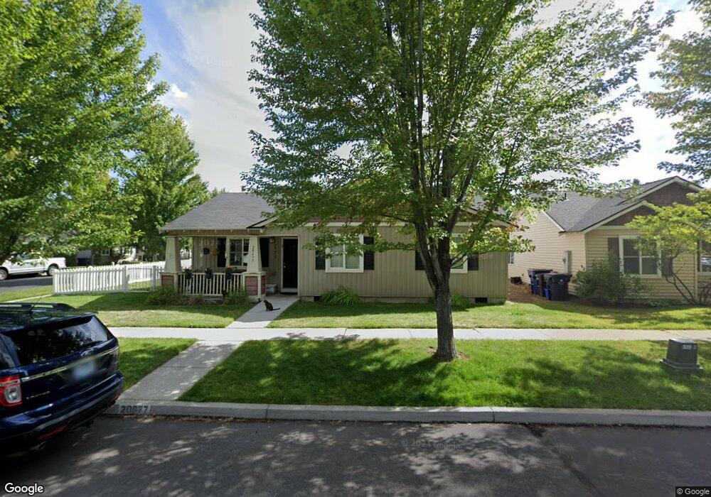
20677 Daisy Ln Bend, OR 97702
Old Farm District NeighborhoodEstimated Value: $474,000 - $499,422
3
Beds
2
Baths
1,200
Sq Ft
$409/Sq Ft
Est. Value
About This Home
This home is located at 20677 Daisy Ln, Bend, OR 97702 and is currently estimated at $491,356, approximately $409 per square foot. 20677 Daisy Ln is a home located in Deschutes County with nearby schools including R.E. Jewell Elementary School, High Desert Middle School, and Deschutes River Montessori School.
Ownership History
Date
Name
Owned For
Owner Type
Purchase Details
Closed on
Dec 19, 2020
Sold by
Christopher And Mary Kent Family Trust and Kent Christopher H
Bought by
Christopher And Mary Kent Family Trust and Kent
Current Estimated Value
Purchase Details
Closed on
Dec 14, 2020
Sold by
Kent Christopher H and Kent Mary K
Bought by
Kent Christopher H and Kent Mary K
Purchase Details
Closed on
Jun 30, 2010
Sold by
Bledsoe Adam M
Bought by
Kent Christopher H and Kent Mary K
Home Financials for this Owner
Home Financials are based on the most recent Mortgage that was taken out on this home.
Original Mortgage
$57,500
Interest Rate
4.82%
Mortgage Type
New Conventional
Purchase Details
Closed on
Jun 15, 2010
Sold by
Reconnect Llc
Bought by
Bledsoe Adam M
Home Financials for this Owner
Home Financials are based on the most recent Mortgage that was taken out on this home.
Original Mortgage
$57,500
Interest Rate
4.82%
Mortgage Type
New Conventional
Purchase Details
Closed on
Mar 29, 2007
Sold by
Bledsoe Adam M
Bought by
Reconnect Llc
Home Financials for this Owner
Home Financials are based on the most recent Mortgage that was taken out on this home.
Original Mortgage
$214,400
Interest Rate
6.37%
Mortgage Type
Unknown
Purchase Details
Closed on
Mar 20, 2007
Sold by
Mac & Jack Llc
Bought by
Bledsoe Adam M
Home Financials for this Owner
Home Financials are based on the most recent Mortgage that was taken out on this home.
Original Mortgage
$214,400
Interest Rate
6.37%
Mortgage Type
Unknown
Purchase Details
Closed on
Apr 27, 2006
Sold by
Bledsoe Adam M and Loper Ian R
Bought by
Mac & Jack Llc
Home Financials for this Owner
Home Financials are based on the most recent Mortgage that was taken out on this home.
Original Mortgage
$218,320
Interest Rate
6.25%
Mortgage Type
Fannie Mae Freddie Mac
Purchase Details
Closed on
Apr 4, 2006
Sold by
Lee Karen M and Lee Jason M
Bought by
Roper Ian R and Bledsoe Adam M
Home Financials for this Owner
Home Financials are based on the most recent Mortgage that was taken out on this home.
Original Mortgage
$218,320
Interest Rate
6.25%
Mortgage Type
Fannie Mae Freddie Mac
Purchase Details
Closed on
Oct 14, 2003
Sold by
The Hollman Co Inc
Bought by
Lee Karen M and Lee Jason M
Home Financials for this Owner
Home Financials are based on the most recent Mortgage that was taken out on this home.
Original Mortgage
$143,450
Interest Rate
4.62%
Mortgage Type
Unknown
Create a Home Valuation Report for This Property
The Home Valuation Report is an in-depth analysis detailing your home's value as well as a comparison with similar homes in the area
Home Values in the Area
Average Home Value in this Area
Purchase History
| Date | Buyer | Sale Price | Title Company |
|---|---|---|---|
| Christopher And Mary Kent Family Trust | -- | None Listed On Document | |
| Kent Christopher H | -- | None Available | |
| Kent Christopher H | $115,000 | Amerititle | |
| Bledsoe Adam M | -- | Accommodation | |
| Reconnect Llc | -- | Accommodation | |
| Bledsoe Adam M | -- | Accommodation | |
| Mac & Jack Llc | -- | Accommodation | |
| Roper Ian R | $272,900 | Western Title & Escrow Co | |
| Lee Karen M | $159,425 | Amerititle |
Source: Public Records
Mortgage History
| Date | Status | Borrower | Loan Amount |
|---|---|---|---|
| Previous Owner | Kent Christopher H | $57,500 | |
| Previous Owner | Bledsoe Adam M | $214,400 | |
| Previous Owner | Roper Ian R | $218,320 | |
| Previous Owner | Lee Karen M | $143,450 |
Source: Public Records
Tax History
| Year | Tax Paid | Tax Assessment Tax Assessment Total Assessment is a certain percentage of the fair market value that is determined by local assessors to be the total taxable value of land and additions on the property. | Land | Improvement |
|---|---|---|---|---|
| 2025 | $3,229 | $191,120 | -- | -- |
| 2024 | $3,107 | $185,560 | -- | -- |
| 2023 | $2,880 | $180,160 | $0 | $0 |
| 2022 | $2,687 | $169,830 | $0 | $0 |
| 2021 | $2,691 | $164,890 | $0 | $0 |
| 2020 | $2,553 | $164,890 | $0 | $0 |
| 2019 | $2,482 | $160,090 | $0 | $0 |
| 2018 | $2,412 | $155,430 | $0 | $0 |
| 2017 | $2,342 | $150,910 | $0 | $0 |
| 2016 | $2,233 | $146,520 | $0 | $0 |
| 2015 | $2,171 | $142,260 | $0 | $0 |
| 2014 | $2,107 | $138,120 | $0 | $0 |
Source: Public Records
Map
Nearby Homes
- 61142 Brookhollow Dr
- 61089 SE Echo Lake Ct
- 20640 SE Cougar Peak Dr
- 60069 SE Ruby Peak Loop
- 20688 White Dove Ln
- 20627 White Dove Ln
- 20596 Button Brush Ave
- 20657 Wild Goose Ln
- 20606 Songbird Ln
- 20844 Sotra Loop
- 20860 SE Sotra Loop
- 61209 Dayspring Dr
- 61163 Ambassador Dr
- 61115 Ambassador Dr
- 61173 Ridgewater Loop
- 20848 Gateway Dr
- 61166 SE Berkshire Way Unit Lot 107
- 61170 SE Berkshire Way Unit Lot 108
- 20836 SE Sunniberg Ln
- 61108 SE Stari Most Loop
- 20671 Daisy Ln
- 61117 Brookhollow Dr
- 61048 Larkspur Loop
- 61122 Brookhollow Dr
- 61126 Brookhollow Dr
- 20678 Daisy Ln
- 61052 Larkspur Loop
- 20672 Daisy Ln
- 61118 Brookhollow Dr
- 20659 Daisy Ln
- 61130 Brookhollow Dr
- 20668 Daisy Ln
- 61056 Larkspur Loop
- 61114 Brookhollow Dr
- 20660 Daisy Ln
- 20653 Daisy Ln
- 20675 Wild Rose Ln
- 20669 Wild Rose Ln
- 61045 Larkspur Loop
- 61049 Larkspur Loop
Your Personal Tour Guide
Ask me questions while you tour the home.