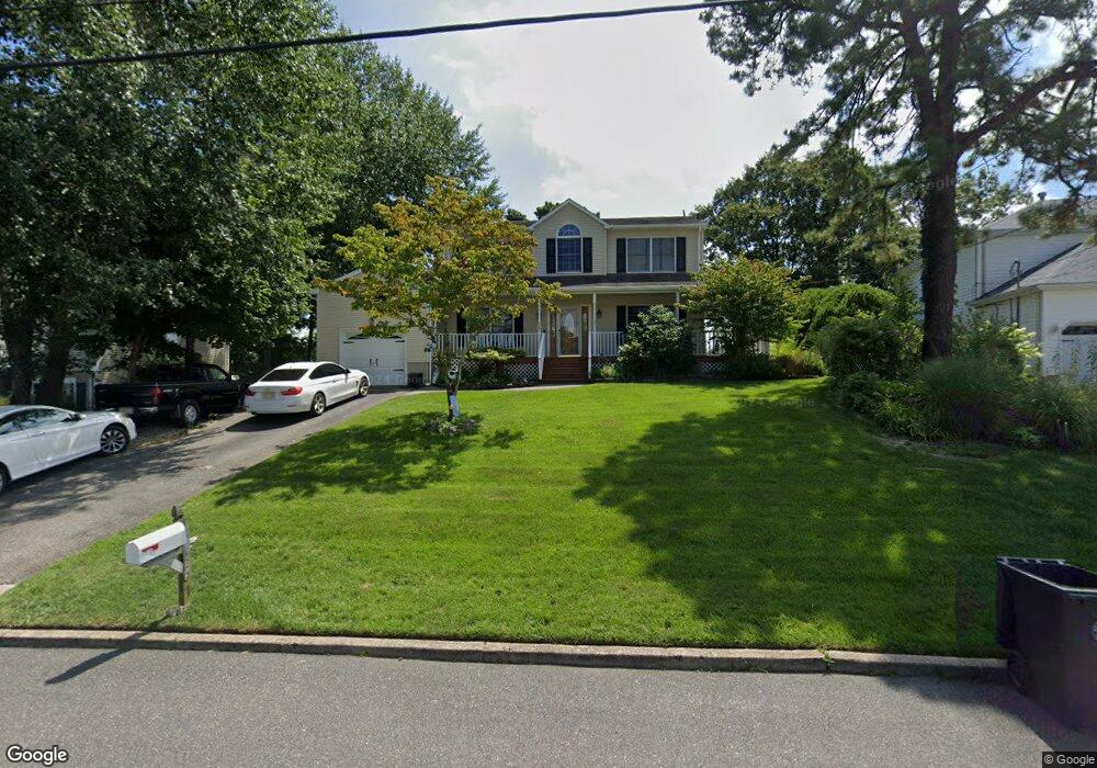
207 Riptide Ave Manahawkin, NJ 08050
Estimated Value: $559,930 - $645,000
4
Beds
4
Baths
2,377
Sq Ft
$252/Sq Ft
Est. Value
About This Home
This home is located at 207 Riptide Ave, Manahawkin, NJ 08050 and is currently estimated at $598,983, approximately $251 per square foot. 207 Riptide Ave is a home located in Ocean County with nearby schools including Ocean Acres Elementary School, Oxycocus Elementary School, and McKinley Avenue Elementary School.
Ownership History
Date
Name
Owned For
Owner Type
Purchase Details
Closed on
Nov 20, 2017
Sold by
Scheffer Kimberly
Bought by
Scheffer William
Current Estimated Value
Home Financials for this Owner
Home Financials are based on the most recent Mortgage that was taken out on this home.
Original Mortgage
$236,000
Outstanding Balance
$197,913
Interest Rate
3.88%
Mortgage Type
New Conventional
Estimated Equity
$401,070
Purchase Details
Closed on
Oct 27, 2003
Sold by
Rivera Robert
Bought by
Scheffer William
Purchase Details
Closed on
Aug 5, 2003
Sold by
Frick Charles
Bought by
Mountain Laurel Homes
Purchase Details
Closed on
Nov 22, 1999
Sold by
Smith Marie and Smith James E
Bought by
Rivera Robert and Rivera Sharon A
Home Financials for this Owner
Home Financials are based on the most recent Mortgage that was taken out on this home.
Original Mortgage
$108,872
Interest Rate
7.86%
Mortgage Type
FHA
Create a Home Valuation Report for This Property
The Home Valuation Report is an in-depth analysis detailing your home's value as well as a comparison with similar homes in the area
Home Values in the Area
Average Home Value in this Area
Purchase History
| Date | Buyer | Sale Price | Title Company |
|---|---|---|---|
| Scheffer William | -- | -- | |
| Scheffer William | $285,000 | -- | |
| Mountain Laurel Homes | $87,500 | -- | |
| Rivera Robert | $172,000 | Transnation Title Insurance |
Source: Public Records
Mortgage History
| Date | Status | Borrower | Loan Amount |
|---|---|---|---|
| Open | Scheffer William | $236,000 | |
| Previous Owner | Rivera Robert | $108,872 |
Source: Public Records
Tax History
| Year | Tax Paid | Tax Assessment Tax Assessment Total Assessment is a certain percentage of the fair market value that is determined by local assessors to be the total taxable value of land and additions on the property. | Land | Improvement |
|---|---|---|---|---|
| 2025 | $6,815 | $259,800 | $62,200 | $197,600 |
| 2024 | $6,388 | $259,800 | $62,200 | $197,600 |
| 2023 | $6,116 | $259,800 | $62,200 | $197,600 |
| 2022 | $6,116 | $259,800 | $62,200 | $197,600 |
| 2021 | $6,033 | $259,800 | $62,200 | $197,600 |
| 2020 | $6,040 | $259,800 | $62,200 | $197,600 |
| 2019 | $5,955 | $259,800 | $62,200 | $197,600 |
| 2018 | $5,918 | $259,800 | $62,200 | $197,600 |
| 2017 | $6,111 | $259,700 | $62,200 | $197,500 |
| 2016 | $6,048 | $259,700 | $62,200 | $197,500 |
| 2015 | $5,835 | $259,700 | $62,200 | $197,500 |
| 2014 | $5,735 | $252,100 | $61,400 | $190,700 |
Source: Public Records
Map
Nearby Homes
- 197 Inlet Ave
- 1070 Rudder Ave
- 1033 Cutlass Ave
- 135 Nautilus Dr
- 118 Autumn Oak Ln
- 160 Spinnaker Ave
- 27 Payton Dr
- 167 Ashburn Ave
- 171 Bradshaw Dr
- 1186 Galley Ave
- 1113 Seashell Ave
- 1029 Beach Ln
- 372 Nautilus Dr
- 223 Serpent Ln
- 58 Flipper Ave
- 491 Lighthouse Dr
- 496 Lighthouse Dr
- 491 Coral Ln
- 0 Levi's Rd
- 1090 Ridge Ave
- 211 Riptide Ave
- 210 Lighthouse Dr
- 206 Lighthouse Dr
- 214 Lighthouse Dr
- 202 Lighthouse Dr
- 199 Riptide Ave
- 215 Riptide Ave
- 204 Riptide Ave
- 200 Riptide Ave
- 208 Riptide Ave
- 218 Lighthouse Dr
- 198 Lighthouse Dr
- 195 Riptide Ave
- 196 Riptide Ave
- 999 White Cap Ave
- 212 Riptide Ave
- 1007 Whitecap Ave
- 194 Lighthouse Dr
- 222 Lighthouse Dr
- 201 Inlet Ave
Your Personal Tour Guide
Ask me questions while you tour the home.