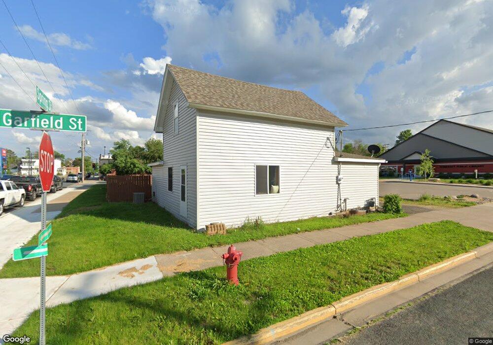
207 Spring St Somerset, WI 54025
Estimated Value: $227,080 - $294,000
3
Beds
2
Baths
280
Sq Ft
$956/Sq Ft
Est. Value
About This Home
This home is located at 207 Spring St, Somerset, WI 54025 and is currently estimated at $267,770, approximately $956 per square foot. 207 Spring St is a home located in St. Croix County with nearby schools including Somerset Elementary School, Somerset Middle School, and Somerset High School.
Ownership History
Date
Name
Owned For
Owner Type
Purchase Details
Closed on
Aug 29, 2019
Sold by
Somerset Library Board Of Trustees
Bought by
Village Of Somerset
Current Estimated Value
Purchase Details
Closed on
Jan 15, 2015
Sold by
Bourn Thomas and Youngblood Bourn Judy
Bought by
Iverson Kevin and Iverson Brenda
Home Financials for this Owner
Home Financials are based on the most recent Mortgage that was taken out on this home.
Original Mortgage
$131,377
Interest Rate
3.84%
Mortgage Type
New Conventional
Purchase Details
Closed on
Apr 24, 2012
Sold by
The Secretary Of Housing & Urban Develop
Bought by
Bourn Thomas and Youngblood Bourn Judy
Purchase Details
Closed on
Oct 10, 2011
Sold by
Jarchow Michael A and Lambert Kathryn L
Bought by
Wells Fargo Bank N A
Purchase Details
Closed on
Oct 5, 2011
Sold by
Wells Fargo Bank N A
Bought by
The Secretary Of Housing & Urban Develop
Create a Home Valuation Report for This Property
The Home Valuation Report is an in-depth analysis detailing your home's value as well as a comparison with similar homes in the area
Home Values in the Area
Average Home Value in this Area
Purchase History
| Date | Buyer | Sale Price | Title Company |
|---|---|---|---|
| Village Of Somerset | -- | None Available | |
| Iverson Kevin | $128,800 | Burnet Title | |
| Bourn Thomas | -- | All American Title Co Inc | |
| Wells Fargo Bank N A | -- | None Available | |
| The Secretary Of Housing & Urban Develop | $163,700 | None Available |
Source: Public Records
Mortgage History
| Date | Status | Borrower | Loan Amount |
|---|---|---|---|
| Previous Owner | Iverson Kevin | $131,377 |
Source: Public Records
Tax History
| Year | Tax Paid | Tax Assessment Tax Assessment Total Assessment is a certain percentage of the fair market value that is determined by local assessors to be the total taxable value of land and additions on the property. | Land | Improvement |
|---|---|---|---|---|
| 2025 | $2,758 | $149,500 | $18,500 | $131,000 |
| 2024 | $27 | $149,500 | $18,500 | $131,000 |
| 2023 | $2,589 | $149,500 | $18,500 | $131,000 |
| 2022 | $2,530 | $149,500 | $18,500 | $131,000 |
| 2021 | $2,510 | $149,500 | $18,500 | $131,000 |
| 2020 | $2,426 | $149,500 | $18,500 | $131,000 |
| 2019 | $2,543 | $98,400 | $17,000 | $81,400 |
| 2018 | $2,354 | $98,400 | $17,000 | $81,400 |
| 2017 | $2,313 | $98,400 | $17,000 | $81,400 |
| 2016 | $2,313 | $98,400 | $17,000 | $81,400 |
| 2015 | $2,283 | $98,400 | $17,000 | $81,400 |
| 2014 | $2,449 | $98,400 | $17,000 | $81,400 |
| 2013 | $2,253 | $98,400 | $17,000 | $81,400 |
Source: Public Records
Map
Nearby Homes
- 108 Main St
- 00 County Highway I
- 419 Schachtner St
- 441 White Pine Ln
- 316 Evergreen Dr
- 505 Chateau Ct
- 00 Cty I
- TBD County Road C
- 415 Bruce Larson Way
- 309 Walnut Ln
- 334 Cypress St
- 873 Sutherland St
- 869 Sutherland St
- 861 Sutherland St
- 1992 80th St
- 1888 80th St
- 651 196th Ave
- 1796 82nd St
- 1982 57th St
- 878 183rd Ct
- 205 Spring St
- 206 Spring St
- 208 Spring St
- 223 Garfield St
- 217 Main St
- 223 Main St
- 210 Spring St
- 235 Main St
- 235 Garfield St
- 235 Garfield St
- 303 Spring St
- 304 Spring St
- 302 Spring St
- 245 Garfield St
- 305 Spring St
- 245 Main St
- 402 Bruce Larson Way
- 305 Bruce Larson Way
- 313 Bruce Larson Way
- 253 Garfield St
Your Personal Tour Guide
Ask me questions while you tour the home.