2070 W 1100 N Provo, UT 84604
Rivergrove NeighborhoodEstimated Value: $390,000 - $488,000
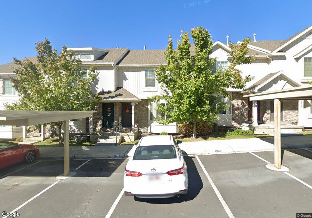
About This Home
This home is located at 2070 W 1100 N, Provo, UT 84604 and is currently estimated at $419,697, approximately $200 per square foot. 2070 W 1100 N is a home located in Utah County with nearby schools including Westridge Elementary School, Dixon Middle School, and Provo High School.
Ownership History
We collect this data history from publicly available records. To have your information removed, we recommend requesting removal directly through your county’s website.
Purchase Details
Purchase Details
Home Financials for this Owner
Home Financials are based on the most recent Mortgage that was taken out on this home.Purchase Details
Home Financials for this Owner
Home Financials are based on the most recent Mortgage that was taken out on this home.Purchase Details
Home Financials for this Owner
Home Financials are based on the most recent Mortgage that was taken out on this home.Home Values in the Area
Average Home Value in this Area
Purchase History
We collect this data history from publicly available records. To have your information removed, we recommend requesting removal directly through your county’s website.
| Date | Buyer | Sale Price | Title Company |
|---|---|---|---|
| -- | -- | ||
| -- | Bartlett Title Ins Agcy Inc | ||
| -- | First American American Fork | ||
| -- | United West Title |
Mortgage History
We collect this data history from publicly available records. To have your information removed, we recommend requesting removal directly through your county’s website.
| Date | Status | Borrower | Loan Amount |
|---|---|---|---|
| Previous Owner | $256,000 | ||
| Previous Owner | $252,103 | ||
| Previous Owner | $174,135 |
Tax History
We collect this data history from publicly available records. To have your information removed, we recommend requesting removal directly through your county’s website.
| Year | Tax Paid | Tax Assessment Tax Assessment Total Assessment is a certain percentage of the fair market value that is determined by local assessors to be the total taxable value of land and additions on the property. | Land | Improvement |
|---|---|---|---|---|
| 2025 | $2,075 | $204,545 | -- | -- |
| 2024 | $2,075 | $204,270 | $0 | $0 |
| 2023 | $2,001 | $194,205 | $0 | $0 |
| 2022 | $1,959 | $191,675 | $0 | $0 |
| 2021 | $1,535 | $262,000 | $39,300 | $222,700 |
| 2020 | $1,571 | $251,400 | $37,700 | $213,700 |
| 2019 | $1,503 | $250,000 | $32,500 | $217,500 |
| 2018 | $1,351 | $228,000 | $29,000 | $199,000 |
| 2017 | $1,220 | $113,080 | $0 | $0 |
| 2016 | $1,228 | $106,150 | $0 | $0 |
| 2015 | $1,159 | $101,200 | $0 | $0 |
| 2014 | $308 | $28,000 | $0 | $0 |
Map
- 2078 W 1100 N
- 1908 W 960 N
- 986 Independence Ave
- 962 Independence Ave
- 932 N 1760 W
- 1906 W 830 N
- 2304 W 1130 Ln N Unit 18
- 2292 W 1130 N
- 2233 W 1130 N Unit 13
- 2292 W 1130 N Unit 19
- 2304 W 1130 Ln N
- 2233 W 1130 N
- 2269 W 1130 N
- 2382 W 1160 N
- 2390 W 1160 N
- 1628 W 1050 N
- 2327 W 880 North St
- 2432 W 1160 N
- 1580 W 900 N
- 579 N Geneva Rd
- 2055 W 1100 N
- 2051 W 1100 N
- 2059 W 1100 N Unit 124
- 2059 W 1100 N
- 2047 W 1100 N
- 2067 W 1100 N
- 2067 W 1100 N Unit 2067
- 2071 W 1100 N
- 2054 W 1100 N
- 2075 W 1100 N
- 2062 W 1100 N
- 2050 W 1100 N
- 2066 W 1100 N
- 2079 W 1100 N
- 2074 W 1100 N
- 2054 W 1080 N
- 2058 W 1080 N
- 2050 W 1080 N
- 2046 W 1080 N
- 2066 W 1080 N Unit 103
Ask me questions while you tour the home.