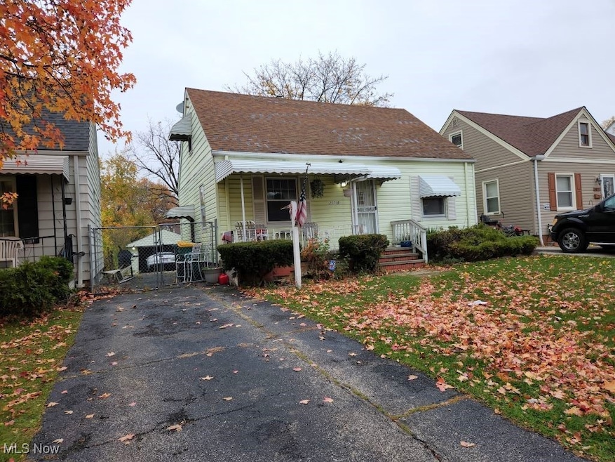
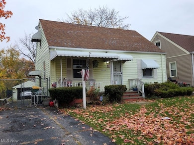
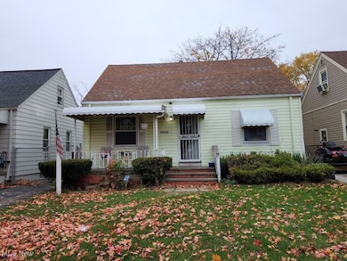
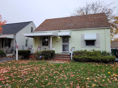
20715 Watson Rd Maple Heights, OH 44137
Estimated payment $740/month
Highlights
- Medical Services
- Cape Cod Architecture
- Property is near public transit
- Views of Trees
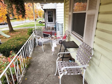
- Deck
- Wooded Lot
About This Home
This home is located at 20715 Watson Rd, Maple Heights, OH 44137 and is currently priced at $100,000. This property was built in 1948. 20715 Watson Rd is a home located in Cuyahoga County with nearby schools including Abraham Lincoln Elementary School, Rockside/ J.F. Kennedy School, and Barack Obama School.
Listing Agent
Berkshire Hathaway HomeServices Stouffer Realty Brokerage Email: dreid@stoufferrealty.com, 216-387-0757 License #360463 Listed on: 11/11/2025

Home Details
Home Type
- Single Family
Est. Annual Taxes
- $2,408
Year Built
- Built in 1948
Lot Details
- 4,800 Sq Ft Lot
- Landscaped
- Level Lot
- Wooded Lot
- Back Yard Fenced and Front Yard
Parking
- 1 Car Detached Garage
- Front Facing Garage
- Driveway
Home Design
- Cape Cod Architecture
- Bungalow
- Block Foundation
- Fiberglass Roof
- Asphalt Roof
- Vinyl Siding
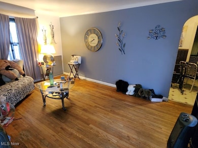
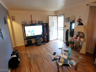
Interior Spaces
- 1.5-Story Property
- Window Treatments
- Views of Trees
- Finished Basement
- Basement Fills Entire Space Under The House
- Storm Windows
- Range
Bedrooms and Bathrooms
- 3 Bedrooms | 2 Main Level Bedrooms
- 1.5 Bathrooms
Laundry
- Dryer
- Washer
Outdoor Features
- Deck
- Covered Patio or Porch
Utilities
- No Cooling
- Forced Air Heating System
- Heating System Uses Gas
Additional Features
- Ventilation
- Property is near public transit
Listing and Financial Details
- Notice Of Default
- Assessor Parcel Number 782-15-050
Community Details
Overview
- No Home Owners Association
- Maple Heights Land Cos Subdivision
Amenities
- Medical Services
- Common Area
- Shops
- Laundry Facilities
Recreation
- Community Playground
- Park
Map
Home Values in the Area
Average Home Value in this Area
Tax History
| Year | Tax Paid | Tax Assessment Tax Assessment Total Assessment is a certain percentage of the fair market value that is determined by local assessors to be the total taxable value of land and additions on the property. | Land | Improvement |
|---|---|---|---|---|
| 2025 | $1,675 | $30,135 | $6,720 | $23,415 |
| 2024 | $2,408 | $30,135 | $6,720 | $23,415 |
| 2023 | $1,009 | $17,540 | $4,060 | $13,480 |
| 2022 | $1,043 | $17,540 | $4,060 | $13,480 |
| 2021 | $1,105 | $17,540 | $4,060 | $13,480 |
| 2020 | $736 | $13,300 | $3,080 | $10,220 |
| 2019 | $725 | $38,000 | $8,800 | $29,200 |
| 2018 | $1,276 | $13,300 | $3,080 | $10,220 |
| 2017 | $1,035 | $15,090 | $2,870 | $12,220 |
| 2016 | $1,918 | $15,090 | $2,870 | $12,220 |
| 2015 | $1,917 | $15,090 | $2,870 | $12,220 |
| 2014 | $1,917 | $16,590 | $3,150 | $13,440 |
Property History
| Date | Event | Price | List to Sale | Price per Sq Ft |
|---|---|---|---|---|
| 11/11/2025 11/11/25 | For Sale | $100,000 | -- | -- |
Purchase History
| Date | Type | Sale Price | Title Company |
|---|---|---|---|
| Warranty Deed | $95,000 | Executive Title Agency | |
| Deed | $57,000 | -- | |
| Deed | $40,000 | -- | |
| Deed | -- | -- | |
| Deed | -- | -- |
Mortgage History
| Date | Status | Loan Amount | Loan Type |
|---|---|---|---|
| Open | $76,000 | Fannie Mae Freddie Mac | |
| Closed | $19,000 | No Value Available |
Source: MLS Now
MLS Number: 5171980
APN: 782-15-050
Disclaimer: Certain information contained herein is derived from information provided by parties other than Homes.com. All information provided is deemed reliable, but is not guaranteed to be accurate and should be independently verified.
![]() IDX information is provided exclusively for personal, non-commercial use, and may not be used for any purpose other than to identify prospective properties consumers may be interested in purchasing. Information is deemed reliable but not guaranteed.
IDX information is provided exclusively for personal, non-commercial use, and may not be used for any purpose other than to identify prospective properties consumers may be interested in purchasing. Information is deemed reliable but not guaranteed.
- 20705 Hansen Rd
- 20600 Watson Rd
- 5147 Warrensville Center Rd
- 21207 Franklin Rd
- 20905 Clare Ave
- 20814 Clare Ave
- 21202 Hillgrove Ave
- 19931 Raymond St
- 20803 Kenyon Dr
- 20111 Mountville Dr
- 21202 Gardenview Dr
- 19910 Mountville Dr
- 21601 Gardenview Dr
- 21860 Louis Rd
- 19520 Maple Heights Blvd
- 19411 Marvin Rd
- 5165 Camden Rd
- 0 Miles Rd Unit 5188561
- 19289 Stafford Ave
- 18990 Raymond St
- 21303 Kenyon Dr
- 19450 Mccracken Rd
- 21831 Libby Rd
- 5305 Northfield Rd
- 22155 Libby Rd
- 18851 Raymond St
- 5327 Northfield Rd
- 4510-4548 Warrensville Center Rd
- 5437 Elmwood Ave
- 19955 Rockside Rd
- 22800 Rockside Rd
- 5103 Philip Ave
- 84 Thames Ave
- 401 Mortimer Dr
- 5713 South Blvd
- 21170 Ellacott Pkwy
- 4361-4471 Granada Blvd
- 4337 Clarkwood Pkwy
- 19802 Meadowlark Ln
- 16811 Priebe Ave
Ask me questions while you tour the home.