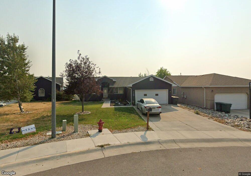
208 E Flying Circle Dr Gillette, WY 82716
Estimated Value: $354,000 - $402,000
4
Beds
3
Baths
2,684
Sq Ft
$138/Sq Ft
Est. Value
About This Home
This home is located at 208 E Flying Circle Dr, Gillette, WY 82716 and is currently estimated at $370,058, approximately $137 per square foot. 208 E Flying Circle Dr is a home located in Campbell County with nearby schools including Westwood High School, Stocktrail Elementary School, and Prairie Wind Elementary School.
Ownership History
Date
Name
Owned For
Owner Type
Purchase Details
Closed on
Dec 19, 2023
Sold by
Knight Heidi
Bought by
Dana John B and Dana Sandro Rex
Current Estimated Value
Home Financials for this Owner
Home Financials are based on the most recent Mortgage that was taken out on this home.
Original Mortgage
$304,385
Outstanding Balance
$299,333
Interest Rate
7.5%
Mortgage Type
FHA
Estimated Equity
$70,725
Purchase Details
Closed on
Oct 18, 2023
Sold by
Knight Heidi
Bought by
Rcf 2 Acquisition Trust
Purchase Details
Closed on
Aug 3, 2022
Sold by
Heidi Knight
Bought by
Premier Home Mortgage Inc
Purchase Details
Closed on
Jul 6, 2012
Sold by
Rhoades Kevin and Rhoades Char
Bought by
Knight Heidi
Home Financials for this Owner
Home Financials are based on the most recent Mortgage that was taken out on this home.
Original Mortgage
$189,000
Interest Rate
3.7%
Mortgage Type
New Conventional
Create a Home Valuation Report for This Property
The Home Valuation Report is an in-depth analysis detailing your home's value as well as a comparison with similar homes in the area
Purchase History
| Date | Buyer | Sale Price | Title Company |
|---|---|---|---|
| Dana John B | -- | None Listed On Document | |
| Rcf 2 Acquisition Trust | -- | -- | |
| Premier Home Mortgage Inc | -- | -- | |
| Knight Heidi | -- | None Available |
Source: Public Records
Mortgage History
| Date | Status | Borrower | Loan Amount |
|---|---|---|---|
| Open | Dana John B | $304,385 | |
| Previous Owner | Knight Heidi | $189,000 |
Source: Public Records
Tax History
| Year | Tax Paid | Tax Assessment Tax Assessment Total Assessment is a certain percentage of the fair market value that is determined by local assessors to be the total taxable value of land and additions on the property. | Land | Improvement |
|---|---|---|---|---|
| 2025 | $2,334 | $25,894 | $4,065 | $21,829 |
| 2024 | $23 | $33,196 | $5,211 | $27,985 |
| 2023 | $1,929 | $27,412 | $5,211 | $22,201 |
| 2022 | $1,793 | $25,417 | $4,166 | $21,251 |
| 2021 | $1,607 | $23,558 | $4,166 | $19,392 |
| 2020 | $1,576 | $23,153 | $4,166 | $18,987 |
| 2019 | $1,645 | $24,227 | $4,166 | $20,061 |
| 2018 | $1,628 | $24,076 | $4,166 | $19,910 |
| 2017 | $1,428 | $21,165 | $3,260 | $17,905 |
| 2016 | $1,464 | $21,678 | $3,260 | $18,418 |
| 2015 | -- | $21,924 | $3,260 | $18,664 |
| 2014 | -- | $21,369 | $3,260 | $18,109 |
Source: Public Records
Map
Nearby Homes
- 0000 Tract A6 Broad Axe Rd
- 209 E Tonk St
- 480 Boxelder Rd
- 2808-2814 Dogwood Ave
- 2371 Mahogany Cir
- 640 W 12th St
- 501 W 8th St
- 816 E 9th St
- 821 Madison St
- 402 S Brooks Ave
- 905 S Gurley Ave
- 913 A&B E 12th St
- 309 Rockpile Blvd
- 1116 Boxelder Rd
- 1105 W Beaver Dr
- 1114 Indian Hills Dr
- 814 E 3rd St
- 907 E 4th St
- 1122 Boxelder Rd
- 410 Edwards St
- 206 E Flying Circle Dr
- 210 E Flying Circle Dr
- 1227 Shipwheel Ln
- 204 E Flying Circle Dr
- 205 E Flying Circle Dr
- 1225 Shipwheel Ln
- 202 E Flying Circle Dr
- 1223 Shipwheel Ln
- 1218 Shipwheel Ln
- 200 E Flying Circle Dr
- 201 E Flying Circle Dr
- 1216 Shipwheel Ln
- 1219 L A Ln
- 1219 Shipwheel Ln
- 1214 Shipwheel Ln
- 1217 L A Ln
- 1217 Shipwheel Ln
- 1218 L A Ln
- 1215 L A Ln
- 1212 Shipwheel Ln
Your Personal Tour Guide
Ask me questions while you tour the home.