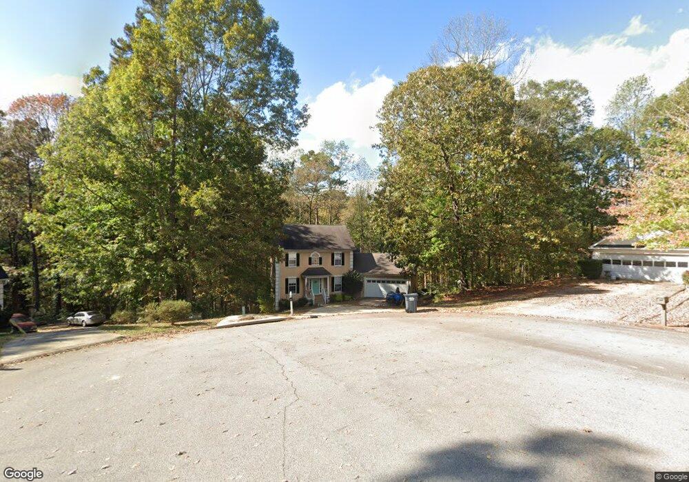
208 Foxdale Ct Lagrange, GA 30240
Estimated Value: $281,955 - $319,000
4
Beds
4
Baths
2,647
Sq Ft
$114/Sq Ft
Est. Value
About This Home
This home is located at 208 Foxdale Ct, Lagrange, GA 30240 and is currently estimated at $302,989, approximately $114 per square foot. 208 Foxdale Ct is a home located in Troup County with nearby schools including Berta Weathersbee Elementary School, Long Cane Elementary School, and Whitesville Road Elementary School.
Ownership History
Date
Name
Owned For
Owner Type
Purchase Details
Closed on
Jan 31, 2020
Sold by
Mcguire Scott J
Bought by
Venuto Anthony Dean and Venuto Megan
Current Estimated Value
Purchase Details
Closed on
Feb 24, 2005
Sold by
Sec Of Veterans Affa
Bought by
Mcguire Scott J and Mcguire Heidi P
Purchase Details
Closed on
Oct 8, 2003
Sold by
Bancorpsouth Bank
Bought by
Secretary Of Veterans Affairs
Purchase Details
Closed on
Oct 7, 2003
Sold by
Goodson Wendell S and Goodson Mary E
Bought by
Bancorpsouth Bank
Purchase Details
Closed on
Aug 12, 1999
Sold by
Dan-Ric Inc
Bought by
Goodson Wendell S and Goodson Mary E
Purchase Details
Closed on
Aug 11, 1999
Sold by
Durand Investment Co Lp
Bought by
Dan-Ric Inc
Purchase Details
Closed on
Jan 1, 1997
Sold by
Huntington Llc
Bought by
Durand Investment Co Lp
Create a Home Valuation Report for This Property
The Home Valuation Report is an in-depth analysis detailing your home's value as well as a comparison with similar homes in the area
Purchase History
| Date | Buyer | Sale Price | Title Company |
|---|---|---|---|
| Venuto Anthony Dean | $208,000 | -- | |
| Mcguire Scott J | $141,900 | -- | |
| Secretary Of Veterans Affairs | $132,200 | -- | |
| Bancorpsouth Bank | $132,200 | -- | |
| Goodson Wendell S | $146,800 | -- | |
| Dan-Ric Inc | -- | -- | |
| Durand Investment Co Lp | -- | -- |
Source: Public Records
Tax History
| Year | Tax Paid | Tax Assessment Tax Assessment Total Assessment is a certain percentage of the fair market value that is determined by local assessors to be the total taxable value of land and additions on the property. | Land | Improvement |
|---|---|---|---|---|
| 2025 | $3,068 | $112,480 | $10,000 | $102,480 |
| 2024 | $2,512 | $92,120 | $10,000 | $82,120 |
| 2023 | $2,510 | $3,548 | $0 | $3,548 |
| 2022 | $2,398 | $85,920 | $8,000 | $77,920 |
| 2021 | $2,509 | $83,200 | $8,000 | $75,200 |
| 2020 | $2,509 | $83,200 | $8,000 | $75,200 |
| 2019 | $2,407 | $81,800 | $8,000 | $73,800 |
| 2018 | $2,266 | $75,120 | $8,000 | $67,120 |
| 2017 | $2,206 | $75,120 | $8,000 | $67,120 |
Source: Public Records
Map
Nearby Homes
- 245 Teaver Rd
- 98 Hearn Rd
- 129 Angela East Dr
- 4.5 ACRES Whatley Rd N
- 0 Deming St Unit 10550189
- 0 Salem Rd Tract 2 Unit 10675187
- 0 Glass Bridge Rd Unit 10679358
- 402 Ginger Cir
- 640 Hudson Rd
- 113 Colonial Ct
- 427 Fling Rd
- 808 S Fling Rd
- 311 Cumberland Dr
- 104 Independence Ct
- 101 Ivy Springs Dr
- 709 Vernon Ferry Rd
- 8 Horace Carter Rd
- 53 Horace Carter Rd
- 474 Newton Rd
- 40 River Point Dr
- 207 Foxdale Ct
- 206 Foxdale Ct
- 205 Foxdale Ct
- 204 Foxdale Ct
- 203 Foxdale Ct
- 108 Huntcliff Ct
- 205 Edgefield Ct
- 109 Huntcliff Ct
- 207 Edgefield Ct
- 201 Foxdale Ct
- 202 Foxdale Ct
- 117 Foxdale Dr
- 203 Edgefield Ct
- 106 Tremble Oaks Ct
- 106 Treble Oaks Ct
- 106 Huntcliff Ct
- 107 Huntcliff Ct Unit 31
- 107 Huntcliff Ct
- 108 Treble Oaks Ct
- 119 Foxdale Dr Unit 38
Your Personal Tour Guide
Ask me questions while you tour the home.