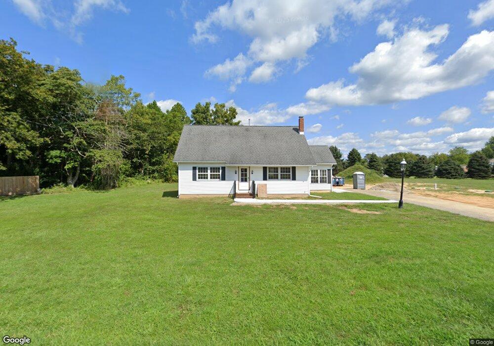
2083 Monroeville Rd Monroeville, NJ 08343
Estimated Value: $334,919 - $396,000
Studio
--
Bath
1,892
Sq Ft
$200/Sq Ft
Est. Value
About This Home
This home is located at 2083 Monroeville Rd, Monroeville, NJ 08343 and is currently estimated at $377,980, approximately $199 per square foot. 2083 Monroeville Rd is a home located in Gloucester County with nearby schools including Delsea Regional Middle School, Delsea Regional High School, and St Michael The Archangel Regional School.
Ownership History
Date
Name
Owned For
Owner Type
Purchase Details
Closed on
Oct 8, 2020
Sold by
Razzo Penny L and Smith Milton S
Bought by
Two Franklin Canter Llc
Current Estimated Value
Home Financials for this Owner
Home Financials are based on the most recent Mortgage that was taken out on this home.
Interest Rate
2.87%
Create a Home Valuation Report for This Property
The Home Valuation Report is an in-depth analysis detailing your home's value as well as a comparison with similar homes in the area
Home Values in the Area
Average Home Value in this Area
Purchase History
| Date | Buyer | Sale Price | Title Company |
|---|---|---|---|
| Two Franklin Canter Llc | $165,000 | -- |
Source: Public Records
Mortgage History
| Date | Status | Borrower | Loan Amount |
|---|---|---|---|
| Closed | Two Franklin Canter Llc | -- |
Source: Public Records
Tax History
| Year | Tax Paid | Tax Assessment Tax Assessment Total Assessment is a certain percentage of the fair market value that is determined by local assessors to be the total taxable value of land and additions on the property. | Land | Improvement |
|---|---|---|---|---|
| 2025 | $7,715 | $201,800 | $35,800 | $166,000 |
| 2024 | $7,537 | $201,800 | $35,800 | $166,000 |
| 2023 | $7,537 | $201,800 | $35,800 | $166,000 |
| 2022 | $6,098 | $167,800 | $35,800 | $132,000 |
| 2021 | $6,014 | $167,800 | $35,800 | $132,000 |
| 2020 | $5,949 | $167,800 | $35,800 | $132,000 |
| 2019 | $5,870 | $167,800 | $35,800 | $132,000 |
| 2018 | $5,792 | $167,800 | $35,800 | $132,000 |
| 2017 | $5,685 | $167,800 | $35,800 | $132,000 |
| 2016 | $5,408 | $167,800 | $35,800 | $132,000 |
| 2015 | $5,438 | $167,800 | $35,800 | $132,000 |
| 2014 | $5,237 | $167,800 | $35,800 | $132,000 |
Source: Public Records
Map
Nearby Homes
- 2800 Delsea Dr
- 1237 Porchtown Rd
- 65 Macarthur Ave
- 900 Delsea Dr
- Lot 89 Delsea Dr
- 2231 Delsea Dr
- 2259 Delsea Dr
- 3071 Delsea Dr
- 595 Royal Ave
- 451 Buttercup St
- 1070 Porchtown Rd
- 153 Lakeside Ave
- 30 Sand Piper Dr
- 919 Little Mill Rd
- 2165 Delsea Dr
- 474 Karen Ave
- 1318 Swedesboro Rd
- 893 Fries Mill Rd
- 30 2nd St
- 60 Spaulding Dr
- 2061 Monroeville Rd
- 2115 Monroeville Rd
- 2102 Monroeville Rd
- 2045 Monroeville Rd
- 571 Swedesboro Rd
- 559 Swedesboro Rd
- 585 Swedesboro Rd
- 2033 Monroeville Rd
- 545 Swedesboro Rd
- 2019 Monroeville Rd
- 611 Swedesboro Rd
- 2129 Monroeville Rd
- 623 Swedesboro Rd
- 590 Swedesboro Rd
- 2140 Monroeville Rd Unit 2160
- 2002 Monroeville Rd
- 518 Swedesboro Rd
- 0 Monroeville Rd Unit 1007401624
- 0 Monroeville Rd Unit 6511590
- 0 Monroeville Rd Unit NJGL2022210
Your Personal Tour Guide
Ask me questions while you tour the home.