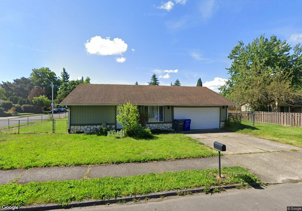
20832 SE Morrison St Gresham, OR 97030
North Central NeighborhoodEstimated Value: $381,988 - $419,000
3
Beds
1
Bath
1,064
Sq Ft
$378/Sq Ft
Est. Value
About This Home
This home is located at 20832 SE Morrison St, Gresham, OR 97030 and is currently estimated at $401,997, approximately $377 per square foot. 20832 SE Morrison St is a home located in Multnomah County with nearby schools including North Gresham Elementary School, Clear Creek Middle School, and Gresham High School.
Ownership History
Date
Name
Owned For
Owner Type
Purchase Details
Closed on
Jun 10, 2002
Sold by
Neely Sheila R
Bought by
Dembroski Amneris
Current Estimated Value
Home Financials for this Owner
Home Financials are based on the most recent Mortgage that was taken out on this home.
Original Mortgage
$117,162
Outstanding Balance
$48,811
Interest Rate
6.74%
Mortgage Type
Stand Alone First
Estimated Equity
$353,186
Create a Home Valuation Report for This Property
The Home Valuation Report is an in-depth analysis detailing your home's value as well as a comparison with similar homes in the area
Home Values in the Area
Average Home Value in this Area
Purchase History
| Date | Buyer | Sale Price | Title Company |
|---|---|---|---|
| Dembroski Amneris | $133,900 | Fidelity National Title Co |
Source: Public Records
Mortgage History
| Date | Status | Borrower | Loan Amount |
|---|---|---|---|
| Open | Dembroski Amneris | $117,162 |
Source: Public Records
Tax History
| Year | Tax Paid | Tax Assessment Tax Assessment Total Assessment is a certain percentage of the fair market value that is determined by local assessors to be the total taxable value of land and additions on the property. | Land | Improvement |
|---|---|---|---|---|
| 2025 | $3,851 | $189,220 | -- | -- |
| 2024 | $3,686 | $183,710 | -- | -- |
| 2023 | $3,686 | $178,360 | -- | -- |
| 2022 | $3,264 | $173,170 | $0 | $0 |
| 2021 | $3,182 | $168,130 | $0 | $0 |
| 2020 | $2,994 | $163,240 | $0 | $0 |
| 2019 | $2,916 | $158,490 | $0 | $0 |
| 2018 | $2,780 | $153,880 | $0 | $0 |
| 2017 | $2,667 | $149,400 | $0 | $0 |
| 2016 | $2,352 | $145,050 | $0 | $0 |
| 2015 | $2,301 | $140,830 | $0 | $0 |
| 2014 | $2,245 | $136,730 | $0 | $0 |
Source: Public Records
Map
Nearby Homes
- 21016 SE Stark St Unit 71
- 21016 SE Stark St Unit 69
- 21260 SE Stark St
- 21400 SE Stark St Unit 2
- 2013 NW Bella Vista Dr
- 1811 NW 19th St
- 209 SE 214th Ave
- 21532 SE Alder St
- 1861 NW Wonderview Ave
- 21033 SE Clay Ct
- 21525 SE Oak St
- 132 SE 214th Ave
- 522 SE 199th Ave
- 21553 SE Ankeny Terrace
- 19776 SE Stark St Unit 147
- 0 SE Burnside St
- 805 SE 197th Ave
- 150 NE 202nd Ave
- 1596 NW Riverview Ave
- 210 SE 218th Ave
- 819 SE 209th Ave
- 808 SE 208th Ave
- 822 SE 208th Ave
- 20825 SE Morrison St
- 804 SE 209th Ave
- 20837 SE Morrison St
- 839 SE 209th Ave
- 810 SE 209th Ave
- 20805 SE Morrison St Unit 20807
- 828 SE 208th Ave
- 20901 SE Morrison St Unit B
- 20901 SE Morrison St
- 824 SE 209th Ave
- 718 SE 208th Ave Unit 720
- 1005 SE 209th Ave
- 20926 SE Morrison St
- 20734 SE Morrison St
- 906 SE 208th Ave
- 811 SE 210th Ave
- 825 SE 208th Ave
Your Personal Tour Guide
Ask me questions while you tour the home.