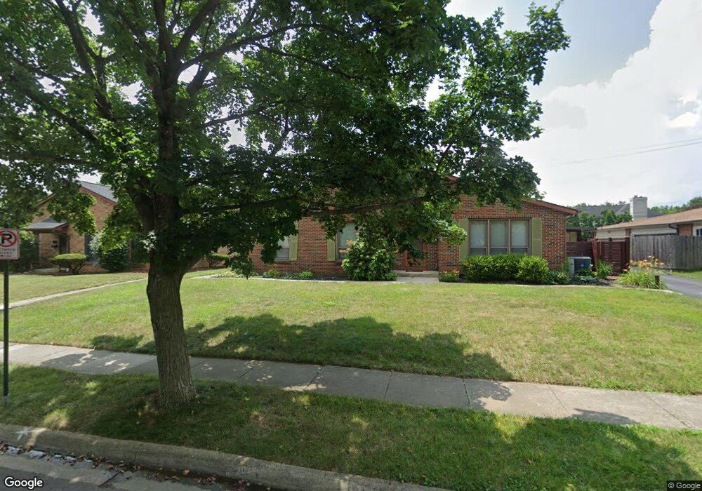
2085 Mackenzie Dr Columbus, OH 43220
Estimated Value: $258,252 - $386,000
About This Home
This home is located at 2085 Mackenzie Dr, Columbus, OH 43220 and is currently estimated at $320,813, approximately $267 per square foot. 2085 Mackenzie Dr is a home located in Franklin County with nearby schools including Greensview Elementary School, Hastings Middle School, and Upper Arlington High School.
Ownership History
We collect this data history from publicly available records. To have your information removed, we recommend requesting removal directly through your county’s website.
Purchase Details
Home Financials for this Owner
Home Financials are based on the most recent Mortgage that was taken out on this home.Purchase Details
Purchase Details
Purchase Details
Home Values in the Area
Average Home Value in this Area
Purchase History
We collect this data history from publicly available records. To have your information removed, we recommend requesting removal directly through your county’s website.
| Date | Buyer | Sale Price | Title Company |
|---|---|---|---|
| $150,000 | Valmer Land Title Agency Box | ||
| -- | None Available | ||
| -- | -- | ||
| -- | -- |
Mortgage History
We collect this data history from publicly available records. To have your information removed, we recommend requesting removal directly through your county’s website.
| Date | Status | Borrower | Loan Amount |
|---|---|---|---|
| Open | $142,500 |
Tax History
We collect this data history from publicly available records. To have your information removed, we recommend requesting removal directly through your county’s website.
| Year | Tax Paid | Tax Assessment Tax Assessment Total Assessment is a certain percentage of the fair market value that is determined by local assessors to be the total taxable value of land and additions on the property. | Land | Improvement |
|---|---|---|---|---|
| 2025 | $4,124 | $71,230 | $17,500 | $53,730 |
| 2024 | $4,124 | $71,230 | $17,500 | $53,730 |
| 2023 | $4,073 | $71,225 | $17,500 | $53,725 |
| 2022 | $3,945 | $56,460 | $14,110 | $42,350 |
| 2021 | $3,492 | $56,460 | $14,110 | $42,350 |
| 2020 | $3,462 | $56,460 | $14,110 | $42,350 |
| 2019 | $3,415 | $49,070 | $12,250 | $36,820 |
| 2018 | $975 | $49,070 | $12,250 | $36,820 |
| 2017 | $3,377 | $49,070 | $12,250 | $36,820 |
| 2016 | $2,430 | $36,750 | $6,300 | $30,450 |
| 2015 | $2,493 | $36,750 | $6,300 | $30,450 |
| 2014 | $1,852 | $36,750 | $6,300 | $30,450 |
| 2013 | $912 | $35,000 | $5,985 | $29,015 |
Map
- 2060 Mackenzie Dr Unit 2
- 4671 Coach Rd
- 2160 Coach Rd N Unit 9
- 2248 Sandover Rd
- 2213 Partlow Dr
- 4792 Merrifield Place Unit 41
- 2315 Haverford Rd
- 1945 Willoway Cir N Unit 1945
- 2462 Lane Rd
- 4573 Arlingate Dr W Unit 4573
- 1915 Brandywine Dr
- 4350 Crown Point Dr
- 1580 Lafayette Dr Unit 1580
- 4342 Randmore Rd
- 3417 Woodview Place
- 2188 Hedgerow Rd Unit 2188B
- 5000 Slate Run Woods Ct
- 2269 Hedgerow Rd Unit 2269B
- 5258 Captains Ct
- 2196 Hedgerow Rd Unit 2196G
- 2101 Mackenzie Dr Unit 105
- 2101-2105 Mackenzie Dr
- 2093-2097 Mackenzie Dr
- 2093 Mackenzie Dr Unit 97
- 2113-2117 Mackenzie Dr
- 2113 Mackenzie Dr Unit 117
- 2081 Mackenzie Dr
- 2081 Mackenzie Dr Unit 2085
- 2121 Mackenzie Dr Unit 125
- 2102 Mackenzie Dr
- 2096 Sandover Ct
- 2112 Sandover Ct
- 2100 Mackenzie Dr Unit 14
- 2120 Mackenzie Dr
- 2106 Mackenzie Dr Unit 15
- 2108 Mackenzie Dr
- 2126 Sandover Ct
- 2082 Sandover Ct
- 2126 Mackenzie Dr Unit 3
- 2073 Mackenzie Dr Unit 77
Ask me questions while you tour the home.