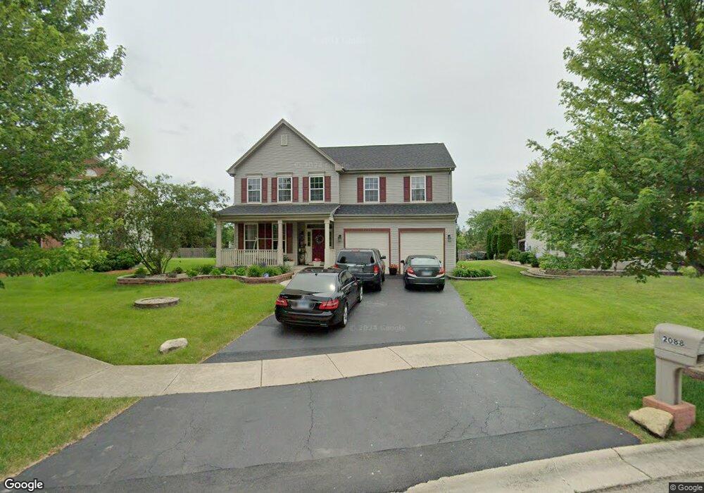
2088 Mark Cir Bolingbrook, IL 60490
West Bolingbrook NeighborhoodEstimated Value: $494,620 - $562,000
About This Home
This home is located at 2088 Mark Cir, Bolingbrook, IL 60490 and is currently estimated at $536,155, approximately $193 per square foot. 2088 Mark Cir is a home located in Will County with nearby schools including Liberty Elementary School, John F Kennedy Middle School, and Plainfield East High School.
Ownership History
We collect this data history from publicly available records. To have your information removed, we recommend requesting removal directly through your county’s website.
Purchase Details
Home Financials for this Owner
Home Financials are based on the most recent Mortgage that was taken out on this home.Purchase Details
Home Financials for this Owner
Home Financials are based on the most recent Mortgage that was taken out on this home.Home Values in the Area
Average Home Value in this Area
Purchase History
We collect this data history from publicly available records. To have your information removed, we recommend requesting removal directly through your county’s website.
| Date | Buyer | Sale Price | Title Company |
|---|---|---|---|
| $305,500 | Heritage Title Co | ||
| $272,500 | -- |
Mortgage History
We collect this data history from publicly available records. To have your information removed, we recommend requesting removal directly through your county’s website.
| Date | Status | Borrower | Loan Amount |
|---|---|---|---|
| Open | $244,400 | ||
| Previous Owner | $231,900 | ||
| Closed | $15,600 |
Tax History
We collect this data history from publicly available records. To have your information removed, we recommend requesting removal directly through your county’s website.
| Year | Tax Paid | Tax Assessment Tax Assessment Total Assessment is a certain percentage of the fair market value that is determined by local assessors to be the total taxable value of land and additions on the property. | Land | Improvement |
|---|---|---|---|---|
| 2024 | $10,176 | $151,594 | $41,067 | $110,527 |
| 2023 | $9,589 | $133,917 | $36,278 | $97,639 |
| 2022 | $8,178 | $116,326 | $34,318 | $82,008 |
| 2021 | $8,235 | $110,787 | $32,684 | $78,103 |
| 2020 | $8,211 | $109,031 | $32,166 | $76,865 |
| 2019 | $8,177 | $105,958 | $31,259 | $74,699 |
| 2018 | $7,856 | $100,328 | $30,571 | $69,757 |
| 2017 | $7,877 | $97,738 | $29,782 | $67,956 |
| 2016 | $8,011 | $95,634 | $29,141 | $66,493 |
| 2015 | $8,038 | $91,956 | $28,020 | $63,936 |
| 2014 | $8,038 | $91,956 | $28,020 | $63,936 |
| 2013 | $8,038 | $91,956 | $28,020 | $63,936 |
Map
- 6 Glenview Ct
- 2154 Muirfield Trail
- 2174 Muirfield Trail Unit 1
- 2297 Deerpath Rd
- 1300 Palisades Dr Unit 2
- 2309 River Hills Ln
- 2308 Pebblestone Way
- 12758 Barrow Ln Unit 1
- 13138 Lake Mary Dr
- 13111 Lake Mary Dr
- 22743 Marina Dr
- 1171 Jefferson Dr
- 23152 W Sweetwater Ln
- 12811 S Slate Ln
- 12825 S Slate Ln
- 23148 W Sweetwater Ln
- 12845 S Slate Ln
- 12817 S Slate Ln
- 12863 S Slate Ln
- 23224 W Teton Ln
- 2080 Mark Cir
- 2084 Mark Cir Unit 1
- 2076 Mark Cir Unit 1
- 2072 Mark Cir
- 2077 Mark Cir
- 2081 Mark Cir Unit 1
- 2073 Mark Cir Unit 1
- 22449 W 127th St
- 2068 Mark Cir Unit 1
- 3 Glenview Ct Unit 2
- 2092 Mark Cir
- 2069 Mark Cir
- 4 Glenview Ct Unit 2
- 2085 Mark Cir Unit 1
- 2155 Muirfield Trail
- 2064 Mark Cir Unit 1
- 2151 Muirfield Trail
- 2 Glenview Ct Unit 2
- 2096 Mark Cir
- 2100 Mark Cir Unit 1
Ask me questions while you tour the home.