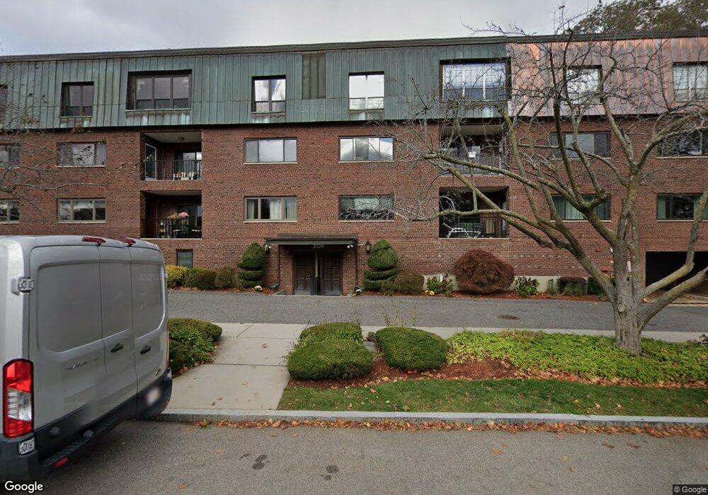
209 Commonwealth Ave Unit 2A Chestnut Hill, MA 02467
Chestnut Hill NeighborhoodEstimated Value: $1,107,000 - $1,272,117
3
Beds
2
Baths
2,114
Sq Ft
$563/Sq Ft
Est. Value
About This Home
This home is located at 209 Commonwealth Ave Unit 2A, Chestnut Hill, MA 02467 and is currently estimated at $1,189,279, approximately $562 per square foot. 209 Commonwealth Ave Unit 2A is a home located in Middlesex County with nearby schools including Ward Elementary School, Bigelow Middle School, and Newton North High School.
Ownership History
Date
Name
Owned For
Owner Type
Purchase Details
Closed on
Mar 30, 1998
Sold by
Michaelson Ira P
Bought by
Kalis Paul J and Kalis Marilyn F
Current Estimated Value
Purchase Details
Closed on
Jun 2, 1988
Sold by
Newman Marilyn
Bought by
Michaelson Ira P
Create a Home Valuation Report for This Property
The Home Valuation Report is an in-depth analysis detailing your home's value as well as a comparison with similar homes in the area
Home Values in the Area
Average Home Value in this Area
Purchase History
| Date | Buyer | Sale Price | Title Company |
|---|---|---|---|
| Kalis Paul J | $315,000 | -- | |
| Michaelson Ira P | $307,500 | -- |
Source: Public Records
Mortgage History
| Date | Status | Borrower | Loan Amount |
|---|---|---|---|
| Open | Michaelson Ira P | $321,948 | |
| Previous Owner | Michaelson Ira P | $229,500 | |
| Previous Owner | Michaelson Ira P | $229,500 |
Source: Public Records
Tax History
| Year | Tax Paid | Tax Assessment Tax Assessment Total Assessment is a certain percentage of the fair market value that is determined by local assessors to be the total taxable value of land and additions on the property. | Land | Improvement |
|---|---|---|---|---|
| 2025 | $10,730 | $1,094,900 | $0 | $1,094,900 |
| 2024 | $10,375 | $1,063,000 | $0 | $1,063,000 |
| 2023 | $10,187 | $1,000,700 | $0 | $1,000,700 |
| 2022 | $10,026 | $953,000 | $0 | $953,000 |
| 2021 | $9,674 | $899,100 | $0 | $899,100 |
| 2020 | $9,387 | $899,100 | $0 | $899,100 |
| 2019 | $9,122 | $872,900 | $0 | $872,900 |
| 2018 | $8,217 | $759,400 | $0 | $759,400 |
| 2017 | $8,445 | $759,400 | $0 | $759,400 |
| 2016 | $8,076 | $709,700 | $0 | $709,700 |
| 2015 | $7,847 | $675,900 | $0 | $675,900 |
Source: Public Records
Map
Nearby Homes
- 5 Hammond St
- 39 Commonwealth Ave Unit 11
- 27 Commonwealth Ave Unit 1
- 66 Montrose St
- 57 Undine Rd
- 20 Montrose St
- 116 Lake Shore Rd Unit 4
- 128 Lake Shore Rd Unit 1
- 137 Lake Shore Rd Unit 4
- 46 Acacia Ave
- 37 Chestnut Hill Terrace
- 207 Lake Shore Rd Unit 2
- 85 Gate House Rd
- 47 Cotton St
- 140 Kenrick St Unit 8
- 98 Lake St
- 394 Hammond St
- 15 Farlow Rd
- 12-14 Nottingham St
- 17 Lancaster Rd
- 209 Commonwealth Ave Unit 2E
- 209 Commonwealth Ave Unit PE
- 209 Commonwealth Ave Unit 2D
- 209 Commonwealth Ave Unit 3D
- 209 Commonwealth Ave Unit PD
- 209 Commonwealth Ave Unit 2C
- 209 Commonwealth Ave Unit 3C
- 209 Commonwealth Ave Unit PC
- 209 Commonwealth Ave Unit 2B
- 209 Commonwealth Ave Unit 3B
- 209 Commonwealth Ave Unit PB
- 209 Commonwealth Ave Unit 3A
- 209 Commonwealth Ave Unit PA
- 209 Commonwealth Ave
- 209 Commonwealth Ave Unit 1
- 34 Manet Rd
- 34 Manet Rd Unit 2
- 34 Manet Rd Unit 1
- 34 Manet Rd
- 217 Commonwealth Ave Unit 45B
Your Personal Tour Guide
Ask me questions while you tour the home.