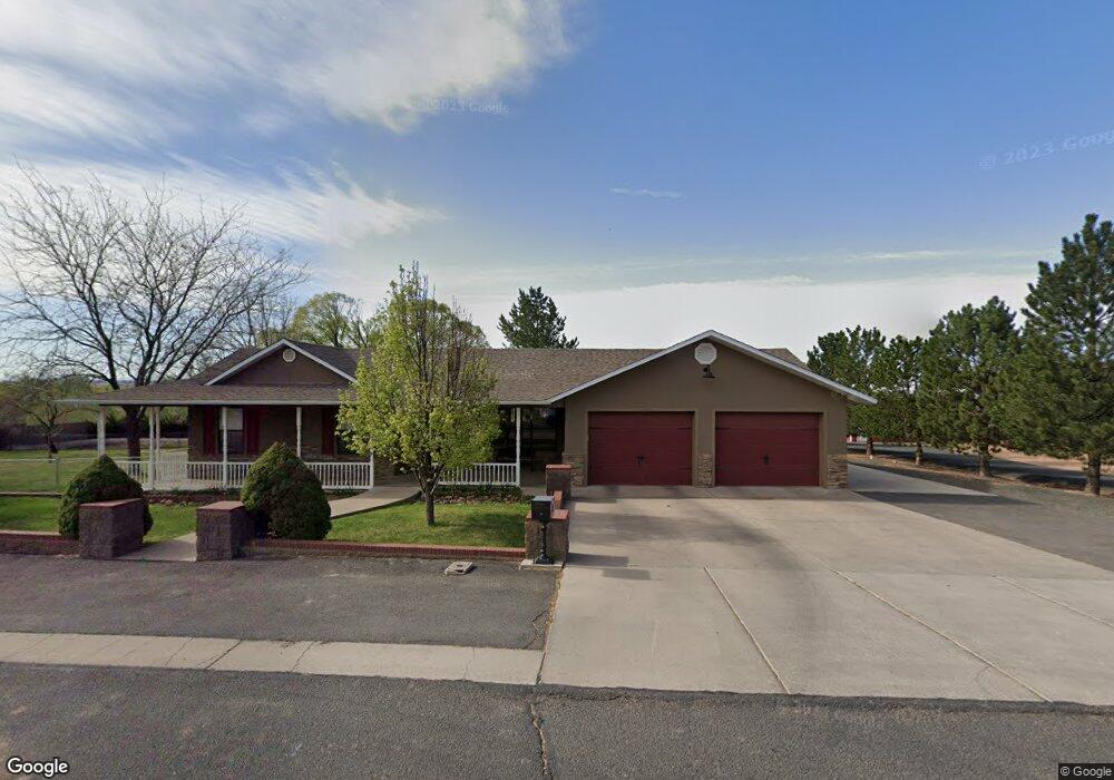
209 E 10th St S Snowflake, AZ 85937
Estimated Value: $701,000 - $863,000
Studio
--
Bath
4,934
Sq Ft
$157/Sq Ft
Est. Value
About This Home
This home is located at 209 E 10th St S, Snowflake, AZ 85937 and is currently estimated at $774,220, approximately $156 per square foot. 209 E 10th St S is a home located in Navajo County with nearby schools including Highland Primary School, Snowflake Intermediate School, and Snowflake Junior High School.
Ownership History
Date
Name
Owned For
Owner Type
Purchase Details
Closed on
Feb 15, 2026
Sold by
Hahn Janice Arlene and Hahn James Alton
Bought by
Janice Arlene Hahn And James Alton Hahn Famil and Hahn
Current Estimated Value
Purchase Details
Closed on
Jul 29, 2025
Sold by
Larson Craig R and Larson Jennifer A
Bought by
Hahn Janice Arlene and Hahn James Alton
Home Financials for this Owner
Home Financials are based on the most recent Mortgage that was taken out on this home.
Original Mortgage
$200,000
Interest Rate
6.77%
Mortgage Type
New Conventional
Purchase Details
Closed on
Apr 30, 2020
Sold by
Farr J Gordon
Bought by
Larson Craig R and Larson Jennifer A
Home Financials for this Owner
Home Financials are based on the most recent Mortgage that was taken out on this home.
Original Mortgage
$340,000
Interest Rate
3.6%
Mortgage Type
New Conventional
Purchase Details
Closed on
Jan 4, 2012
Sold by
Cowley John Phillip
Bought by
Farr J Gordon
Purchase Details
Closed on
Sep 18, 2007
Sold by
Farr J Gordon and Farr Lori
Bought by
Cowley John Philip
Create a Home Valuation Report for This Property
The Home Valuation Report is an in-depth analysis detailing your home's value as well as a comparison with similar homes in the area
Home Values in the Area
Average Home Value in this Area
Purchase History
| Date | Buyer | Sale Price | Title Company |
|---|---|---|---|
| Janice Arlene Hahn And James Alton Hahn Famil | -- | None Listed On Document | |
| Hahn Janice Arlene | $800,000 | Lawyers Title Of Arizona | |
| Larson Craig R | $580,000 | Lawyers Title Of Arizona Inc | |
| Farr J Gordon | -- | Lawyers Title Of Arizona Inc | |
| Cowley John Philip | $600,000 | Landamerica Transnation Titl |
Source: Public Records
Mortgage History
| Date | Status | Borrower | Loan Amount |
|---|---|---|---|
| Previous Owner | Hahn Janice Arlene | $200,000 | |
| Previous Owner | Larson Craig R | $340,000 |
Source: Public Records
Tax History
| Year | Tax Paid | Tax Assessment Tax Assessment Total Assessment is a certain percentage of the fair market value that is determined by local assessors to be the total taxable value of land and additions on the property. | Land | Improvement |
|---|---|---|---|---|
| 2026 | $1,828 | -- | -- | -- |
| 2025 | $1,777 | $70,125 | $6,797 | $63,328 |
| 2024 | $1,896 | $69,373 | $5,910 | $63,463 |
| 2023 | $1,777 | $51,130 | $1,827 | $49,303 |
| 2022 | $1,896 | $0 | $0 | $0 |
| 2021 | $2,057 | $0 | $0 | $0 |
| 2020 | $2,068 | $0 | $0 | $0 |
| 2019 | $2,028 | $0 | $0 | $0 |
| 2018 | $1,965 | $0 | $0 | $0 |
| 2017 | $1,730 | $0 | $0 | $0 |
| 2016 | $1,189 | $0 | $0 | $0 |
| 2015 | $1,044 | $12,837 | $1,778 | $11,058 |
Source: Public Records
Map
Nearby Homes
- 841 S 2nd East St
- 0 S Main St
- 999 S Highland Dr
- 7545 E Sherwood Ln Unit R
- 7545 E Sherwood Ln
- 7525 E Sherwood Dr
- 744 S 7th West St
- 294 First Base Ln
- 44 S 3rd St W Unit W
- 44 S 3rd St W
- 341 W Center St
- 461 W Center St
- 420 S Astante Dr
- 190 E Snowflake Blvd
- 0 W 19th St S
- 1251 E Snowflake Blvd
- 4141 W Juniper Crest Rd
- 4123 W Juniper Crest Rd
- 1023 E Jefferson St
- 1058 E Adams St
- 284 E 10th St S
- 252 E 10th St S
- 128 E Austin Dr
- 285 E 9th St S
- 237 E 10th St S
- 265 E 9th St S
- 191 E 9th St S
- 235 E 9th St S
- 98 E Austin Dr
- 257 E 9th St S
- 119 E 9th St S
- 942 S Hoyt St
- 220 E 9th St S
- 222 E 9th St S
- 103 W 7th St S
- 79 E Austin Dr
- 82 E Austin Dr
- 885 S 4th St E
- 118 E 9th St S
- 883 S 3rd St E
Your Personal Tour Guide
Ask me questions while you tour the home.