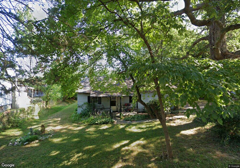
209 E Bailey St Asheboro, NC 27203
Estimated Value: $76,000 - $131,536
Studio
1
Bath
852
Sq Ft
$116/Sq Ft
Est. Value
About This Home
This home is located at 209 E Bailey St, Asheboro, NC 27203 and is currently estimated at $98,634, approximately $115 per square foot. 209 E Bailey St is a home located in Randolph County with nearby schools including Balfour Elementary School, North Asheboro Middle School, and Asheboro High School.
Ownership History
Date
Name
Owned For
Owner Type
Purchase Details
Closed on
Aug 15, 2025
Sold by
Messersmith Theresa and Potts Aaron Thomas
Bought by
Potts Brittany Brandon
Current Estimated Value
Home Financials for this Owner
Home Financials are based on the most recent Mortgage that was taken out on this home.
Original Mortgage
$79,000
Outstanding Balance
$78,847
Interest Rate
6.15%
Mortgage Type
New Conventional
Estimated Equity
$19,787
Create a Home Valuation Report for This Property
The Home Valuation Report is an in-depth analysis detailing your home's value as well as a comparison with similar homes in the area
Home Values in the Area
Average Home Value in this Area
Purchase History
| Date | Buyer | Sale Price | Title Company |
|---|---|---|---|
| Potts Brittany Brandon | $77,000 | None Listed On Document |
Source: Public Records
Mortgage History
| Date | Status | Borrower | Loan Amount |
|---|---|---|---|
| Open | Potts Brittany Brandon | $79,000 |
Source: Public Records
Tax History
| Year | Tax Paid | Tax Assessment Tax Assessment Total Assessment is a certain percentage of the fair market value that is determined by local assessors to be the total taxable value of land and additions on the property. | Land | Improvement |
|---|---|---|---|---|
| 2025 | $870 | $65,610 | $24,120 | $41,490 |
| 2024 | $870 | $65,610 | $24,120 | $41,490 |
| 2023 | $870 | $65,610 | $24,120 | $41,490 |
| 2022 | $255 | $42,710 | $14,530 | $28,180 |
| 2021 | $255 | $42,710 | $14,530 | $28,180 |
| 2020 | $255 | $42,710 | $14,530 | $28,180 |
| 2019 | $260 | $42,710 | $14,530 | $28,180 |
| 2018 | $175 | $36,940 | $14,820 | $22,120 |
| 2016 | $175 | $36,943 | $14,820 | $22,123 |
| 2015 | $176 | $36,943 | $14,820 | $22,123 |
| 2014 | -- | $36,943 | $14,820 | $22,123 |
Source: Public Records
Map
Nearby Homes
- 238 Underwood St
- 218 Barber Dr
- 0 English St
- 404 Sharon Ave
- 308 W Beasley St
- 1684 Pen Oak Dr
- 421 W Beasley St
- 728 Central Falls Rd
- 734 Central Falls Rd
- 223 Mclaurin Dr
- 1931 Greenwood Rd
- 1249 Eton Ave
- 1954 Lakeview Rd
- 1958 Lakeview Rd
- 1962 & 1966 Lakeview Rd
- 203 Sunrise Ave
- 307 Sunrise Ave
- 2206 N Asheboro School Rd
- 0 E Allred St Unit 1125495
- 1067 Camden Ct
- 207 E Bailey St
- 213 E Bailey St
- 205 E Bailey St
- 1709 Pine Knoll Ct
- 237 Underwood St
- 235 Underwood St
- 1713 Pine Knoll Ct
- 231 Underwood St
- 229 Underwood St
- 1721 Pine Knoll Ct
- 1706 Pine Knoll Ct
- 225 Underwood St
- 234 Underwood St
- 1716 Pine Knoll Ct
- 1729 Pine Knoll Ct
- 230 Underwood St
- 1726 Pine Knoll Ct
- 226 Underwood St
- 305 E Bailey St
- 304 E Bailey St
Your Personal Tour Guide
Ask me questions while you tour the home.