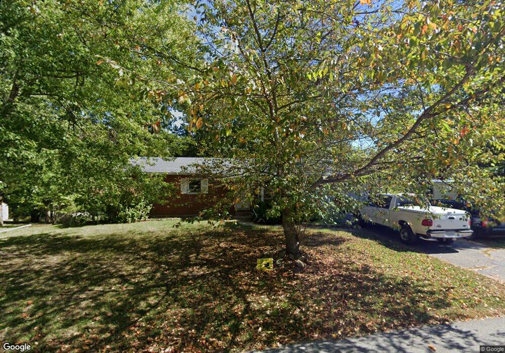
209 Frances St Waynesville, MO 65583
Estimated Value: $198,000 - $234,852
About This Home
This home is located at 209 Frances St, Waynesville, MO 65583 and is currently estimated at $215,713, approximately $175 per square foot. 209 Frances St is a home located in Pulaski County with nearby schools including Waynesville East Elementary School, Freedom Elementary School, and Waynesville Middle School.
Ownership History
We collect this data history from publicly available records. To have your information removed, we recommend requesting removal directly through your county’s website.
Purchase Details
Purchase Details
Home Financials for this Owner
Home Financials are based on the most recent Mortgage that was taken out on this home.Home Values in the Area
Average Home Value in this Area
Purchase History
We collect this data history from publicly available records. To have your information removed, we recommend requesting removal directly through your county’s website.
| Date | Buyer | Sale Price | Title Company |
|---|---|---|---|
| -- | -- | ||
| -- | -- |
Mortgage History
We collect this data history from publicly available records. To have your information removed, we recommend requesting removal directly through your county’s website.
| Date | Status | Borrower | Loan Amount |
|---|---|---|---|
| Previous Owner | $136,881 |
Tax History
We collect this data history from publicly available records. To have your information removed, we recommend requesting removal directly through your county’s website.
| Year | Tax Paid | Tax Assessment Tax Assessment Total Assessment is a certain percentage of the fair market value that is determined by local assessors to be the total taxable value of land and additions on the property. | Land | Improvement |
|---|---|---|---|---|
| 2025 | $760 | $19,094 | $2,964 | $16,130 |
| 2024 | $725 | $17,133 | $2,470 | $14,663 |
| 2023 | $707 | $17,133 | $2,470 | $14,663 |
| 2022 | $702 | $17,133 | $2,470 | $14,663 |
| 2021 | $694 | $17,133 | $2,470 | $14,663 |
| 2020 | $681 | $16,535 | $0 | $0 |
| 2019 | $680 | $16,435 | $0 | $0 |
| 2018 | $680 | $16,435 | $0 | $0 |
| 2017 | $671 | $18,099 | $0 | $0 |
| 2016 | $639 | $16,440 | $0 | $0 |
| 2015 | $634 | $16,440 | $0 | $0 |
| 2014 | $634 | $16,440 | $0 | $0 |
Map
- 109 Lincoln Ln
- 21470 Sail Rd
- 606 Sunset Dr
- 1809-A U S Route 66
- 100 Lasalle
- 101 Bailey Renee Ct
- 1701 Pearson St
- 186 Settlers Pass
- 113 Jared St
- 178 Jared St
- 116 Jared St
- 103 Maxwell
- 220 Settlers Pass
- 218 Fritts Cir
- 166 Jared St
- 213 Settlers Pass
- 215 Settlers Pass
- 226 Settlers Pass
- 116 Pioneer Ct
- 123 Hull Dr
- 211 Frances St
- 207 Frances St
- 220 Frances St
- 206 Frances St
- 208 Frances St
- 205 Frances St
- 210 Frances St
- 206 Frances St
- 213 Frances St
- 204 Frances St
- 212 Frances St
- 215 Frances St
- 202 Frances St
- 216 Frances St
- 201 Frances St
- 402 Sunset Dr
- 1410 Mary Catherine
- 409 Sunset Dr
- 200 Frances St
- 404 Sunset Dr
Ask me questions while you tour the home.