Estimated Value: $1,307,000 - $2,339,028
5
Beds
4
Baths
4,576
Sq Ft
$423/Sq Ft
Est. Value
About This Home
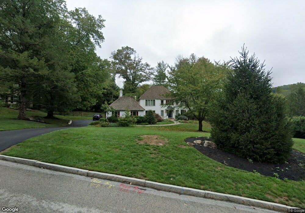
This home is located at 209 Ravenscliff Rd, Wayne, PA 19087 and is currently estimated at $1,936,757, approximately $423 per square foot. 209 Ravenscliff Rd is a home located in Delaware County with nearby schools including Wayne Elementary School, Radnor Middle School, and Radnor Senior High School.
Ownership History
Date
Name
Owned For
Owner Type
Purchase Details
Closed on
Jan 18, 1994
Sold by
Foreman James L and Foreman Jane K
Bought by
Samett Paul S and Samett Barbara W
Current Estimated Value
Home Financials for this Owner
Home Financials are based on the most recent Mortgage that was taken out on this home.
Original Mortgage
$532,000
Interest Rate
7.08%
Mortgage Type
Purchase Money Mortgage
Create a Home Valuation Report for This Property
The Home Valuation Report is an in-depth analysis detailing your home's value as well as a comparison with similar homes in the area
Purchase History
| Date | Buyer | Sale Price | Title Company |
|---|---|---|---|
| Samett Paul S | $665,000 | -- |
Source: Public Records
Mortgage History
| Date | Status | Borrower | Loan Amount |
|---|---|---|---|
| Closed | Samett Paul S | $532,000 |
Source: Public Records
Tax History
| Year | Tax Paid | Tax Assessment Tax Assessment Total Assessment is a certain percentage of the fair market value that is determined by local assessors to be the total taxable value of land and additions on the property. | Land | Improvement |
|---|---|---|---|---|
| 2025 | $21,266 | $1,051,790 | $309,700 | $742,090 |
| 2024 | $21,266 | $1,051,790 | $309,700 | $742,090 |
| 2023 | $20,422 | $1,051,790 | $309,700 | $742,090 |
| 2022 | $20,200 | $1,051,790 | $309,700 | $742,090 |
| 2021 | $32,446 | $1,051,790 | $309,700 | $742,090 |
| 2020 | $23,668 | $680,350 | $211,070 | $469,280 |
| 2019 | $23,000 | $680,350 | $211,070 | $469,280 |
| 2018 | $22,549 | $680,350 | $0 | $0 |
| 2017 | $22,077 | $680,350 | $0 | $0 |
| 2016 | $3,734 | $680,350 | $0 | $0 |
| 2015 | $3,810 | $680,350 | $0 | $0 |
| 2014 | $3,810 | $680,350 | $0 | $0 |
Source: Public Records
Map
Nearby Homes
- 205 Ravenscliff Rd
- 217 Ravenscliff Rd
- 846 Maplewood Rd
- 1 Dunminning Rd
- 11 Harrison Dr
- 8 Harrow Cir
- 203 Church St
- 412 Fairview Dr
- 658 Brooke Rd
- 151 Eaton Dr
- 423 Maplewood Ave
- 312 Conestoga Rd
- 120 S Devon Ave
- 321 Conestoga Rd
- 317 S Devon Ave
- 623 S Waterloo Rd
- 216 Bloomingdale Ave
- 848 Parkes Run Ln
- 718 S Waterloo Rd
- 0 Greenwell Ln
- 211 Ravenscliff Rd
- 207 Ravenscliff Rd
- 239 Ravenscliff Rd
- 214 Ravenscliff Rd
- 235 Ravenscliff Rd
- 237 Ravenscliff Rd
- 233 Ravenscliff Rd
- 213 Ravenscliff Rd
- 212 Ravenscliff Rd
- 216 Ravenscliff Rd
- 272 Ravenscliff Rd
- 231 Ravenscliff Rd
- 210 Ravenscliff Rd
- 215 Ravenscliff Rd
- 270 Ravenscliff Rd
- 266 Ravenscliff Rd
- 262 Ravenscliff Rd
- 260 Ravenscliff Rd
- 230 Ravenscliff Rd
- 264 Ravenscliff Rd
Your Personal Tour Guide
Ask me questions while you tour the home.