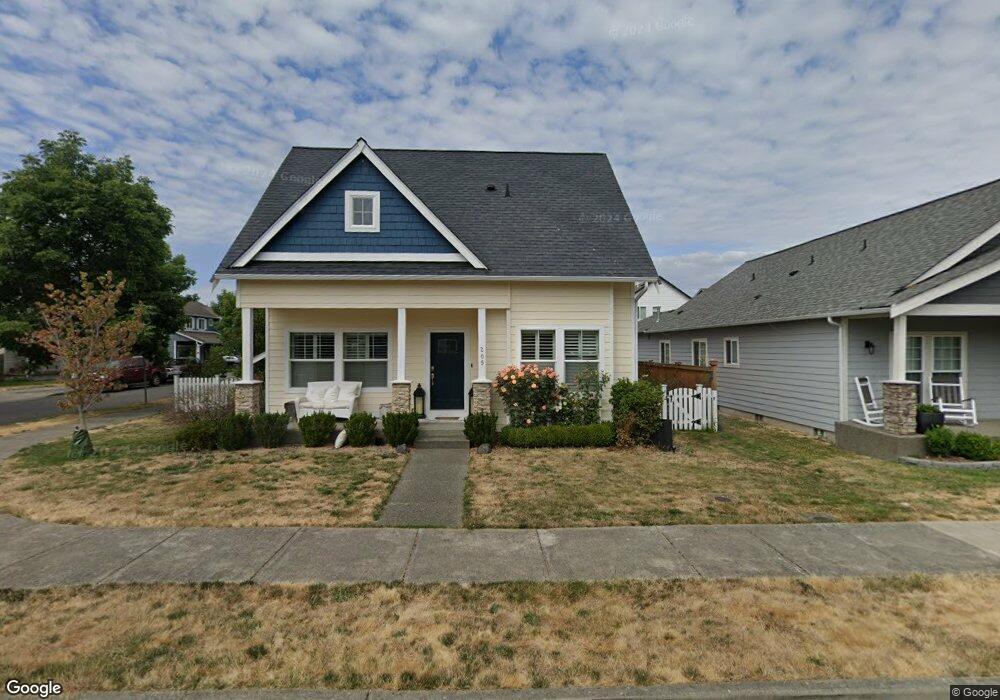
209 Riggs Dr E Enumclaw, WA 98022
Estimated Value: $593,251 - $647,000
3
Beds
3
Baths
1,984
Sq Ft
$314/Sq Ft
Est. Value
About This Home
This home is located at 209 Riggs Dr E, Enumclaw, WA 98022 and is currently estimated at $623,063, approximately $314 per square foot. 209 Riggs Dr E is a home located in King County with nearby schools including Southwood Elementary School, Enumclaw Middle School, and Enumclaw Senior High School.
Ownership History
Date
Name
Owned For
Owner Type
Purchase Details
Closed on
Dec 6, 2016
Sold by
Elk Meadows Investors Llc
Bought by
Chynoweh Anthony G and Chynoweth Regina M
Current Estimated Value
Purchase Details
Closed on
Dec 15, 2011
Sold by
Elk Meadows Investors Llc
Bought by
Chynoweth Anthony G and Chynoweth Regina M
Home Financials for this Owner
Home Financials are based on the most recent Mortgage that was taken out on this home.
Original Mortgage
$193,088
Interest Rate
3.5%
Create a Home Valuation Report for This Property
The Home Valuation Report is an in-depth analysis detailing your home's value as well as a comparison with similar homes in the area
Home Values in the Area
Average Home Value in this Area
Purchase History
| Date | Buyer | Sale Price | Title Company |
|---|---|---|---|
| Chynoweh Anthony G | -- | None Available | |
| Chynoweth Anthony G | -- | First American | |
| Chynoweth Anthony G | $259,950 | Old Republic T |
Source: Public Records
Mortgage History
| Date | Status | Borrower | Loan Amount |
|---|---|---|---|
| Previous Owner | Chynoweth Anthony G | $193,088 |
Source: Public Records
Tax History
| Year | Tax Paid | Tax Assessment Tax Assessment Total Assessment is a certain percentage of the fair market value that is determined by local assessors to be the total taxable value of land and additions on the property. | Land | Improvement |
|---|---|---|---|---|
| 2024 | $4,936 | $514,000 | $202,000 | $312,000 |
| 2023 | $4,576 | $441,000 | $174,000 | $267,000 |
| 2022 | $4,097 | $503,000 | $199,000 | $304,000 |
| 2021 | $3,935 | $408,000 | $172,000 | $236,000 |
| 2020 | $3,592 | $357,000 | $129,000 | $228,000 |
| 2018 | $3,655 | $329,000 | $118,000 | $211,000 |
| 2017 | $3,245 | $298,000 | $108,000 | $190,000 |
| 2016 | $3,187 | $273,000 | $100,000 | $173,000 |
| 2015 | $3,442 | $264,000 | $95,000 | $169,000 |
| 2014 | -- | $273,000 | $90,000 | $183,000 |
| 2013 | -- | $210,000 | $72,000 | $138,000 |
Source: Public Records
Map
Nearby Homes
- 385 Bruhn Ln N
- 176 Love Dr
- 413 Becky Ave E
- 629 Barquist Ln N
- 643 Barquist Ln N
- 657 Barquist Ln N
- 685 Barquist Ln N
- 505 Thompson (Lot 1) Dr
- 508 Thompson (Lot 22) Dr
- 549 Thompson (Lot 3) Dr
- 721 Weaver Dr E
- 746 Weaver Dr E
- 755 Weaver Dr E
- 760 Weaver Dr E
- 769 Weaver Dr E
- 797 Weaver Dr E
- 811 Weaver Dr E
- 637 Thompson (Lot 7) Dr
- 783 Weaver Dr E
- 659 Thompson (Lot 8) Dr
- 243 Riggs Dr E
- 210 Petersen Dr E
- 245 Riggs Dr E
- 222 Petersen Dr E
- 336 Asmundson Ln N
- 208 Riggs Dr E
- 314 Asmundson Ln N
- 220 Riggs Dr E
- 360 Asmundson Ln N
- 2 Asmundson Ln N
- 204 Riggs Dr E
- 244 Petersen Dr E
- 255 Riggs Dr E
- 242 Riggs Dr E
- 372 Asmundson Ln N
- 256 Petersen Dr E
- 302 Asmundson Ln N
- 0 Asmundson Ln N Unit 111561
- 254 Riggs Dr E
- 277 Riggs Dr E
Your Personal Tour Guide
Ask me questions while you tour the home.