
Seller's Agent in 2026
Joe Mullaney
RE/MAX Michigan
(517) 325-5888
157 Total Sales
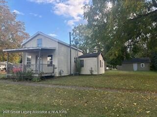
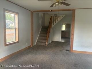
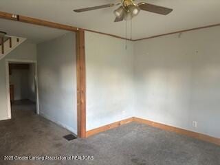
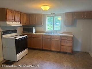
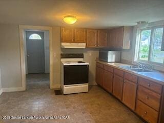
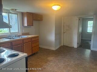
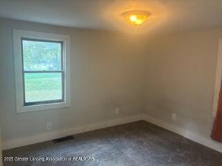
Welcome to this charming 2-bedroom, 1-bath home! Inside you'll find a spacious living room and an accommodating kitchen, perfect for everyday living. Start your mornings with coffee on the inviting front porch, or take advantage of the park just across the street for some playtime. Craving something fresh? Dewey's Trading Post—the neighborhood grocery—is only a block away and known for its great grilling and smoking options at unbeatable prices. Plus, the home includes a one-car garage, ideal for parking or projects
Last Agent to Sell the Property
RE/MAX Finest License #6506001040 Listed on: 09/26/2025
| Date | Type | Sale Price | Title Company |
|---|---|---|---|
| Sheriffs Deed | $70,500 | None Listed On Document | |
| Sheriffs Deed | $70,500 | None Listed On Document | |
| Warranty Deed | $120,000 | Cislo Title | |
| Warranty Deed | $78,000 | None Available |
| Date | Status | Loan Amount | Loan Type |
|---|---|---|---|
| Previous Owner | $121,200 | New Conventional | |
| Previous Owner | $62,400 | Balloon |
| Date | Event | Price | List to Sale | Price per Sq Ft |
|---|---|---|---|---|
| 03/13/2026 03/13/26 | Sold | $82,500 | -10.8% | $84 / Sq Ft |
| 01/20/2026 01/20/26 | Pending | -- | -- | -- |
| 01/05/2026 01/05/26 | Price Changed | $92,500 | -7.5% | $95 / Sq Ft |
| 09/26/2025 09/26/25 | For Sale | $100,000 | -- | $102 / Sq Ft |
| Year | Tax Paid | Tax Assessment Tax Assessment Total Assessment is a certain percentage of the fair market value that is determined by local assessors to be the total taxable value of land and additions on the property. | Land | Improvement |
|---|---|---|---|---|
| 2025 | $1,740 | $46,100 | $5,600 | $40,500 |
| 2024 | $5 | $41,100 | $5,100 | $36,000 |
| 2023 | $456 | $38,500 | $0 | $0 |
| 2022 | $616 | $24,100 | $4,700 | $19,400 |
| 2021 | $601 | $21,500 | $4,500 | $17,000 |
| 2020 | $553 | $19,700 | $4,300 | $15,400 |
| 2019 | $531 | $17,400 | $4,300 | $13,100 |
| 2018 | $518 | $15,800 | $4,300 | $11,500 |
| 2017 | -- | $16,500 | $4,300 | $12,200 |
| 2016 | $276 | $15,600 | $4,300 | $11,300 |
| 2015 | -- | $13,400 | $0 | $0 |
| 2011 | -- | $14,000 | $0 | $0 |
Seller's Agent in 2026
Joe Mullaney
RE/MAX Michigan
(517) 325-5888
157 Total Sales
Source: Greater Lansing Association of Realtors®
MLS Number: 291547
APN: 081-000-013-001-00
Disclaimer: Certain information contained herein is derived from information provided by parties other than Homes.com. All information provided is deemed reliable, but is not guaranteed to be accurate and should be independently verified.
![]() IDX information is provided exclusively for Consumers'
IDX information is provided exclusively for Consumers'
personal, non-commercial use, that it may not be used for any purpose other than to identify prospective properties Consumers may be interested in purchasing. Data is deemed reliable but is not guaranteed accurate by the MLS.
Copyright © 2026 Greater Lansing Association of REALTORS®
Ask me questions while you tour the home.