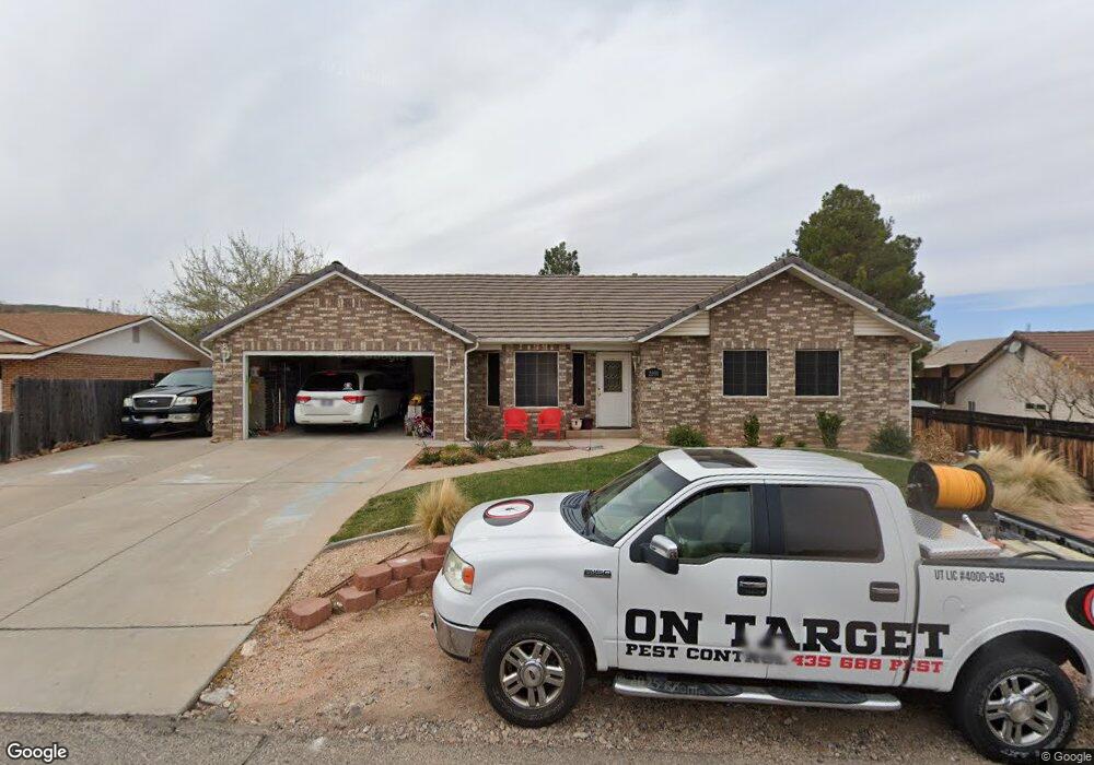
2090 Sherman Rd St. George, UT 84790
Bloomington Hills NeighborhoodEstimated Value: $491,000 - $516,000
About This Home
This home is located at 2090 Sherman Rd, St. George, UT 84790 and is currently estimated at $502,544, approximately $210 per square foot. 2090 Sherman Rd is a home located in Washington County with nearby schools including Bloomington Hills Elementary School, Desert Hills Middle School, and Sunrise Ridge Intermediate School.
Ownership History
We collect this data history from publicly available records. To have your information removed, we recommend requesting removal directly through your county’s website.
Purchase Details
Home Financials for this Owner
Home Financials are based on the most recent Mortgage that was taken out on this home.Purchase Details
Purchase Details
Home Financials for this Owner
Home Financials are based on the most recent Mortgage that was taken out on this home.Home Values in the Area
Average Home Value in this Area
Purchase History
We collect this data history from publicly available records. To have your information removed, we recommend requesting removal directly through your county’s website.
| Date | Buyer | Sale Price | Title Company |
|---|---|---|---|
| $162,000 | Southern Utah Title Of Cedar | ||
| $204,453 | None Available | ||
| -- | Southern Utah Title Co |
Mortgage History
We collect this data history from publicly available records. To have your information removed, we recommend requesting removal directly through your county’s website.
| Date | Status | Borrower | Loan Amount |
|---|---|---|---|
| Closed | $228,000 | ||
| Closed | $157,893 | ||
| Closed | $49,880 | ||
| Closed | $201,520 |
Tax History
We collect this data history from publicly available records. To have your information removed, we recommend requesting removal directly through your county’s website.
| Year | Tax Paid | Tax Assessment Tax Assessment Total Assessment is a certain percentage of the fair market value that is determined by local assessors to be the total taxable value of land and additions on the property. | Land | Improvement |
|---|---|---|---|---|
| 2025 | $1,720 | $252,395 | $74,195 | $178,200 |
| 2023 | $1,796 | $268,345 | $78,375 | $189,970 |
| 2022 | $1,885 | $264,825 | $65,340 | $199,485 |
| 2021 | $927 | $354,200 | $76,000 | $278,200 |
| 2020 | $1,527 | $301,400 | $61,800 | $239,600 |
| 2019 | $1,503 | $289,800 | $61,800 | $228,000 |
| 2018 | $1,486 | $143,605 | $0 | $0 |
| 2017 | $1,585 | $153,175 | $0 | $0 |
| 2016 | $1,663 | $148,665 | $0 | $0 |
| 2015 | $1,584 | $135,850 | $0 | $0 |
| 2014 | $1,580 | $136,345 | $0 | $0 |
Map
- 1125 E Sherman Cir
- 1110 E Sherman Cir
- 1964 Hedera Place
- 1040 E Fort Pierce Dr N
- 1020 E Fort Pierce Dr N
- 2274 Mountain View Cir
- 2054 Sanford Place
- 1045 E Fort Pierce Dr
- 2280 Bloomington Hills Dr Unit 7
- 985 E Fort Pierce Dr
- 2050 S 1400 E Unit K101
- 2050 S 1400 E Unit 23
- 2050 S 1400 E Unit B111
- 890 Larkspur Rd
- 955 Summit Ridge Dr Unit 20
- 1790 S River Rd
- 2045 S 1400 E Unit 13
- 2288 S Augusta Dr
- 1448 E 2190 South Cir
- 2235 S 1400 E Unit 20
- 1133 Oxford Place
- 1129 Oxford Place
- 1135 Oxford Place
- 2044 Sherman Rd
- 1125 Oxford Place
- 2030 Sherman Rd
- 1130 Oxford Place
- 2080 Sherman Rd
- 2074 Princeton Cir
- 0 Sherman Rd
- 2020 Sherman Rd
- 2020 S Sherman
- 1122 Oxford Place
- 2061 Sherman Rd
- 1121 Oxford Place
- 1120 E Oxford
- 1120 Oxford Place
- 2090 Sherman Rd
- 2031 Sherman Rd
- 1151 Hubbard Place
Ask me questions while you tour the home.