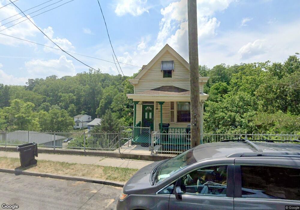
2093 Baltimore Ave Cincinnati, OH 45225
East Westwood NeighborhoodEstimated Value: $11,000 - $103,000
4
Beds
2
Baths
--
Sq Ft
0.35
Acres Lot
About This Home
This home is located at 2093 Baltimore Ave, Cincinnati, OH 45225 and is currently estimated at $64,333. 2093 Baltimore Ave is a home located in Hamilton County with nearby schools including Western Hills High School, Gilbert A. Dater High School, and Robert A. Taft Information Technology High School.
Ownership History
Date
Name
Owned For
Owner Type
Purchase Details
Closed on
Mar 7, 2023
Sold by
Kiani Farrokhlegha
Bought by
Kiani Farrokhlegha and Salimian Kathrin
Current Estimated Value
Purchase Details
Closed on
Oct 12, 2007
Sold by
Davis Donald H
Bought by
Kiani Goshtasp
Home Financials for this Owner
Home Financials are based on the most recent Mortgage that was taken out on this home.
Original Mortgage
$42,800
Interest Rate
6.33%
Mortgage Type
Unknown
Purchase Details
Closed on
Jul 24, 2006
Sold by
Ib Property Holdings Llc
Bought by
Davis Donald H
Purchase Details
Closed on
Jul 17, 2006
Sold by
Estate Of Rosemary Stanford
Bought by
Ib Property Holdings Llc
Create a Home Valuation Report for This Property
The Home Valuation Report is an in-depth analysis detailing your home's value as well as a comparison with similar homes in the area
Home Values in the Area
Average Home Value in this Area
Purchase History
We collect this data history from publicly available records. To have your information removed, we recommend requesting removal directly through your county’s website.
| Date | Buyer | Sale Price | Title Company |
|---|---|---|---|
| Kiani Farrokhlegha | $750 | None Listed On Document | |
| Kiani Goshtasp | $53,500 | Royal Title Agency Llc | |
| Davis Donald H | $6,500 | Fidelity Land Title Agency | |
| Ib Property Holdings Llc | $11,500 | None Available |
Source: Public Records
Mortgage History
We collect this data history from publicly available records. To have your information removed, we recommend requesting removal directly through your county’s website.
| Date | Status | Borrower | Loan Amount |
|---|---|---|---|
| Previous Owner | Kiani Goshtasp | $42,800 |
Source: Public Records
Tax History
| Year | Tax Paid | Tax Assessment Tax Assessment Total Assessment is a certain percentage of the fair market value that is determined by local assessors to be the total taxable value of land and additions on the property. | Land | Improvement |
|---|---|---|---|---|
| 2025 | $56 | $368 | $368 | -- |
| 2024 | $56 | $368 | $368 | -- |
| 2023 | $56 | $368 | $368 | $0 |
| 2022 | $51 | $273 | $273 | $0 |
| 2021 | $41 | $273 | $273 | $0 |
| 2020 | $41 | $273 | $273 | $0 |
| 2019 | $42 | $266 | $266 | $0 |
| 2018 | $42 | $266 | $266 | $0 |
| 2017 | $40 | $266 | $266 | $0 |
| 2016 | $60 | $536 | $536 | $0 |
| 2015 | $56 | $536 | $536 | $0 |
| 2014 | $56 | $536 | $536 | $0 |
| 2013 | $74 | $798 | $798 | $0 |
Source: Public Records
Map
Nearby Homes
- 2167 Westwood Northern Blvd
- 2041 Baltimore Ave
- 2183 Westwood Northern Blvd
- 3384 Ninann Ct
- 1970 Westwood Northern Blvd
- 1767 Sutter Ave
- 1959 Baltimore Ave
- 3295 Fyffe Ave
- 3555 Mchenry Ave
- 3521 Mchenry Ave
- 3519 Mchenry Ave
- 2352 Iroll Ave
- 2088 N Teralta Cir
- 2043 E Teralta Cir
- 3111 Cavanaugh Ave
- 1883 Baltimore Ave
- 2428 Kremer Ave
- 2114 Saint Leo Place
- 3065 Moosewood Ave
- 3091 Beekman St
- 2135 Baltimore Ave
- 2137 Baltimore Ave
- 2090 Harkness St
- 2095 Harkness St
- 2132 Baltimore Ave
- 2094 Baltimore Ave
- 2136 Baltimore Ave
- 2087 Baltimore Ave
- 2092 Baltimore Ave
- 2114 Harkness St
- 2140 Baltimore Ave
- 2142 Baltimore Ave
- 2087 Harkness St
- 2088 Baltimore Ave
- 2149 Baltimore Ave
- 2085 Harkness St
- 2061 Baltimore Ave
- 2144 Baltimore Ave
- 1642 Baltimore Ave Unit 1644
- 1616 Baltimore Ave Unit 1618
Your Personal Tour Guide
Ask me questions while you tour the home.