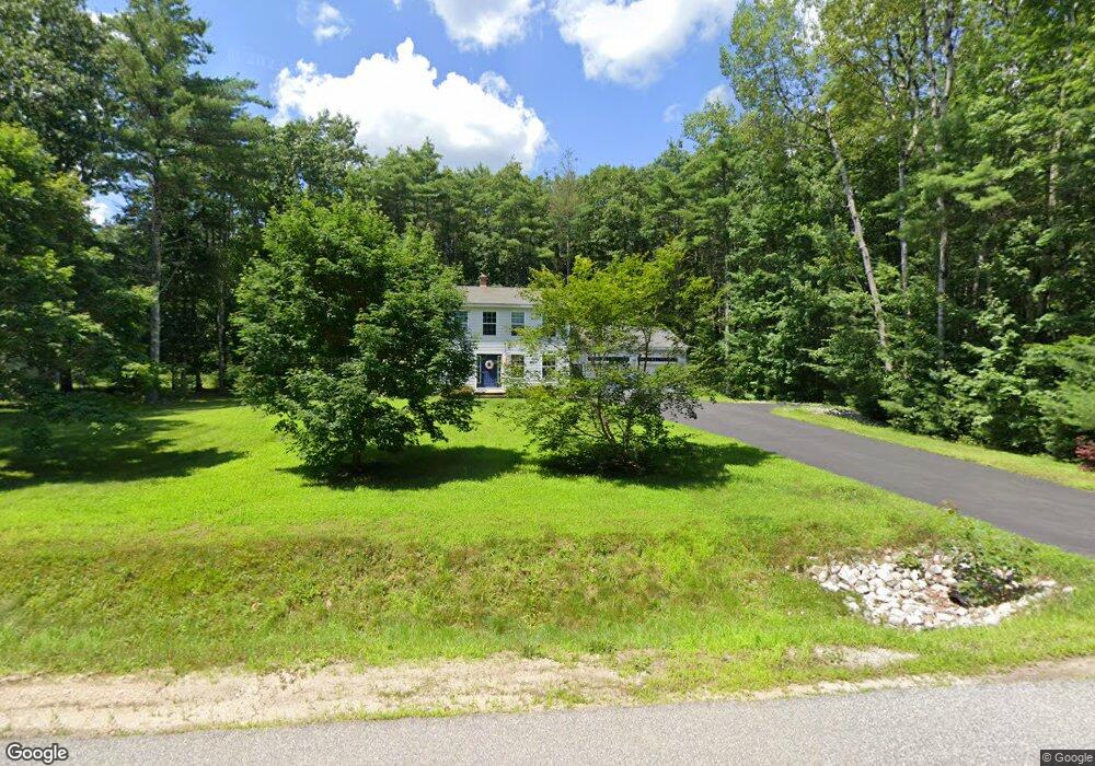
21 Captains Way Buxton, ME 04093
Estimated Value: $491,168 - $572,000
About This Home
This home is located at 21 Captains Way, Buxton, ME 04093 and is currently estimated at $533,292, approximately $347 per square foot. 21 Captains Way is a home located in York County with nearby schools including Bonny Eagle High School.
Ownership History
We collect this data history from publicly available records. To have your information removed, we recommend requesting removal directly through your county’s website.
Purchase Details
Home Financials for this Owner
Home Financials are based on the most recent Mortgage that was taken out on this home.Home Values in the Area
Average Home Value in this Area
Purchase History
We collect this data history from publicly available records. To have your information removed, we recommend requesting removal directly through your county’s website.
| Date | Buyer | Sale Price | Title Company |
|---|---|---|---|
| -- | -- | ||
| -- | -- |
Mortgage History
We collect this data history from publicly available records. To have your information removed, we recommend requesting removal directly through your county’s website.
| Date | Status | Borrower | Loan Amount |
|---|---|---|---|
| Open | $175,200 | ||
| Closed | $185,440 |
Tax History
We collect this data history from publicly available records. To have your information removed, we recommend requesting removal directly through your county’s website.
| Year | Tax Paid | Tax Assessment Tax Assessment Total Assessment is a certain percentage of the fair market value that is determined by local assessors to be the total taxable value of land and additions on the property. | Land | Improvement |
|---|---|---|---|---|
| 2025 | $4,649 | $407,800 | $105,600 | $302,200 |
| 2024 | $4,482 | $407,800 | $105,600 | $302,200 |
| 2023 | $4,253 | $407,800 | $105,600 | $302,200 |
| 2022 | $4,180 | $408,200 | $105,600 | $302,600 |
| 2021 | $3,575 | $271,484 | $68,300 | $203,184 |
| 2020 | $3,594 | $271,484 | $68,300 | $203,184 |
| 2019 | $3,563 | $240,400 | $68,300 | $172,100 |
| 2018 | $3,399 | $240,400 | $68,300 | $172,100 |
| 2017 | $3,269 | $240,400 | $68,300 | $172,100 |
| 2016 | $3,137 | $240,400 | $68,300 | $172,100 |
| 2015 | $3,113 | $240,400 | $68,300 | $172,100 |
| 2014 | $3,113 | $245,100 | $73,000 | $172,100 |
| 2013 | $3,064 | $245,100 | $73,000 | $172,100 |
Map
- 77 Wood Rd
- 109 Turkey Ln
- 36 Wescott Cir
- 16 Richard Rd
- 52 Green Acres Dr
- 252 Ossipee Trail E
- 866 Parker Farm Rd Unit A
- 866 Parker Farm Rd Unit Lot B
- 866 Parker Farm Rd Unit B
- 866 Parker Farm Rd Unit Lot A
- 35 Rust Rd
- 866 Parker Farm Lot A Rd
- 866 Parker Farm Lot B Rd
- 21 Libby Dr
- 30 Joan Dixon Way
- 10 Old Orchard Rd
- 159 Henry Hill Rd
- 0 Waterman
- 30 Boreal Dr
- 163 State St
- 17 Captains Way
- 9 Captains Way
- 16 Captains Way
- 6 Captains Way
- 26 Captains Way
- 25 Webster Rd
- 31 Captains Way
- 7 Captain's Way
- 63 Webster Rd
- 250 Church Hill Rd
- 266 Church Hill Rd
- 35 Captains Way
- 34 Captains Way
- 137 Church Hill Rd
- 177 Webster Rd
- 210 Webster Rd
- 309 Church Hill Rd
- 211 Webster Rd
- 243 Church Hill Rd
- 140 Webster Rd
Ask me questions while you tour the home.