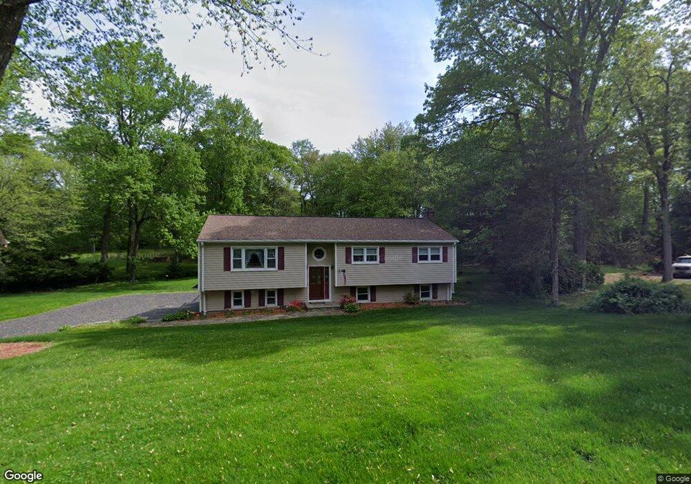
21 Cardinal Cir Trumbull, CT 06611
Daniel Farm District NeighborhoodEstimated Value: $679,000 - $765,000
About This Home
This home is located at 21 Cardinal Cir, Trumbull, CT 06611 and is currently estimated at $713,296, approximately $494 per square foot. 21 Cardinal Cir is a home located in Fairfield County with nearby schools including Daniels Farm School, Hillcrest Middle School, and Trumbull High School.
Ownership History
We collect this data history from publicly available records. To have your information removed, we recommend requesting removal directly through your county’s website.
Purchase Details
Purchase Details
Home Values in the Area
Average Home Value in this Area
Purchase History
We collect this data history from publicly available records. To have your information removed, we recommend requesting removal directly through your county’s website.
| Date | Buyer | Sale Price | Title Company |
|---|---|---|---|
| $216,500 | -- | ||
| $205,000 | -- |
Mortgage History
We collect this data history from publicly available records. To have your information removed, we recommend requesting removal directly through your county’s website.
| Date | Status | Borrower | Loan Amount |
|---|---|---|---|
| Closed | $69,000 | ||
| Open | $160,000 | ||
| Previous Owner | $172,000 |
Tax History
We collect this data history from publicly available records. To have your information removed, we recommend requesting removal directly through your county’s website.
| Year | Tax Paid | Tax Assessment Tax Assessment Total Assessment is a certain percentage of the fair market value that is determined by local assessors to be the total taxable value of land and additions on the property. | Land | Improvement |
|---|---|---|---|---|
| 2025 | $10,627 | $287,840 | $159,950 | $127,890 |
| 2024 | $10,336 | $287,840 | $159,950 | $127,890 |
| 2023 | $10,169 | $287,840 | $159,950 | $127,890 |
| 2022 | $10,007 | $287,840 | $159,950 | $127,890 |
| 2021 | $9,217 | $252,210 | $145,530 | $106,680 |
| 2020 | $9,042 | $252,210 | $145,530 | $106,680 |
| 2018 | $8,819 | $252,210 | $145,530 | $106,680 |
| 2017 | $8,641 | $252,210 | $145,530 | $106,680 |
| 2016 | $8,467 | $252,210 | $145,530 | $106,680 |
| 2015 | $7,791 | $229,400 | $145,600 | $83,800 |
| 2014 | $7,623 | $229,400 | $145,600 | $83,800 |
Map
- 23 Great Neck Rd
- 56 Brookside Dr
- 237 Strobel Rd
- 57 Gray Rock Rd
- 0 Pinewood Trail
- 4 Bridle Trail Unit 4
- 100 Old Dike Rd
- 286 Daniels Farm Rd
- 68 Old Dike Rd
- 890 Daniels Farm Rd
- 88 Scenic Hill Rd
- 141 Putting Green Rd
- 606 Booth Hill Rd
- Lot #4 W Mischa Rd
- 82 Cricket Ln
- 64 Tait Rd
- 33 Manor Dr
- 41 Capitol Dr
- 14 Hunters Ridge Rd
- 59 Friar Ln
Ask me questions while you tour the home.