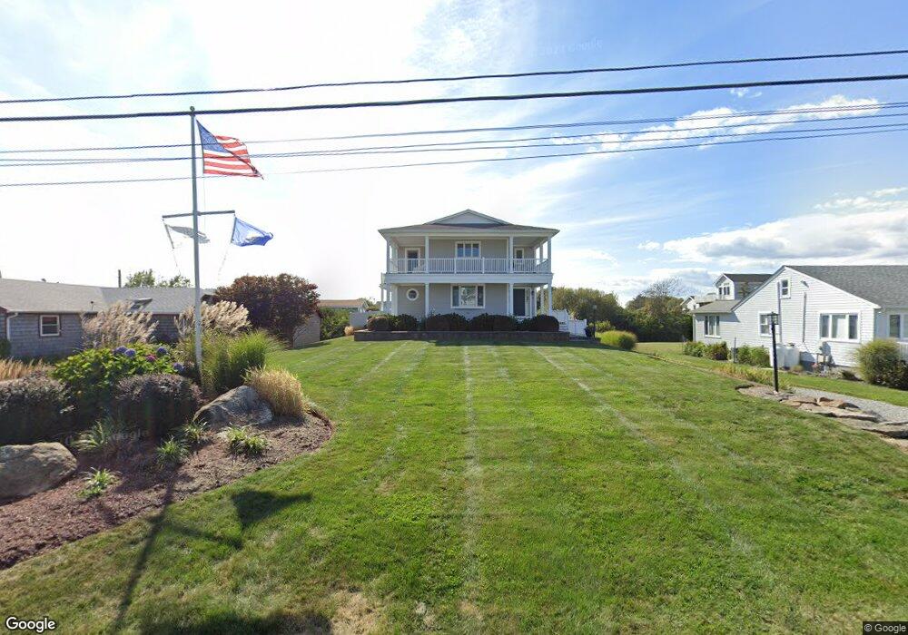
21 Coast Guard Ave Wakefield, RI 02879
Estimated Value: $1,224,000 - $2,294,000
About This Home
This home is located at 21 Coast Guard Ave, Wakefield, RI 02879 and is currently estimated at $1,975,081, approximately $2,506 per square foot. 21 Coast Guard Ave is a home located in Washington County with nearby schools including South Kingstown High School.
Ownership History
We collect this data history from publicly available records. To have your information removed, we recommend requesting removal directly through your county’s website.
Purchase Details
Purchase Details
Home Financials for this Owner
Home Financials are based on the most recent Mortgage that was taken out on this home.Home Values in the Area
Average Home Value in this Area
Purchase History
We collect this data history from publicly available records. To have your information removed, we recommend requesting removal directly through your county’s website.
| Date | Buyer | Sale Price | Title Company |
|---|---|---|---|
| -- | -- | ||
| -- | -- | ||
| $209,000 | -- |
Mortgage History
We collect this data history from publicly available records. To have your information removed, we recommend requesting removal directly through your county’s website.
| Date | Status | Borrower | Loan Amount |
|---|---|---|---|
| Previous Owner | $369,384 | ||
| Previous Owner | $169,000 |
Tax History
We collect this data history from publicly available records. To have your information removed, we recommend requesting removal directly through your county’s website.
| Year | Tax Paid | Tax Assessment Tax Assessment Total Assessment is a certain percentage of the fair market value that is determined by local assessors to be the total taxable value of land and additions on the property. | Land | Improvement |
|---|---|---|---|---|
| 2025 | $18,025 | $2,016,200 | $1,371,400 | $644,800 |
| 2024 | $16,056 | $1,453,000 | $940,400 | $512,600 |
| 2023 | $16,056 | $1,453,000 | $940,400 | $512,600 |
| 2022 | $15,910 | $1,453,000 | $940,400 | $512,600 |
| 2021 | $13,391 | $926,700 | $561,000 | $365,700 |
| 2020 | $13,391 | $926,700 | $561,000 | $365,700 |
| 2019 | $13,391 | $926,700 | $561,000 | $365,700 |
| 2018 | $12,706 | $810,300 | $512,600 | $297,700 |
| 2017 | $12,406 | $810,300 | $512,600 | $297,700 |
| 2016 | $12,227 | $810,300 | $512,600 | $297,700 |
| 2015 | $11,277 | $726,600 | $465,800 | $260,800 |
| 2014 | $11,248 | $726,600 | $465,800 | $260,800 |
Map
- 7 Rosebriar Ave
- 2 Green Hill Ave
- 155 Green Hill Ave
- 137 Rosebriar Ave
- 76 Green Hill Ocean Dr
- 146 Green Hill Ocean Dr
- 96 Wild Goose Rd
- 38 Beach Dr
- 19 Teal Dr
- 28 Arrow Wood Trail
- 5 Shadberry Trail
- 49 Auburn Rd
- 1935 Matunuck School House Rd
- 919 Matunuck School House Rd
- 121 Tupelo Rd
- 75 Spruce Rd
- 19 Traymore St
- 0 Cedar Rd
- 550 Cards Pond Rd
- 76 Hemlock Rd
- 13 Coast Guard Ave
- 7 Coast Guard Ave
- 22 Surfside Ave
- 14 Surfside Ave
- 37 Coast Guard Ave
- 22 Coast Guard Ave
- 39 Coast Guard Ave
- 30 Coast Guard Ave
- 16 Coast Guard Ave
- 79 Browning St
- 34 Surfside Ave
- 0 Browning St Unit 12598
- 0 Browning St Unit 849218
- 0 Browning St Unit 934602
- 0 Browning St Unit 1129681
- 0 Browning St Unit 1164721
- 0 Browning St Unit 1275635
- 0 Browning St Unit 1286321
- 38 Coast Guard Ave
- 2 Carpenter Dr
Ask me questions while you tour the home.