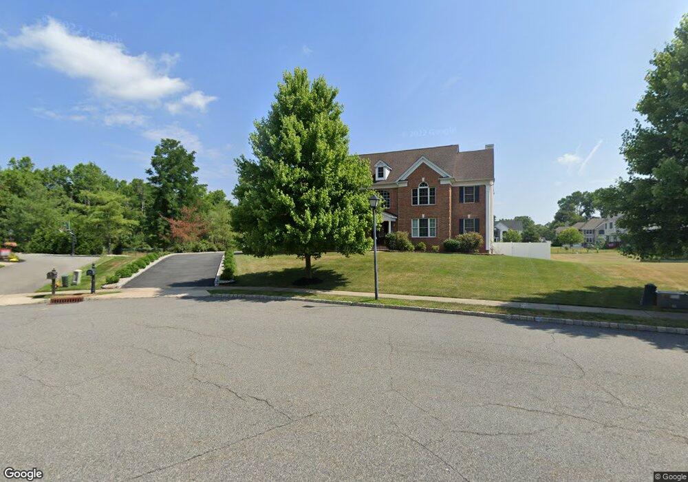
21 David Dr Whippany, NJ 07981
Estimated Value: $1,388,000 - $1,590,000
About This Home
This home is located at 21 David Dr, Whippany, NJ 07981 and is currently estimated at $1,453,300, approximately $360 per square foot. 21 David Dr is a home located in Morris County with nearby schools including Whippany Park High School, Arrow Academy, and The Morristown-Beard School.
Ownership History
We collect this data history from publicly available records. To have your information removed, we recommend requesting removal directly through your county’s website.
Purchase Details
Purchase Details
Home Financials for this Owner
Home Financials are based on the most recent Mortgage that was taken out on this home.Home Values in the Area
Average Home Value in this Area
Purchase History
We collect this data history from publicly available records. To have your information removed, we recommend requesting removal directly through your county’s website.
| Date | Buyer | Sale Price | Title Company |
|---|---|---|---|
| -- | None Listed On Document | ||
| -- | None Listed On Document | ||
| $1,103,493 | -- |
Mortgage History
We collect this data history from publicly available records. To have your information removed, we recommend requesting removal directly through your county’s website.
| Date | Status | Borrower | Loan Amount |
|---|---|---|---|
| Previous Owner | $300,000 |
Tax History
We collect this data history from publicly available records. To have your information removed, we recommend requesting removal directly through your county’s website.
| Year | Tax Paid | Tax Assessment Tax Assessment Total Assessment is a certain percentage of the fair market value that is determined by local assessors to be the total taxable value of land and additions on the property. | Land | Improvement |
|---|---|---|---|---|
| 2025 | $18,757 | $889,800 | $258,400 | $631,400 |
| 2024 | $18,677 | $889,800 | $258,400 | $631,400 |
| 2023 | $18,677 | $889,800 | $258,400 | $631,400 |
| 2022 | $17,084 | $889,800 | $258,400 | $631,400 |
| 2021 | $16,835 | $889,800 | $258,400 | $631,400 |
| 2020 | $16,782 | $889,800 | $258,400 | $631,400 |
| 2019 | $16,835 | $889,800 | $258,400 | $631,400 |
| 2018 | $16,541 | $889,800 | $258,400 | $631,400 |
| 2017 | $16,052 | $889,800 | $258,400 | $631,400 |
| 2016 | $15,821 | $889,800 | $258,400 | $631,400 |
| 2015 | $15,189 | $889,800 | $258,400 | $631,400 |
| 2014 | $14,860 | $889,800 | $258,400 | $631,400 |
Map
- 92 Louis St
- 6 Beaumont Place
- 11 Manchester Dr
- 31 Phillip Dr
- 128 Troy Hills Rd
- 1240 S Beverwyck Rd
- 25 Trouville Dr
- 94 Parsippany Rd Unit 1
- 94 Parsippany Rd
- 96 Parsippany Rd
- 42 Berkshire St
- 3 Trouville Dr
- 82 Sunrise Dr
- 25 Lord Stirling Dr
- 51 Sunrise Dr
- 46 Westminster Dr
- 909 Brook Hollow Dr Unit 909
- 72 Schindler Ct
- 83 Schindler Ct
- 6 John St
Ask me questions while you tour the home.