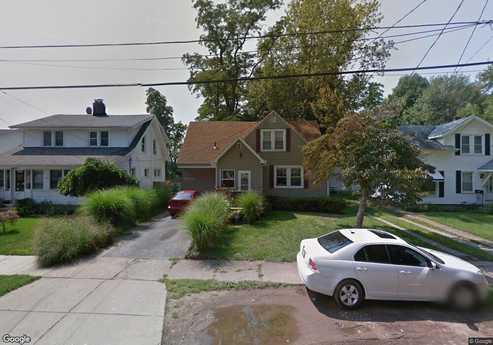
21 Hurst Rd Painesville, OH 44077
Estimated Value: $187,715 - $214,000
3
Beds
2
Baths
1,004
Sq Ft
$202/Sq Ft
Est. Value
About This Home
This home is located at 21 Hurst Rd, Painesville, OH 44077 and is currently estimated at $202,429, approximately $201 per square foot. 21 Hurst Rd is a home located in Lake County with nearby schools including Henry F. Lamuth Middle School, Riverside Junior/Senior High School, and Hershey Montessori School PreK-Elementary.
Ownership History
Date
Name
Owned For
Owner Type
Purchase Details
Closed on
Mar 30, 1998
Sold by
Secoy Mona Lee
Bought by
Secoy R Micahel
Current Estimated Value
Home Financials for this Owner
Home Financials are based on the most recent Mortgage that was taken out on this home.
Original Mortgage
$87,200
Outstanding Balance
$16,425
Interest Rate
8.5%
Estimated Equity
$186,004
Purchase Details
Closed on
Jan 28, 1992
Bought by
Secoy R Michael
Create a Home Valuation Report for This Property
The Home Valuation Report is an in-depth analysis detailing your home's value as well as a comparison with similar homes in the area
Home Values in the Area
Average Home Value in this Area
Purchase History
| Date | Buyer | Sale Price | Title Company |
|---|---|---|---|
| Secoy R Micahel | -- | Conway Land Title Company | |
| Secoy R Michael | $70,300 | -- |
Source: Public Records
Mortgage History
| Date | Status | Borrower | Loan Amount |
|---|---|---|---|
| Open | Secoy R Micahel | $87,200 |
Source: Public Records
Tax History
| Year | Tax Paid | Tax Assessment Tax Assessment Total Assessment is a certain percentage of the fair market value that is determined by local assessors to be the total taxable value of land and additions on the property. | Land | Improvement |
|---|---|---|---|---|
| 2025 | -- | $56,840 | $13,220 | $43,620 |
| 2024 | -- | $56,840 | $13,220 | $43,620 |
| 2023 | $4,774 | $43,810 | $11,450 | $32,360 |
| 2022 | $2,986 | $43,810 | $11,450 | $32,360 |
| 2021 | $2,990 | $43,810 | $11,450 | $32,360 |
| 2020 | $2,748 | $35,050 | $9,160 | $25,890 |
| 2019 | $2,755 | $35,050 | $9,160 | $25,890 |
| 2018 | $2,623 | $29,940 | $7,170 | $22,770 |
| 2017 | $2,483 | $29,940 | $7,170 | $22,770 |
| 2016 | $2,227 | $29,940 | $7,170 | $22,770 |
| 2015 | $1,714 | $29,940 | $7,170 | $22,770 |
| 2014 | $1,742 | $29,940 | $7,170 | $22,770 |
| 2013 | $1,703 | $29,940 | $7,170 | $22,770 |
Source: Public Records
Map
Nearby Homes
- 21 Urban St
- 190 Normandy Dr
- 1001 the Capes Blvd
- 163 Hawthorne Dr
- 152 Linden Dr
- 1651 Mentor Ave Unit 1406
- 1651 Mentor Ave Unit 2605
- 1651 Mentor Ave Unit 212
- 1237 Crescent Dr
- 535 Cherrywood Ln
- 2014 S Ashwood Ln
- 1997 Spruce Ln
- 519 N Ashwood Ln
- 0 Academy Ct Unit 5189600
- 165 Fairfield Rd
- 10247 Cherry Hill Dr
- 1936 Mentor Ave
- 1990 Boxwood Trail
- 154 Nantucket Cir
- 45 Chatfield Dr
Your Personal Tour Guide
Ask me questions while you tour the home.