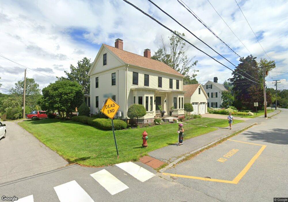
21 Lewis Point Rd Damariscotta, ME 04543
Estimated Value: $443,000 - $583,000
3
Beds
2
Baths
1,800
Sq Ft
$272/Sq Ft
Est. Value
About This Home
This home is located at 21 Lewis Point Rd, Damariscotta, ME 04543 and is currently estimated at $490,304, approximately $272 per square foot. 21 Lewis Point Rd is a home located in Lincoln County with nearby schools including Great Salt Bay Community School and Lincoln Academy.
Ownership History
Date
Name
Owned For
Owner Type
Purchase Details
Closed on
Nov 15, 2006
Sold by
Petti Robert D
Bought by
Lamb Sidney and Reilly Lamb Nancy
Current Estimated Value
Home Financials for this Owner
Home Financials are based on the most recent Mortgage that was taken out on this home.
Original Mortgage
$320,000
Outstanding Balance
$118,441
Interest Rate
6.33%
Mortgage Type
Commercial
Estimated Equity
$371,863
Create a Home Valuation Report for This Property
The Home Valuation Report is an in-depth analysis detailing your home's value as well as a comparison with similar homes in the area
Home Values in the Area
Average Home Value in this Area
Purchase History
We collect this data history from publicly available records. To have your information removed, we recommend requesting removal directly through your county’s website.
| Date | Buyer | Sale Price | Title Company |
|---|---|---|---|
| Lamb Sidney | -- | -- |
Source: Public Records
Mortgage History
We collect this data history from publicly available records. To have your information removed, we recommend requesting removal directly through your county’s website.
| Date | Status | Borrower | Loan Amount |
|---|---|---|---|
| Open | Lamb Sidney | $320,000 |
Source: Public Records
Tax History
| Year | Tax Paid | Tax Assessment Tax Assessment Total Assessment is a certain percentage of the fair market value that is determined by local assessors to be the total taxable value of land and additions on the property. | Land | Improvement |
|---|---|---|---|---|
| 2025 | $6,902 | $328,200 | $108,200 | $220,000 |
| 2024 | $6,072 | $328,200 | $108,200 | $220,000 |
| 2023 | $5,136 | $328,200 | $108,200 | $220,000 |
| 2022 | $4,582 | $275,200 | $91,000 | $184,200 |
| 2021 | $4,376 | $275,200 | $91,000 | $184,200 |
| 2020 | $2,887 | $275,200 | $91,000 | $184,200 |
| 2019 | $4,431 | $275,200 | $91,000 | $184,200 |
| 2018 | $4,486 | $275,200 | $91,000 | $184,200 |
| 2017 | $4,632 | $275,200 | $91,000 | $184,200 |
| 2016 | $5,186 | $275,200 | $91,000 | $184,200 |
| 2015 | $4,695 | $275,200 | $91,000 | $184,200 |
| 2014 | $4,348 | $275,200 | $91,000 | $184,200 |
| 2013 | $4,156 | $275,200 | $91,000 | $184,200 |
Source: Public Records
Map
Nearby Homes
- 80 Riverview Landing
- 72 Glidden St
- 11 Water St
- 61 Bristol Rd
- 15 High St
- 11 Academy Hill Rd
- 80 Academy Hill Rd
- 0 Hopkins Hill Rd
- 29 Pleasant St
- 244 Academy Hill Rd
- 5 Waterview Ln
- 574 Main St Unit 111
- Lot 60 Heater Rd
- 6 Stonewyck Ln
- 16 Townley Dr
- 00 Townley Dr
- 4 Shamrock Ln
- 22 Shamrock Ln
- 826 Atlantic Hwy
- 65 Borland Hill Rd
- 34 Lewis Point Rd Unit 5
- 30 Lewis Point Rd Unit 3
- 28 Lewis Point Rd Unit 2
- 26 Lewis Point Rd
- 36 Lewis Point Rd
- 22 Lewis Point Rd
- 13 Lewis Point Rd
- 25 Lewis Point Rd
- 17 Lewis Point Rd
- 38 Lewis Point Rd
- 20 Lewis Point Rd
- Map6/Lot47 Lewis Point Rd
- 32 Lewis Point Rd Unit 32
- 19 Lewis Point Rd
- 7 River Ln
- 6 River Ln
- 2 Hodgdon St
- 6 Hodgdon St
- 206 Elm St
- 186 Elm St Unit 5
Your Personal Tour Guide
Ask me questions while you tour the home.