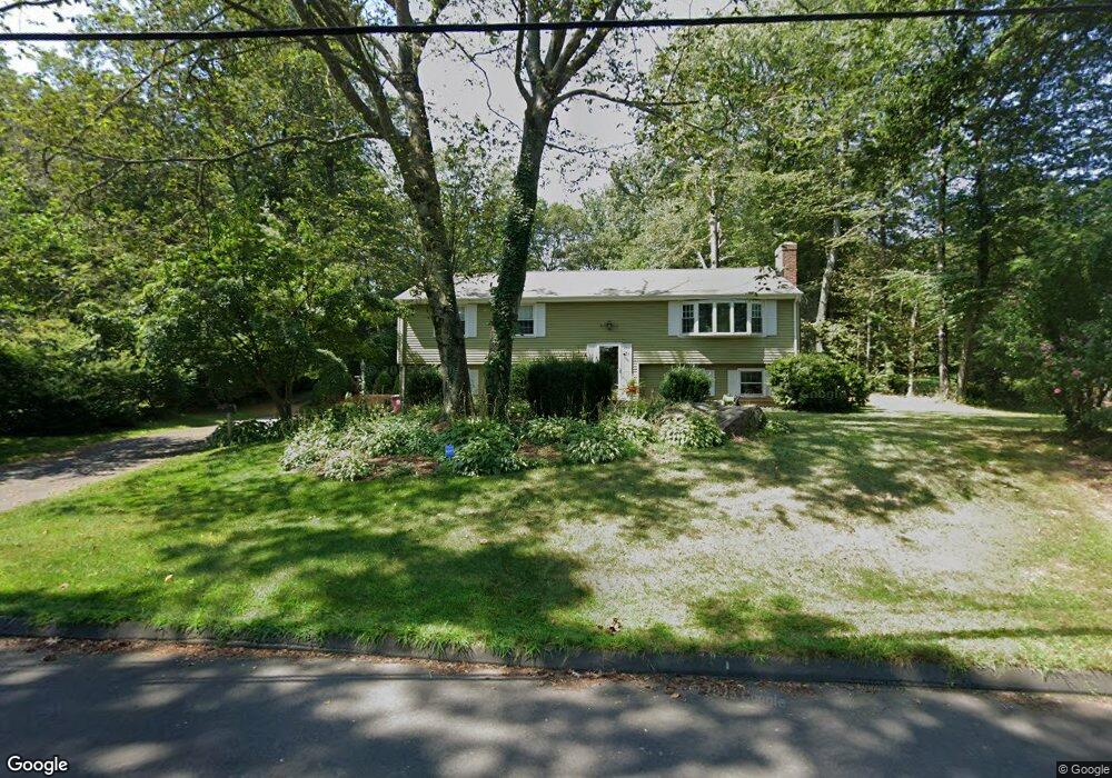
21 Silversmith Rd Unionville, CT 06085
Estimated Value: $477,000 - $546,000
3
Beds
3
Baths
1,350
Sq Ft
$371/Sq Ft
Est. Value
About This Home
This home is located at 21 Silversmith Rd, Unionville, CT 06085 and is currently estimated at $500,641, approximately $370 per square foot. 21 Silversmith Rd is a home located in Hartford County with nearby schools including West Woods Upper Elementary School, Irving A. Robbins Middle School, and Farmington High School.
Ownership History
Date
Name
Owned For
Owner Type
Purchase Details
Closed on
May 28, 1999
Sold by
Bopp Carole
Bought by
Linehan Jeffrey L and Levesque Carol L
Current Estimated Value
Home Financials for this Owner
Home Financials are based on the most recent Mortgage that was taken out on this home.
Original Mortgage
$145,000
Outstanding Balance
$37,517
Interest Rate
6.82%
Estimated Equity
$463,124
Create a Home Valuation Report for This Property
The Home Valuation Report is an in-depth analysis detailing your home's value as well as a comparison with similar homes in the area
Home Values in the Area
Average Home Value in this Area
Purchase History
| Date | Buyer | Sale Price | Title Company |
|---|---|---|---|
| Linehan Jeffrey L | $200,000 | -- |
Source: Public Records
Mortgage History
| Date | Status | Borrower | Loan Amount |
|---|---|---|---|
| Open | Linehan Jeffrey L | $145,000 |
Source: Public Records
Tax History
| Year | Tax Paid | Tax Assessment Tax Assessment Total Assessment is a certain percentage of the fair market value that is determined by local assessors to be the total taxable value of land and additions on the property. | Land | Improvement |
|---|---|---|---|---|
| 2025 | $6,764 | $254,100 | $91,910 | $162,190 |
| 2024 | $6,467 | $254,100 | $91,910 | $162,190 |
| 2023 | $6,152 | $254,100 | $91,910 | $162,190 |
| 2022 | $5,756 | $196,300 | $79,920 | $116,380 |
| 2021 | $5,655 | $196,300 | $79,920 | $116,380 |
| 2020 | $5,491 | $196,300 | $79,920 | $116,380 |
| 2019 | $5,491 | $196,300 | $79,920 | $116,380 |
| 2018 | $5,335 | $196,300 | $79,920 | $116,380 |
| 2017 | $5,226 | $195,880 | $83,720 | $112,160 |
| 2016 | $5,050 | $195,880 | $83,720 | $112,160 |
| 2015 | $4,899 | $195,880 | $83,720 | $112,160 |
| 2014 | $4,787 | $195,880 | $83,720 | $112,160 |
Source: Public Records
Map
Nearby Homes
- 513 Plainville Ave
- 61 Litchfield Rd
- 42 Keene Place
- 24 Green Woods Ln
- 19 Village View Ln
- 8 Old Field Rd
- 13 Silver Dr
- 55 Depot Place
- 8 Gateshead Way
- 8 Dominiques Ct
- 50 Woodhaven Dr
- 23 Keyes St
- 32 Canterbury Ln
- 8919 Taine Mountain Rd
- 1421 Farmington Ave Unit A
- 52 Wood Creek Rd
- 33 Lufkin Ln
- 1 Winter Creek Place
- 119 Cherry Hill Dr
- 18 Ledgewood Dr
- 23 Silversmith Rd
- 30 Silversmith Rd
- 15 Silversmith Rd
- 25 Silversmith Rd
- 18 Silversmith Rd
- 27 Silversmith Rd
- 9 Silversmith Rd
- 14 Silversmith Rd
- 200 Coppermine Rd
- 31 Silversmith Rd
- 196 Coppermine Rd
- 465 Plainville Ave
- 33 Silversmith Rd
- 4 Silversmith Rd
- 6 Silversmith Rd
- 471 Plainville Ave
- 47 Redcoat Ln
- 45 Redcoat Ln
- 465 Plainville Ave
- 481 Plainville Ave
Your Personal Tour Guide
Ask me questions while you tour the home.