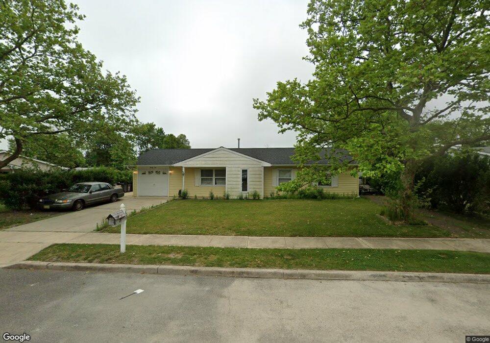
21 Tulsa Dr Barnegat, NJ 08005
Barnegat Township NeighborhoodEstimated Value: $324,000 - $423,000
3
Beds
2
Baths
1,064
Sq Ft
$368/Sq Ft
Est. Value
About This Home
This home is located at 21 Tulsa Dr, Barnegat, NJ 08005 and is currently estimated at $391,092, approximately $367 per square foot. 21 Tulsa Dr is a home located in Ocean County with nearby schools including Barnegat High School.
Ownership History
Date
Name
Owned For
Owner Type
Purchase Details
Closed on
Apr 6, 2006
Sold by
Dang Minh Nguyet
Bought by
Diaz Caridad
Current Estimated Value
Home Financials for this Owner
Home Financials are based on the most recent Mortgage that was taken out on this home.
Original Mortgage
$238,500
Interest Rate
10.7%
Mortgage Type
Purchase Money Mortgage
Purchase Details
Closed on
Jul 12, 1999
Sold by
Macdonald James P and Macdonald Leslie
Bought by
Vo Hoang X and Dang Minh Nguyet
Home Financials for this Owner
Home Financials are based on the most recent Mortgage that was taken out on this home.
Original Mortgage
$63,000
Interest Rate
7.61%
Purchase Details
Closed on
Jul 21, 1995
Sold by
Romeo Angela
Bought by
Macdonald James and Macdonald Leslie
Home Financials for this Owner
Home Financials are based on the most recent Mortgage that was taken out on this home.
Original Mortgage
$89,000
Interest Rate
7.49%
Mortgage Type
FHA
Create a Home Valuation Report for This Property
The Home Valuation Report is an in-depth analysis detailing your home's value as well as a comparison with similar homes in the area
Home Values in the Area
Average Home Value in this Area
Purchase History
| Date | Buyer | Sale Price | Title Company |
|---|---|---|---|
| Diaz Caridad | $265,000 | None Available | |
| Vo Hoang X | $84,000 | First American Title Ins Co | |
| Macdonald James | $89,000 | -- |
Source: Public Records
Mortgage History
| Date | Status | Borrower | Loan Amount |
|---|---|---|---|
| Previous Owner | Diaz Caridad | $238,500 | |
| Previous Owner | Vo Hoang X | $63,000 | |
| Previous Owner | Macdonald James | $89,000 |
Source: Public Records
Tax History
| Year | Tax Paid | Tax Assessment Tax Assessment Total Assessment is a certain percentage of the fair market value that is determined by local assessors to be the total taxable value of land and additions on the property. | Land | Improvement |
|---|---|---|---|---|
| 2025 | $5,623 | $182,400 | $100,500 | $81,900 |
| 2024 | $5,310 | $182,400 | $100,500 | $81,900 |
| 2023 | $5,138 | $182,400 | $100,500 | $81,900 |
| 2022 | $5,138 | $182,400 | $100,500 | $81,900 |
| 2021 | $5,115 | $182,400 | $100,500 | $81,900 |
| 2020 | $5,091 | $182,400 | $100,500 | $81,900 |
| 2019 | $5,016 | $182,400 | $100,500 | $81,900 |
| 2018 | $4,978 | $182,400 | $100,500 | $81,900 |
| 2017 | $4,896 | $182,400 | $100,500 | $81,900 |
| 2016 | $4,795 | $182,400 | $100,500 | $81,900 |
| 2015 | $4,644 | $182,400 | $100,500 | $81,900 |
| 2014 | $4,525 | $182,400 | $100,500 | $81,900 |
Source: Public Records
Map
Nearby Homes
- 205 11th St
- 15 S Seas Ct
- 5 Fresno St
- 31 S Seas Ct
- 48 S Seas Ct Unit 11A
- 48 S South Seas Ct
- 11 Emerald Dr Unit A
- 109 Englewood Ave
- 309 5th St
- 4 Union Blvd
- 125 Clifton Rd
- 23 Twain Ave
- 22 Forest Park Dr
- 20 Forest Park Dr
- 18 Forest Park Dr
- 16 Forest Park Dr
- 14 Forest Park Dr
- 30 Forest Park Dr
- 12 Forest Park Dr
- 28 Forest Park Dr
Your Personal Tour Guide
Ask me questions while you tour the home.