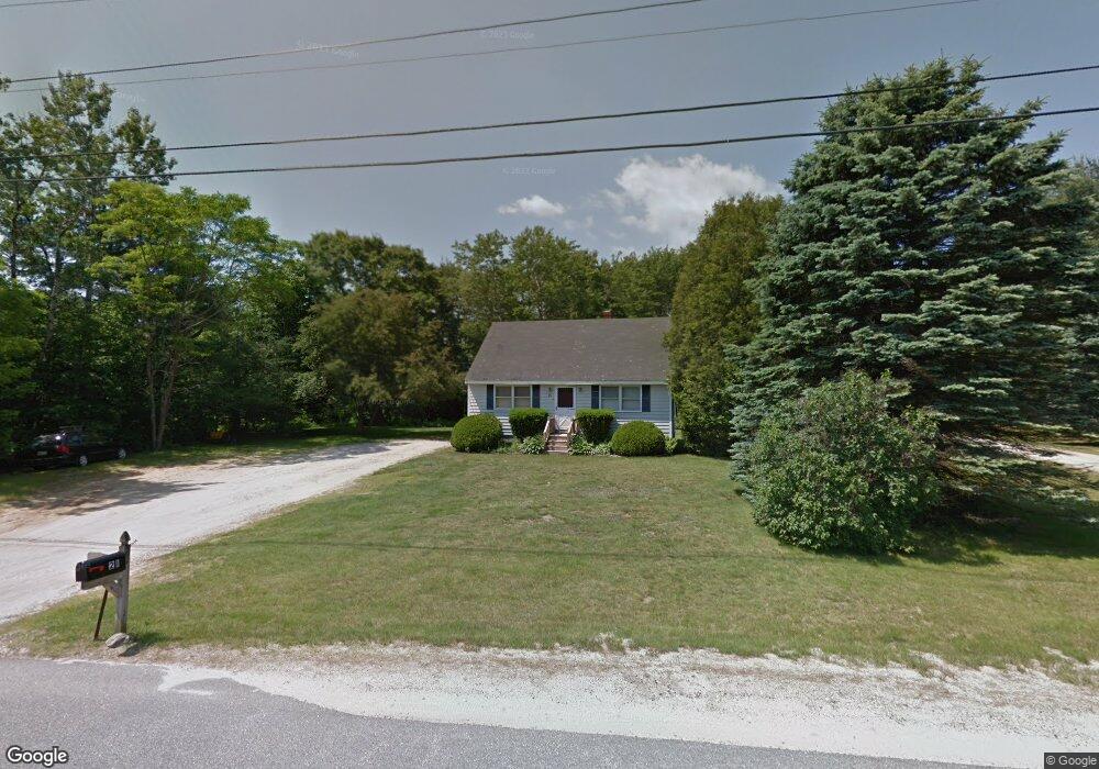
21 Webster Rd Freeport, ME 04032
Estimated Value: $416,011 - $480,000
4
Beds
1
Bath
1,114
Sq Ft
$392/Sq Ft
Est. Value
About This Home
This home is located at 21 Webster Rd, Freeport, ME 04032 and is currently estimated at $436,253, approximately $391 per square foot. 21 Webster Rd is a home with nearby schools including Morse Street School, Mast Landing School, and Freeport Middle School.
Create a Home Valuation Report for This Property
The Home Valuation Report is an in-depth analysis detailing your home's value as well as a comparison with similar homes in the area
Home Values in the Area
Average Home Value in this Area
Tax History
We collect this data history from publicly available records. To have your information removed, we recommend requesting removal directly through your county’s website.
| Year | Tax Paid | Tax Assessment Tax Assessment Total Assessment is a certain percentage of the fair market value that is determined by local assessors to be the total taxable value of land and additions on the property. | Land | Improvement |
|---|---|---|---|---|
| 2025 | $3,594 | $259,500 | $153,900 | $105,600 |
| 2024 | $3,367 | $252,200 | $146,600 | $105,600 |
| 2023 | $3,094 | $225,000 | $133,300 | $91,700 |
| 2022 | $2,882 | $211,100 | $119,400 | $91,700 |
| 2021 | $2,818 | $211,100 | $119,400 | $91,700 |
| 2020 | $2,689 | $192,100 | $110,500 | $81,600 |
| 2019 | $2,578 | $180,300 | $104,300 | $76,000 |
| 2018 | $2,634 | $175,000 | $97,500 | $77,500 |
| 2017 | $2,530 | $169,200 | $95,200 | $74,000 |
| 2016 | $2,479 | $156,900 | $88,200 | $68,700 |
Source: Public Records
Map
Nearby Homes
- 607 Granite St
- 49 Desert Rd
- 531 Ledge Rd
- 40 Primrose Ln
- 0 Redding Ln Unit 1657670
- 8 Evergreen Dr
- 177 Bluff Rd Unit 20
- 0 Hodsdon Rd Unit 1667974
- 67 S Freeport Rd
- 532 E Elm St
- 7 Somerset Unit A-7
- 29 Crows Nest Dr
- 62 South St
- 800 North Rd
- 321 Pownal Rd
- 15 Cushing Briggs Rd
- 73 Autumn Ln
- 16 Deer Run Rd
- 304 Pownal Rd
- 63 Rebecca Ln Unit 18
Your Personal Tour Guide
Ask me questions while you tour the home.