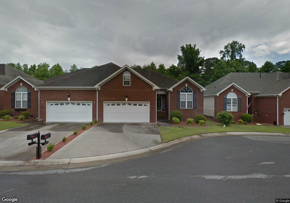
210 Commonsgate Dr Goldsboro, NC 27530
Estimated Value: $277,968 - $284,000
3
Beds
2
Baths
1,754
Sq Ft
$160/Sq Ft
Est. Value
About This Home
This home is located at 210 Commonsgate Dr, Goldsboro, NC 27530 and is currently estimated at $280,992, approximately $160 per square foot. 210 Commonsgate Dr is a home located in Wayne County with nearby schools including Tommy's Road Elementary School, Norwayne Middle School, and Charles B. Aycock High School.
Ownership History
Date
Name
Owned For
Owner Type
Purchase Details
Closed on
Feb 2, 2022
Sold by
Douglas Tart Paul and Douglas Ann Jo
Bought by
Tart Stephen Paul
Current Estimated Value
Purchase Details
Closed on
Feb 4, 2014
Sold by
Long Matthew Elmo
Bought by
Tart Paul Douglas and Tart Jo Ann Mccabe
Purchase Details
Closed on
Oct 1, 2003
Create a Home Valuation Report for This Property
The Home Valuation Report is an in-depth analysis detailing your home's value as well as a comparison with similar homes in the area
Purchase History
| Date | Buyer | Sale Price | Title Company |
|---|---|---|---|
| Tart Stephen Paul | -- | None Listed On Document | |
| Tart Paul Douglas | $174,000 | None Available | |
| -- | $178,000 | -- |
Source: Public Records
Tax History
| Year | Tax Paid | Tax Assessment Tax Assessment Total Assessment is a certain percentage of the fair market value that is determined by local assessors to be the total taxable value of land and additions on the property. | Land | Improvement |
|---|---|---|---|---|
| 2025 | -- | $277,220 | $35,000 | $242,220 |
| 2024 | $2,639 | $179,220 | $30,000 | $149,220 |
| 2023 | $2,639 | $179,220 | $30,000 | $149,220 |
| 2022 | $2,549 | $179,220 | $30,000 | $149,220 |
| 2021 | $2,487 | $179,220 | $30,000 | $149,220 |
| 2020 | $2,354 | $179,220 | $30,000 | $149,220 |
| 2018 | $2,517 | $191,660 | $30,000 | $161,660 |
| 2017 | $2,517 | $191,660 | $30,000 | $161,660 |
| 2016 | $2,517 | $191,660 | $30,000 | $161,660 |
| 2015 | $2,520 | $191,660 | $30,000 | $161,660 |
| 2014 | $2,523 | $191,660 | $30,000 | $161,660 |
Source: Public Records
Map
Nearby Homes
- 200 Commonsgate Dr
- 102 Essex Ct
- 402 Tryon Dr
- 208 Grove Ln
- 106 Kingston Cir
- 104 Kingston Cir
- 422 Kingston Cir
- 110 Somervale Ln
- 900 E Patetown Rd
- 1108 Elanor Ave
- 312 Kingston Cir
- 1202 Patetown Rd
- 2502 Bradford Place
- 104 10th Place
- 1104 Wessex Ct
- 2405 Wayne Memorial Dr
- 607 Gloucester Rd
- 905 7th St
- 105 Sumpter Dr
- 405 Quail Dr
- 208 Commonsgate Dr
- 206 Commonsgate Dr
- 214 Commonsgate Dr
- 301 Commonsgate Dr
- 204 Commonsgate Dr
- 300 Commonsgate Dr
- 302 Commonsgate Dr
- 304 Commonsgate Dr
- 202 Commonsgate Dr
- 303 Commonsgate Dr
- 203 Commonsgate Dr
- 306 Commonsgate Dr
- 201 Commonsgate Dr
- 305 Commonsgate Dr
- 110 Commonsgate Dr
- 308 Commonsgate Dr
- 307 Commonsgate Dr
- 101 Stonegate Ct
- 108 Commonsgate Dr
- 310 Commonsgate Dr
Your Personal Tour Guide
Ask me questions while you tour the home.